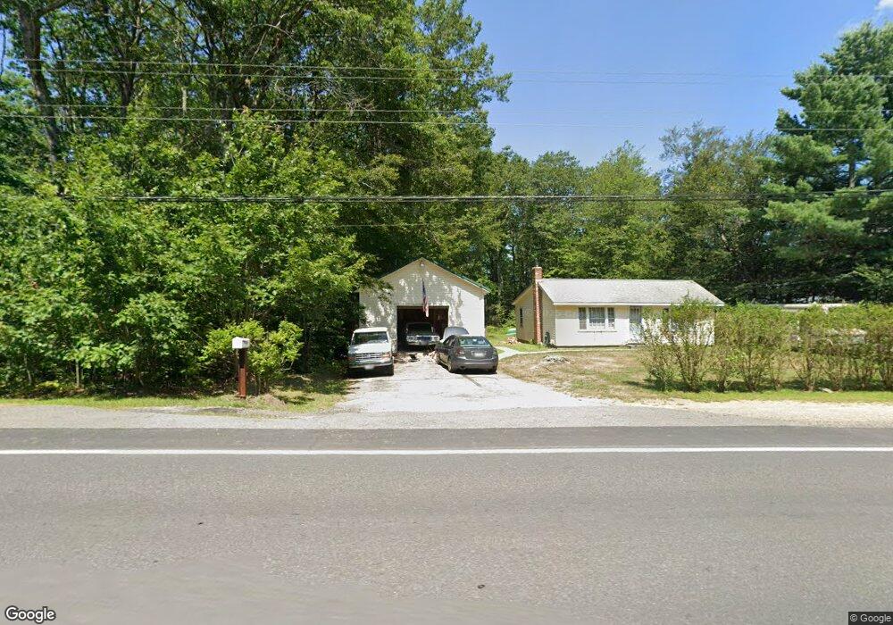
1180 Nh Route 119 Rindge, NH 03461
Estimated Value: $304,556 - $424,000
3
Beds
1
Bath
1,092
Sq Ft
$332/Sq Ft
Est. Value
About This Home
This home is located at 1180 Nh Route 119, Rindge, NH 03461 and is currently estimated at $362,139, approximately $331 per square foot. 1180 Nh Route 119 is a home located in Cheshire County with nearby schools including Rindge Memorial School, Conant Middle High School, and Conant High School.
Ownership History
Date
Name
Owned For
Owner Type
Purchase Details
Closed on
Jul 30, 2010
Sold by
Nhfa
Bought by
Fenton Shawn P and Fenton Megan C
Current Estimated Value
Home Financials for this Owner
Home Financials are based on the most recent Mortgage that was taken out on this home.
Original Mortgage
$88,804
Outstanding Balance
$59,416
Interest Rate
4.78%
Mortgage Type
Purchase Money Mortgage
Estimated Equity
$302,723
Create a Home Valuation Report for This Property
The Home Valuation Report is an in-depth analysis detailing your home's value as well as a comparison with similar homes in the area
Home Values in the Area
Average Home Value in this Area
Purchase History
| Date | Buyer | Sale Price | Title Company |
|---|---|---|---|
| Fenton Shawn P | $45,000 | -- |
Source: Public Records
Mortgage History
| Date | Status | Borrower | Loan Amount |
|---|---|---|---|
| Open | Fenton Shawn P | $88,804 |
Source: Public Records
Tax History Compared to Growth
Tax History
| Year | Tax Paid | Tax Assessment Tax Assessment Total Assessment is a certain percentage of the fair market value that is determined by local assessors to be the total taxable value of land and additions on the property. | Land | Improvement |
|---|---|---|---|---|
| 2024 | $3,700 | $146,200 | $29,400 | $116,800 |
| 2023 | $3,661 | $146,200 | $29,400 | $116,800 |
| 2022 | $3,374 | $146,500 | $29,400 | $117,100 |
| 2021 | $3,318 | $146,500 | $29,400 | $117,100 |
| 2020 | $3,289 | $146,500 | $29,400 | $117,100 |
| 2019 | $2,887 | $104,000 | $24,000 | $80,000 |
| 2018 | $2,860 | $104,000 | $24,000 | $80,000 |
| 2017 | $2,828 | $104,000 | $24,000 | $80,000 |
| 2016 | $2,903 | $104,000 | $24,000 | $80,000 |
| 2015 | $2,901 | $104,000 | $24,000 | $80,000 |
| 2014 | $3,535 | $135,800 | $60,800 | $75,000 |
| 2013 | $3,457 | $135,800 | $60,800 | $75,000 |
Source: Public Records
Map
Nearby Homes
- 12 Mark St
- 94 Main St
- 20 W Main St
- 243 Main St
- 88 Drag Hill Rd
- 196 Lord Brook Rd
- 17 Jowders Cove Rd
- 41 Willow Ln
- 43 Willow Ln
- 39 Willow Ln
- 31 Willow Ln
- 37 Willow Ln
- 336 Main St
- 286 Old New Ipswich Rd
- 0 Thomas Rd Unit 10 5014817
- Lot 14-0 Saybrook Dr
- lot 2-0 Saybrook Dr
- 1 Saybrook Dr
- 20 Amalia Way
- 16 Amalia Way
- 1180 Nh Route 119
- 1180 Nh Route 119
- 1174 Nh Route 119
- 1174 Us Route 119
- 4 Letourneau Ln
- 41 Mark St
- 28 Mark St
- Lot 17 Mark St Unit 17
- Lot 6 Mark St Unit 6
- Lot 17 Mark St
- 117 Mark St
- 6-15 Mark St
- 9 Fitzgerald Rd
- 1134 New Hampshire 119
- 1134 Nh Route 119
- 6 Main St
- 626 Old Rd N
- 31 Shady Ln
- 51-6 W Binney Hill Rd
- 77 Main St