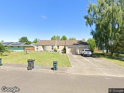
1180 Picture St Independence, OR 97351
Estimated Value: $335,000 - $463,000
4
Beds
2
Baths
1,776
Sq Ft
$236/Sq Ft
Est. Value
About This Home
This home is located at 1180 Picture St, Independence, OR 97351 and is currently estimated at $419,460, approximately $236 per square foot. 1180 Picture St is a home with nearby schools including Ash Creek Elementary School, Talmadge Middle School, and Central High School.
Ownership History
Date
Name
Owned For
Owner Type
Purchase Details
Closed on
Mar 4, 2005
Sold by
Brown Stanley G and Brown Joan M
Bought by
Mcginnis Timothy D and Mcginnis Cynthia L
Current Estimated Value
Home Financials for this Owner
Home Financials are based on the most recent Mortgage that was taken out on this home.
Original Mortgage
$101,600
Interest Rate
5.66%
Mortgage Type
Purchase Money Mortgage
Create a Home Valuation Report for This Property
The Home Valuation Report is an in-depth analysis detailing your home's value as well as a comparison with similar homes in the area
Home Values in the Area
Average Home Value in this Area
Purchase History
| Date | Buyer | Sale Price | Title Company |
|---|---|---|---|
| Mcginnis Timothy D | $127,000 | Ticor Title |
Source: Public Records
Mortgage History
| Date | Status | Borrower | Loan Amount |
|---|---|---|---|
| Closed | Mcginnis Timothy D | $250,000 | |
| Closed | Mcginnis Timothy D | $101,600 |
Source: Public Records
Tax History Compared to Growth
Tax History
| Year | Tax Paid | Tax Assessment Tax Assessment Total Assessment is a certain percentage of the fair market value that is determined by local assessors to be the total taxable value of land and additions on the property. | Land | Improvement |
|---|---|---|---|---|
| 2025 | $3,260 | $185,350 | $45,270 | $140,080 |
| 2024 | $3,260 | $179,960 | $43,960 | $136,000 |
| 2023 | $3,343 | $174,720 | $42,680 | $132,040 |
| 2022 | $3,069 | $169,640 | $41,440 | $128,200 |
| 2021 | $3,035 | $164,700 | $40,240 | $124,460 |
| 2020 | $2,956 | $159,910 | $39,070 | $120,840 |
| 2019 | $2,879 | $155,260 | $37,930 | $117,330 |
| 2018 | $2,787 | $150,740 | $36,820 | $113,920 |
| 2017 | $2,772 | $146,350 | $35,750 | $110,600 |
| 2016 | $2,823 | $142,090 | $34,700 | $107,390 |
| 2015 | -- | $137,960 | $33,690 | $104,270 |
Source: Public Records
Map
Nearby Homes
- 521 Picture Place
- 585 Airport Rd
- 820 Covey Run St
- 510 16th St N
- 1135 Monmouth St
- 1390 Monmouth St
- 375 S 11th St
- 471 Williams St
- 112 S 6th St
- 1256 S 11th St
- 1379 Natalie Ct
- 141 S St Unit 64
- 0 Stryker Rd Unit 792158
- 141 S 17th St
- 212 Picture St
- 731 Marsh St
- 741 Marsh St
- 1439 Falcon (-1441) Lp
- 558 S 7th St
- 674 Stearman St
- 1180 Picture St
- 1170 Picture St
- 1190 Picture St
- 1160 Picture St
- 1185 Picture St
- 1155 Marigold Dr
- 1135 Marigold Dr
- 1175 Picture St
- 1125 Marigold Dr
- 1165 Marigold Dr
- 1150 Picture St
- 1250 Picture St
- 1165 Picture St
- 1185 Marigold Dr
- 1152 Picture St
- 1105 Marigold Dr
- 585 Morning Glory Dr
- 1225 Marigold Dr
- 1150 Picture St (- 1158)
- 1151 Picture St