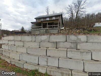
11803 Murleys Branch Rd NE Flintstone, MD 21530
Estimated Value: $150,161 - $185,000
--
Bed
1
Bath
1,880
Sq Ft
$85/Sq Ft
Est. Value
About This Home
This home is located at 11803 Murleys Branch Rd NE, Flintstone, MD 21530 and is currently estimated at $160,540, approximately $85 per square foot. 11803 Murleys Branch Rd NE is a home located in Allegany County with nearby schools including Flintstone Elementary School, Washington Middle School, and Fort Hill High School.
Ownership History
Date
Name
Owned For
Owner Type
Purchase Details
Closed on
Oct 16, 2023
Sold by
Reikie Timothy I and Bridges Yvonne
Bought by
Ott Keegan and Bridges Leah
Current Estimated Value
Home Financials for this Owner
Home Financials are based on the most recent Mortgage that was taken out on this home.
Original Mortgage
$125,000
Interest Rate
5.5%
Mortgage Type
New Conventional
Purchase Details
Closed on
Oct 2, 2003
Sold by
American General Financial Serv In
Bought by
Reikie Timothy I Bridges Yvonne
Purchase Details
Closed on
Jul 23, 2003
Sold by
Moyer Steven L
Bought by
American General Financial Serv In
Purchase Details
Closed on
Nov 5, 1998
Sold by
Moyer Walter D
Bought by
Moyer Steven L
Create a Home Valuation Report for This Property
The Home Valuation Report is an in-depth analysis detailing your home's value as well as a comparison with similar homes in the area
Home Values in the Area
Average Home Value in this Area
Purchase History
| Date | Buyer | Sale Price | Title Company |
|---|---|---|---|
| Ott Keegan | $156,250 | None Listed On Document | |
| Reikie Timothy I Bridges Yvonne | $50,000 | -- | |
| American General Financial Serv In | $48,000 | -- | |
| Moyer Steven L | -- | -- |
Source: Public Records
Mortgage History
| Date | Status | Borrower | Loan Amount |
|---|---|---|---|
| Previous Owner | Ott Keegan | $125,000 | |
| Previous Owner | Olsen Randy | $57,000 | |
| Previous Owner | Reikie Timothy I | $50,000 |
Source: Public Records
Tax History Compared to Growth
Tax History
| Year | Tax Paid | Tax Assessment Tax Assessment Total Assessment is a certain percentage of the fair market value that is determined by local assessors to be the total taxable value of land and additions on the property. | Land | Improvement |
|---|---|---|---|---|
| 2024 | $1,152 | $106,000 | $40,300 | $65,700 |
| 2023 | $1,133 | $104,200 | $0 | $0 |
| 2022 | $1,113 | $102,400 | $0 | $0 |
| 2021 | $1,084 | $100,600 | $38,900 | $61,700 |
| 2020 | $1,050 | $96,633 | $0 | $0 |
| 2019 | $1,007 | $92,667 | $0 | $0 |
| 2018 | $964 | $88,700 | $28,300 | $60,400 |
| 2017 | $965 | $88,700 | $0 | $0 |
| 2016 | -- | $88,700 | $0 | $0 |
| 2015 | $990 | $90,900 | $0 | $0 |
| 2014 | $990 | $90,733 | $0 | $0 |
Source: Public Records
Map
Nearby Homes
- 0 Town Creek Rd Unit MDAL2010760
- 11749 Town Creek Rd NE
- 13507 Black Valley Rd NE
- 24200 E Hancock Rd
- 0 Old Cumberland Rd Unit MDAL2010314
- 10406 Black Sulphur Rd NE
- 12105 Cresap Mill Rd SE
- 18.87 Acres Elbinsville Rd NE
- 12515 Cresap Mill Rd SE
- 15915 Williams Rd SE
- 11109 Butternut Ln NE
- 14404 Old Hancock Rd NE
- 306 Jacksonville Rd
- 13910 Bedford Rd NE
- 14600 Williams Rd SE
- 13317 Lerae St NE
- 0 Christie Rd
- 13400 Grevener St
- 12801 Piney Flats Rd SE
- 0 Green Ridge Rd Unit MDAL2010948