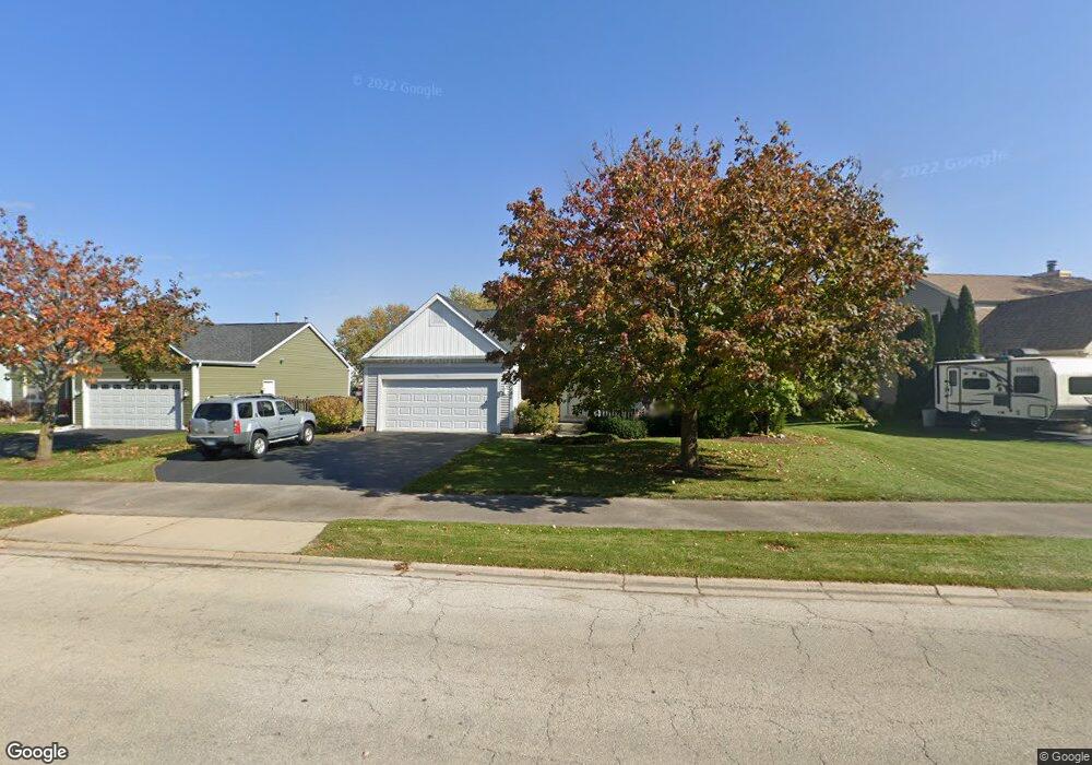
1181 Stonegate Rd Algonquin, IL 60102
Estimated Value: $317,306 - $375,000
Studio
1
Bath
1,451
Sq Ft
$238/Sq Ft
Est. Value
About This Home
This home is located at 1181 Stonegate Rd, Algonquin, IL 60102 and is currently estimated at $345,577, approximately $238 per square foot. 1181 Stonegate Rd is a home located in McHenry County with nearby schools including Westfield Community School, Kenneth E Neubert Elementary School, and Harry D Jacobs High School.
Ownership History
Date
Name
Owned For
Owner Type
Purchase Details
Closed on
Jul 18, 1997
Sold by
Pulte Home Corp
Bought by
Weng Christopher A and Weng Connie M
Current Estimated Value
Home Financials for this Owner
Home Financials are based on the most recent Mortgage that was taken out on this home.
Original Mortgage
$144,150
Outstanding Balance
$21,466
Interest Rate
7.94%
Estimated Equity
$324,111
Create a Home Valuation Report for This Property
The Home Valuation Report is an in-depth analysis detailing your home's value as well as a comparison with similar homes in the area
Purchase History
| Date | Buyer | Sale Price | Title Company |
|---|---|---|---|
| Weng Christopher A | $154,500 | 1St American Title |
Source: Public Records
Mortgage History
| Date | Status | Borrower | Loan Amount |
|---|---|---|---|
| Open | Weng Christopher A | $144,150 |
Source: Public Records
Tax History
| Year | Tax Paid | Tax Assessment Tax Assessment Total Assessment is a certain percentage of the fair market value that is determined by local assessors to be the total taxable value of land and additions on the property. | Land | Improvement |
|---|---|---|---|---|
| 2024 | $6,938 | $96,690 | $26,292 | $70,398 |
| 2023 | $6,569 | $86,477 | $23,515 | $62,962 |
| 2022 | $6,592 | $82,861 | $22,049 | $60,812 |
| 2021 | $6,317 | $77,195 | $20,541 | $56,654 |
| 2020 | $6,147 | $74,462 | $19,814 | $54,648 |
| 2019 | $5,993 | $71,269 | $18,964 | $52,305 |
| 2018 | $5,704 | $65,838 | $17,519 | $48,319 |
| 2017 | $5,579 | $62,024 | $16,504 | $45,520 |
| 2016 | $5,486 | $58,173 | $15,479 | $42,694 |
| 2013 | -- | $57,754 | $14,440 | $43,314 |
Source: Public Records
Map
Nearby Homes
- 760 Regal Ln
- 681 Majestic Dr
- 1157 Sawmill Ln
- 2380 Dawson Ln Unit 165
- 1820 Crofton Dr
- 1920 Jester Ln
- 700 Fairfield Ln
- 2051 Carlisle St
- 1002 Interloch Ct Unit 152
- 20 Peach Tree Ct Unit 4153
- 18 Peach Tree Ct Unit 4154
- 2069 Peach Tree Ln Unit 4116
- 145 S Oakleaf Rd
- 1 N Hubbard St
- SWC Talaga and Algonquin Rd
- 7 Falcon Ridge Ct
- 135 Arquilla Dr
- 1431 Essex St
- 1900 Waverly Ln
- 14 Wander Way
- 1171 Stonegate Rd
- 1191 Stonegate Rd
- 1116 Sawmill Ln
- 1161 Stonegate Rd
- 1114 Sawmill Ln
- 1118 Sawmill Ln
- 1199 Stonegate Rd
- 1180 Stonegate Rd
- 1112 Sawmill Ln
- 1170 Stonegate Rd
- 1190 Stonegate Rd
- 1151 Stonegate Rd
- 1160 Stonegate Rd
- 1110 Sawmill Ln
- 1122 Sawmill Ln
- 1141 Stonegate Rd
- 1150 Stonegate Rd
- 1124 Sawmill Ln
- 1108 Sawmill Ln
- 1117 Sawmill Ln
Your Personal Tour Guide
Ask me questions while you tour the home.