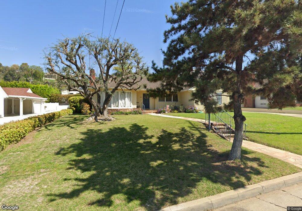
11815 Beverly Dr Whittier, CA 90601
West Whittier NeighborhoodEstimated Value: $886,000 - $1,030,000
2
Beds
2
Baths
1,726
Sq Ft
$561/Sq Ft
Est. Value
About This Home
This home is located at 11815 Beverly Dr, Whittier, CA 90601 and is currently estimated at $967,801, approximately $560 per square foot. 11815 Beverly Dr is a home located in Los Angeles County with nearby schools including Longfellow Elementary School, Walter F. Dexter Middle School, and Whittier High School.
Ownership History
Date
Name
Owned For
Owner Type
Purchase Details
Closed on
Jan 9, 2002
Sold by
Felszeghy Stephen Francis
Bought by
Felszeghy Diana Gutierrez
Current Estimated Value
Purchase Details
Closed on
Dec 15, 2000
Sold by
Jones Torrey B and Jones Jenny C
Bought by
Felszeghy Stephen and Felszeghy Diana
Home Financials for this Owner
Home Financials are based on the most recent Mortgage that was taken out on this home.
Original Mortgage
$228,000
Interest Rate
7.71%
Purchase Details
Closed on
Apr 12, 1999
Sold by
Jenkins Jon A and Jenkins Frances A
Bought by
Jones Torrey B and Jones Jenny C
Home Financials for this Owner
Home Financials are based on the most recent Mortgage that was taken out on this home.
Original Mortgage
$200,000
Interest Rate
6.92%
Create a Home Valuation Report for This Property
The Home Valuation Report is an in-depth analysis detailing your home's value as well as a comparison with similar homes in the area
Home Values in the Area
Average Home Value in this Area
Purchase History
| Date | Buyer | Sale Price | Title Company |
|---|---|---|---|
| Felszeghy Diana Gutierrez | -- | Fidelity Title | |
| Felszeghy Stephen | $285,000 | American Title Co | |
| Jones Torrey B | $250,000 | Equity Title |
Source: Public Records
Mortgage History
| Date | Status | Borrower | Loan Amount |
|---|---|---|---|
| Previous Owner | Felszeghy Stephen | $228,000 | |
| Previous Owner | Jones Torrey B | $200,000 | |
| Closed | Jones Torrey B | $37,500 |
Source: Public Records
Tax History
| Year | Tax Paid | Tax Assessment Tax Assessment Total Assessment is a certain percentage of the fair market value that is determined by local assessors to be the total taxable value of land and additions on the property. | Land | Improvement |
|---|---|---|---|---|
| 2025 | $5,407 | $429,427 | $279,206 | $150,221 |
| 2024 | $5,407 | $421,008 | $273,732 | $147,276 |
| 2023 | $5,373 | $412,754 | $268,365 | $144,389 |
| 2022 | $5,286 | $404,661 | $263,103 | $141,558 |
| 2021 | $5,153 | $396,728 | $257,945 | $138,783 |
| 2019 | $5,080 | $384,963 | $250,296 | $134,667 |
| 2018 | $4,846 | $377,416 | $245,389 | $132,027 |
| 2017 | $4,733 | $370,017 | $240,578 | $129,439 |
| 2016 | $4,634 | $362,762 | $235,861 | $126,901 |
| 2015 | $4,550 | $357,314 | $232,319 | $124,995 |
| 2014 | $4,484 | $350,316 | $227,769 | $122,547 |
Source: Public Records
Map
Nearby Homes
- 5315 Bihr Ct
- 5205 Tierra Bonita Dr
- 10602 Monaco Ct
- 5235 Andalucia Ct
- 12408 Carinthia Dr
- 5518 Rockne Ave
- 5029 Tierra Antigua Dr Unit 107
- 10605 Cordoba Ct
- 12208 Rose Dr
- 12530 Carinthia Dr
- 5628 Panorama Dr
- 10607 Orange Dr
- 5433 Mesagrove Ave
- 4807 Cinco View Dr
- 4810 Cinco View Dr
- 11422 Ridgegate Dr
- 5522 Greenleaf Ave
- 11141 Dorland St
- 5915 Morrill Ave
- 11835 Pocasset Dr
- 11823 Beverly Dr
- 11805 Beverly Dr
- 11818 Norino Dr
- 11810 Norino Dr
- 11831 Beverly Dr
- 11824 Norino Dr
- 11802 Norino Dr
- 11816 Beverly Dr
- 11810 Beverly Dr
- 11822 Beverly Dr
- 11804 Beverly Dr
- 11837 Beverly Dr
- 11836 Norino Dr
- 11742 Beverly Dr
- 5401 Magnolia Ave
- 5082 Magnolia Ave
- 11733 Beverly Dr
- 11744 Norino Dr
- 11809 Norino Dr
- 11830 Norino Dr
Your Personal Tour Guide
Ask me questions while you tour the home.