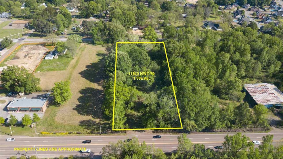
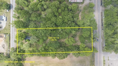
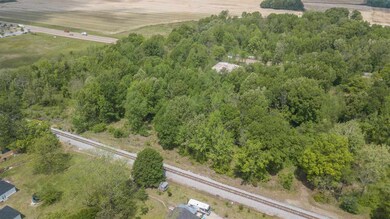
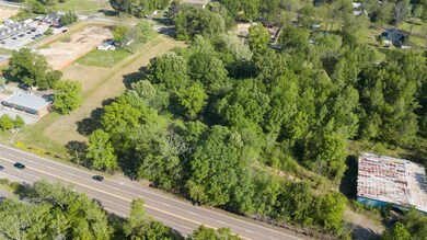
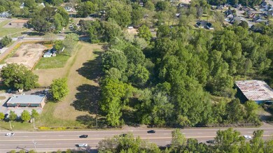
11819 Highway 70 Arlington, TN 38002
Estimated payment $1,615/month
Highlights
- 1.86 Acre Lot
- Wooded Lot
- Level Lot
- Arlington Elementary School Rated A
- Door to Door Trash Pickup
About This Lot
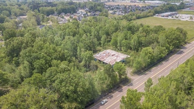
11819 HWY 70 - 1.86 Acre +/- Zoned S-C (Shopping Center) This Parcel has approximately 147 frontage feet that runs along the South Line of HWY 70 and is approximately 553 feet deep. It shares the east lot line of 11791 HWY 70. The rear property line is shared with the CSX Rail Road. Part of the Property is in the 100-year flood plain Zone AE and also the 500-year flood plain TDEC Order (closed) & Soil Remediation Summary Report - HES Project NO. 3707.17 are available for review
Property Details
Property Type
- Land
Est. Annual Taxes
- $1,417
Lot Details
- 1.86 Acre Lot
- Property fronts a state road
- Level Lot
- Wooded Lot
- Property is zoned S-C
Utilities
- Phone Available
Community Details
- Arlington Subdivision
- Door to Door Trash Pickup
Listing and Financial Details
- Assessor Parcel Number A0142 00053
Map
Home Values in the Area
Average Home Value in this Area
Tax History
| Year | Tax Paid | Tax Assessment Tax Assessment Total Assessment is a certain percentage of the fair market value that is determined by local assessors to be the total taxable value of land and additions on the property. | Land | Improvement |
|---|---|---|---|---|
| 2025 | $1,417 | $41,800 | $41,800 | -- |
| 2024 | $2,834 | $41,800 | $41,800 | -- |
| 2023 | $1,952 | $41,800 | $41,800 | $0 |
| 2022 | $1,952 | $41,800 | $41,800 | $0 |
| 2021 | $1,977 | $41,800 | $41,800 | $0 |
| 2020 | $2,266 | $41,800 | $41,800 | $0 |
| 2019 | $1,693 | $41,800 | $41,800 | $0 |
| 2018 | $2,174 | $41,800 | $41,800 | $0 |
| 2017 | $2,199 | $41,800 | $41,800 | $0 |
| 2016 | $2,221 | $40,240 | $0 | $0 |
| 2014 | $1,758 | $40,240 | $0 | $0 |
Property History
| Date | Event | Price | List to Sale | Price per Sq Ft |
|---|---|---|---|---|
| 02/02/2024 02/02/24 | Price Changed | $283,573 | +62.0% | -- |
| 09/12/2018 09/12/18 | For Sale | $175,000 | -- | -- |
Source: Memphis Area Association of REALTORS®
MLS Number: 10036410
APN: A0-142-0-0053
Disclaimer: Certain information contained herein is derived from information provided by parties other than Homes.com. All information provided is deemed reliable, but is not guaranteed to be accurate and should be independently verified.
![]() Listing content and images Copyright 2025 Memphis Area Association of REALTORS®. Information provided is for the consumer’s personal, non-commercial use and may not be used for any purpose other than to identify prospective properties consumers may be interested in purchasing. Do not rely upon listing data without independently verifying it.
Listing content and images Copyright 2025 Memphis Area Association of REALTORS®. Information provided is for the consumer’s personal, non-commercial use and may not be used for any purpose other than to identify prospective properties consumers may be interested in purchasing. Do not rely upon listing data without independently verifying it.
Some or all of the listings displayed may not belong to the firm whose website is being visited.
- 11850 Us 70 Hwy
- 6071 Woodson St
- 0 Us 70 Hwy Unit 10096004
- 5995 Henning Oaks Cove
- 12133 S Shady Tree Ln
- 11771 Mcauley St
- 11996 Douglass St
- 12260 Afton Place
- 6350 Bevan Lake Dr
- 6342 Bevan Lake Dr
- 6324 Bevan Lake Dr
- 6318 Bevan Lake Dr
- 6314 Bevan Lake Dr
- 6284 Bevan Lake Dr
- 5143 Lawrenceburg Ln W
- 12345 Oil Field Ln
- 12006 Cranston Dr
- 5118 Lawrenceburg Ln E
- 6205 Lubiani Valley Dr
- 5030 Jon Oak Cove
- 6029 Marley St
- 12214 Mary Alice Dr
- 6111 Lubiani Valley Dr
- 12435 Garrett Valley Place
- 5707 Chester St
- 12242 Stately Oaks Cove
- 5624 Draper Trail
- 11635 Dempsey Dr
- 5396 Mahogany Ridge Dr
- 11215 Ram Hill Cove
- 11616 Leewood Dr
- 5380 Milton Ridge Dr
- 11652 Mahogany Dr
- 11183 Ewe Turn Dr
- 5245 Charlotte Oak Cove
- 5155 Zachary Run Cove
- 11625 Belle Manor Dr
- 5086 Jon Oak Dr
- 4902 Longleaf Oak Cove
- 5357 Conifer View Ln
