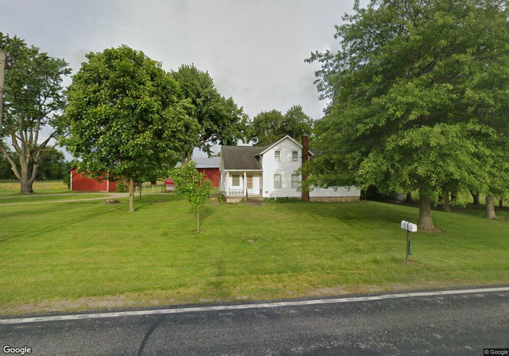
11819 Patten Tract Rd Monroeville, OH 44847
Estimated Value: $228,000 - $891,452
4
Beds
1
Bath
2,146
Sq Ft
$261/Sq Ft
Est. Value
About This Home
This home is located at 11819 Patten Tract Rd, Monroeville, OH 44847 and is currently estimated at $559,726, approximately $260 per square foot. 11819 Patten Tract Rd is a home with nearby schools including Monroeville Elementary School and Monroeville High School.
Ownership History
Date
Name
Owned For
Owner Type
Purchase Details
Closed on
Jun 17, 2020
Sold by
Schlessman Rodney W
Bought by
Schlessman Rodney W and The Rodney W Schlessman Revoca
Current Estimated Value
Purchase Details
Closed on
Nov 26, 2019
Sold by
Schlessman Paul M and Schlessman Rodney W
Bought by
Schlessman Rodney W
Purchase Details
Closed on
Jul 18, 2019
Sold by
Schlessman Harriett K Trustee
Bought by
Schlessman Paul M and Schlessman Rodney W
Purchase Details
Closed on
Jun 19, 2013
Sold by
Schlessman Paul M and Schlessman Rodney W
Bought by
Schlessman Harriett K
Create a Home Valuation Report for This Property
The Home Valuation Report is an in-depth analysis detailing your home's value as well as a comparison with similar homes in the area
Purchase History
We collect this data history from publicly available records. To have your information removed, we recommend requesting removal directly through your county’s website.
| Date | Buyer | Sale Price | Title Company |
|---|---|---|---|
| Schlessman Rodney W | -- | None Available | |
| Schlessman Rodney W | -- | None Available | |
| Schlessman Paul M | -- | -- | |
| Schlessman Harriett K | -- | None Available |
Source: Public Records
Tax History
| Year | Tax Paid | Tax Assessment Tax Assessment Total Assessment is a certain percentage of the fair market value that is determined by local assessors to be the total taxable value of land and additions on the property. | Land | Improvement |
|---|---|---|---|---|
| 2025 | $4,714 | $214,703 | $166,932 | $47,771 |
| 2024 | $4,714 | $214,703 | $166,932 | $47,771 |
| 2023 | $4,728 | $134,630 | $102,119 | $32,511 |
| 2022 | $3,490 | $134,630 | $102,119 | $32,511 |
| 2021 | $3,391 | $134,630 | $102,120 | $32,510 |
| 2020 | $3,773 | $133,600 | $102,120 | $31,480 |
| 2019 | $3,477 | $133,600 | $102,120 | $31,480 |
| 2018 | $3,480 | $133,600 | $102,120 | $31,480 |
| 2017 | $3,700 | $112,370 | $85,980 | $26,390 |
| 2016 | $3,657 | $112,370 | $85,980 | $26,390 |
| 2015 | $3,846 | $112,370 | $85,980 | $26,390 |
| 2014 | $2,067 | $75,870 | $49,480 | $26,390 |
| 2013 | $1,086 | $75,870 | $49,480 | $26,390 |
Source: Public Records
Map
Nearby Homes
- 5109 Delematre Rd
- 5295 Ohio 99
- 4702 W Mason Rd
- 2 Eagle View Dr
- 117 North St
- 113 North St
- 162 West St
- 134 Monroe St
- 15 Jackson St
- 412 Monroe St
- 6208 Skadden Rd
- 0 Skadden Rd
- 3050 E Main St
- 9312 Milan
- 12714 US Highway 250 N
- 60 Grassland Cir
- 4591 Whittlesey Ave
- 9039 Milan
- 6136 State Route 113
- 1 E Front St
- 11917 Patten Tract Rd
- 5615 Delematre Rd
- 11715 Patten Tract Rd
- 5601 Delematre Rd
- 11703 Patten Tract
- 5425 Delematre Rd
- 12211 Patten Tract Rd
- 11609 Patten Tract Rd
- 5411 Delematre Rd
- 12215 Patten Tract Rd
- 12206 Patten Tract Rd
- 12303 Patten Tract Rd
- 12303 Patten Tract Rd
- 5315 Delematre Rd
- 5313 Delematre Rd
- 12309 Patten Tract Rd
- 5311 Delematre Rd
- 12313 Patten Tract Rd
- 5307 Delematre Rd
- 12319 Patten Tract Rd
Your Personal Tour Guide
Ask me questions while you tour the home.