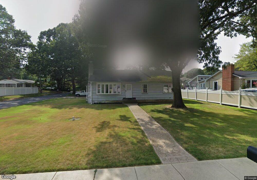
1182 Hampton Rd Annapolis, MD 21409
Cape Saint Claire NeighborhoodEstimated Value: $398,700 - $488,000
Studio
1
Bath
1,188
Sq Ft
$372/Sq Ft
Est. Value
About This Home
This home is located at 1182 Hampton Rd, Annapolis, MD 21409 and is currently estimated at $441,925, approximately $371 per square foot. 1182 Hampton Rd is a home located in Anne Arundel County with nearby schools including Cape St. Claire Elementary School, Magothy River Middle School, and Broadneck High School.
Ownership History
Date
Name
Owned For
Owner Type
Purchase Details
Closed on
Dec 15, 2003
Sold by
Nelson Mark W
Bought by
Nelson Mark W
Current Estimated Value
Purchase Details
Closed on
Nov 3, 1989
Sold by
D'Ambra Salvatore F
Bought by
Nelson Mark W
Home Financials for this Owner
Home Financials are based on the most recent Mortgage that was taken out on this home.
Original Mortgage
$104,500
Interest Rate
9.82%
Create a Home Valuation Report for This Property
The Home Valuation Report is an in-depth analysis detailing your home's value as well as a comparison with similar homes in the area
Home Values in the Area
Average Home Value in this Area
Purchase History
| Date | Buyer | Sale Price | Title Company |
|---|---|---|---|
| Nelson Mark W | -- | -- | |
| Nelson Mark W | $110,000 | -- |
Source: Public Records
Mortgage History
| Date | Status | Borrower | Loan Amount |
|---|---|---|---|
| Previous Owner | Nelson Mark W | $104,500 |
Source: Public Records
Tax History
| Year | Tax Paid | Tax Assessment Tax Assessment Total Assessment is a certain percentage of the fair market value that is determined by local assessors to be the total taxable value of land and additions on the property. | Land | Improvement |
|---|---|---|---|---|
| 2025 | $4,419 | $348,000 | -- | -- |
| 2024 | $4,419 | $332,900 | $236,300 | $96,600 |
| 2023 | $4,287 | $329,933 | $0 | $0 |
| 2022 | $3,417 | $326,967 | $0 | $0 |
| 2020 | $3,793 | $306,933 | $0 | $0 |
| 2019 | $3,612 | $289,867 | $0 | $0 |
| 2018 | $413 | $272,800 | $191,000 | $81,800 |
| 2017 | $3,290 | $268,100 | $0 | $0 |
| 2016 | $413 | $263,400 | $0 | $0 |
| 2015 | $413 | $258,700 | $0 | $0 |
| 2014 | -- | $258,700 | $0 | $0 |
Source: Public Records
Map
Nearby Homes
- 982 Highpoint Dr
- 1041 Skyview Dr
- 1162 Saint George Dr
- 1207 Hampton Rd
- 1217 Hampton Rd
- 1337 Swan Dr
- 1045 Saint Margarets Dr
- 1107 Crestview Dr
- 1014 St Charles Dr
- 1148 Riverview Dr
- 1155 Bayview Vista
- 1250A Cedar Tree Ln
- 1165 Green Holly Ct
- 1176 Green Holly Dr
- 1138 Ramblewood Dr
- 1359 Almond Dr
- 721 Fairway Dr
- 959 Morgan Dr
- 1382 Almond Dr
- 1019 Landon Ln
- 1180 Hampton Rd
- 996 Saint Johns Dr
- 1178 Hampton Rd
- 1184 Hampton Rd
- 1011 Saint Margarets Dr
- 995 Saint Johns Dr
- 994 Saint Johns Dr
- 1181 Hampton Rd
- 1183 Hampton Rd
- 1179 Hampton Rd
- 1185 Hampton Rd
- 1235001233 Hampton Rd
- 993 Saint Johns Dr
- 1177 Hampton Rd
- 992 Saint Johns Dr
- 1187 Hampton Rd
- 1175 Hampton Rd
- 1176 Hampton Rd
- 1188 Hampton Rd
- 996 Highpoint Dr
Your Personal Tour Guide
Ask me questions while you tour the home.