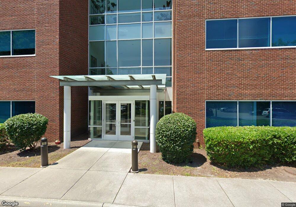
11837 Rock Landing Dr Newport News, VA 23606
--
Bed
--
Bath
28,560
Sq Ft
1.5
Acres
About This Home
This home is located at 11837 Rock Landing Dr, Newport News, VA 23606. 11837 Rock Landing Dr is a home located in Newport News City with nearby schools including L.F. Palmer Elementary School, Homer L. Hines Middle School, and Warwick High School.
Ownership History
Date
Name
Owned For
Owner Type
Purchase Details
Closed on
Sep 10, 2004
Sold by
Economic Dev Athuority Of
Bought by
Cedar Enterprises L L C
Home Financials for this Owner
Home Financials are based on the most recent Mortgage that was taken out on this home.
Original Mortgage
$100,000
Outstanding Balance
$50,005
Interest Rate
6.02%
Mortgage Type
Commercial
Create a Home Valuation Report for This Property
The Home Valuation Report is an in-depth analysis detailing your home's value as well as a comparison with similar homes in the area
Home Values in the Area
Average Home Value in this Area
Purchase History
| Date | Buyer | Sale Price | Title Company |
|---|---|---|---|
| Cedar Enterprises L L C | $300,000 | -- |
Source: Public Records
Mortgage History
| Date | Status | Borrower | Loan Amount |
|---|---|---|---|
| Open | Cedar Enterprises L L C | $100,000 |
Source: Public Records
Tax History Compared to Growth
Tax History
| Year | Tax Paid | Tax Assessment Tax Assessment Total Assessment is a certain percentage of the fair market value that is determined by local assessors to be the total taxable value of land and additions on the property. | Land | Improvement |
|---|---|---|---|---|
| 2024 | $47,541 | $4,028,900 | $270,500 | $3,758,400 |
| 2023 | $50,834 | $4,028,900 | $270,500 | $3,758,400 |
| 2022 | $51,640 | $4,028,900 | $270,500 | $3,758,400 |
| 2021 | $44,038 | $3,609,700 | $270,500 | $3,339,200 |
| 2020 | $47,331 | $3,609,700 | $270,500 | $3,339,200 |
| 2019 | $45,331 | $3,454,600 | $270,500 | $3,184,100 |
| 2018 | $41,784 | $3,169,300 | $270,500 | $2,898,800 |
| 2017 | $41,784 | $3,169,300 | $270,500 | $2,898,800 |
| 2016 | $41,689 | $3,169,300 | $270,500 | $2,898,800 |
| 2015 | $39,291 | $2,983,700 | $270,500 | $2,713,200 |
| 2014 | $30,754 | $2,795,800 | $225,400 | $2,570,400 |
Source: Public Records
Map
Nearby Homes
- 670 Town Center Dr Unit 406
- 670 Town Center Dr
- 670 Town Center Dr Unit 418
- 332 Nantucket Place
- 106 Deep Water Cove
- 103 Nantucket Place
- 1001 Willow Green Dr
- 101 Nantucket Place
- 1080 Willow Green Dr
- 103 Wreck Shoal Dr
- 135 Wreck Shoal Dr
- 7 Sandhurst Cir
- 748 Leonard Ln
- 902 Miller Creek Ln
- 923 Chatsworth Dr
- 825 Greenwich Ln
- 818 Miller Creek Ln
- 215 Belray Dr
- 731 Oak Mill Ln
- 615 Commonwealth Dr
- 11835 Rock Landing Dr
- 818 Bluecrab Rd
- 11839 Rock Landing Dr
- 11825 Rock Landing Dr
- 814 Bluecrab Rd
- 11821 Rock Landing Dr
- 11832 Rock Landing Dr
- 11841 Rock Landing Dr
- 810 Bluecrab Rd
- 11819 Rock Landing Dr
- 815-A Bluecrab Rd
- 815-B Bluecrab Rd
- 815-C Bluecrab Rd
- 815-D Bluecrab Rd
- 819 Bluecrab Rd
- 815 Bluecrab Rd Unit E
- 815 Bluecrab Rd Unit I
- 815 Bluecrab Rd Unit G
- 815 Bluecrab Rd Unit F
- 815 Bluecrab Rd Unit D