Estimated Value: $469,280 - $531,000
4
Beds
3
Baths
2,224
Sq Ft
$225/Sq Ft
Est. Value
About This Home
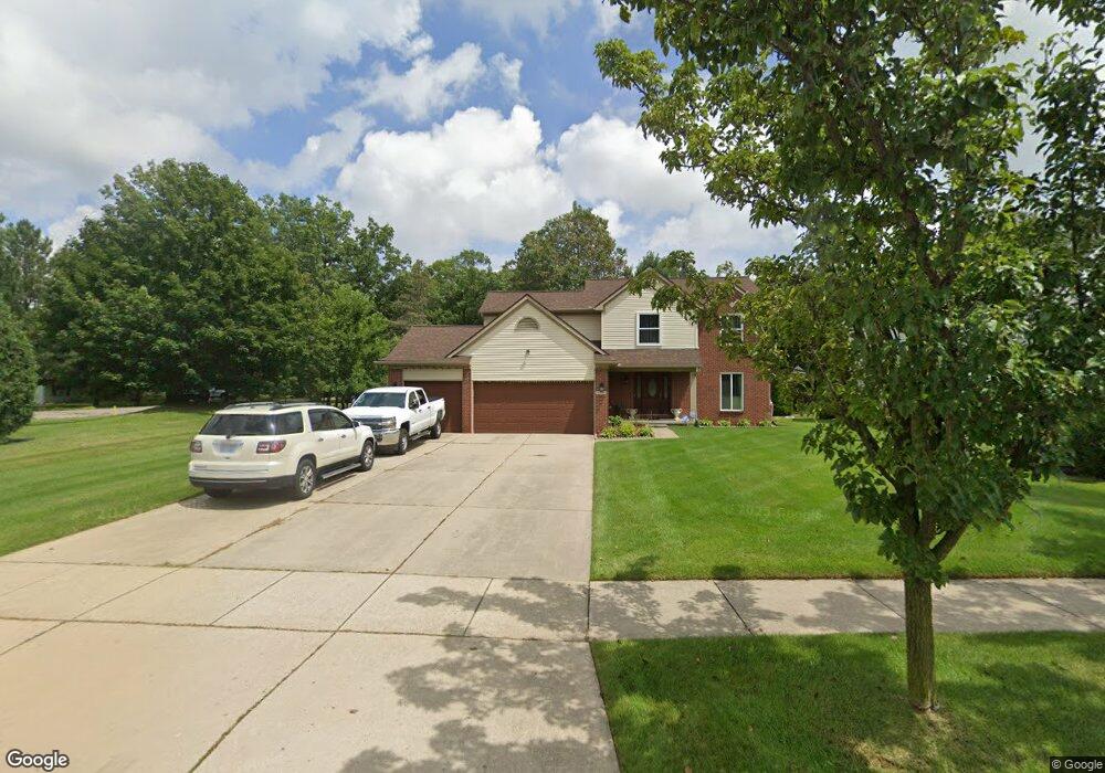
This home is located at 1184 Black Locust Dr, Wixom, MI 48393 and is currently estimated at $499,570, approximately $224 per square foot. 1184 Black Locust Dr is a home located in Oakland County with nearby schools including Walled Lake Elementary School, Sarah G. Banks Middle School, and Walled Lake Western High School.
Ownership History
Date
Name
Owned For
Owner Type
Purchase Details
Closed on
Mar 13, 2004
Sold by
Hall Pinda K and Williams Matthew E
Bought by
Salama Dhafer
Current Estimated Value
Purchase Details
Closed on
Feb 5, 2001
Sold by
Uplands Properties Inc
Bought by
Williams Matthew E
Purchase Details
Closed on
Mar 24, 1999
Sold by
Potter Road Prop
Bought by
Upland Properties Inc
Create a Home Valuation Report for This Property
The Home Valuation Report is an in-depth analysis detailing your home's value as well as a comparison with similar homes in the area
Home Values in the Area
Average Home Value in this Area
Purchase History
| Date | Buyer | Sale Price | Title Company |
|---|---|---|---|
| Salama Dhafer | $277,500 | -- | |
| Williams Matthew E | $259,900 | -- | |
| Upland Properties Inc | $57,500 | -- |
Source: Public Records
Tax History Compared to Growth
Tax History
| Year | Tax Paid | Tax Assessment Tax Assessment Total Assessment is a certain percentage of the fair market value that is determined by local assessors to be the total taxable value of land and additions on the property. | Land | Improvement |
|---|---|---|---|---|
| 2024 | $5,953 | $202,530 | $0 | $0 |
| 2023 | $5,651 | $174,690 | $0 | $0 |
| 2022 | $5,578 | $162,110 | $0 | $0 |
| 2021 | $5,546 | $160,450 | $0 | $0 |
| 2020 | $5,220 | $150,100 | $0 | $0 |
| 2019 | $5,350 | $145,200 | $0 | $0 |
| 2018 | $5,373 | $138,670 | $0 | $0 |
| 2017 | $5,297 | $136,930 | $0 | $0 |
| 2016 | $5,276 | $134,250 | $0 | $0 |
| 2015 | -- | $120,270 | $0 | $0 |
| 2014 | -- | $99,770 | $0 | $0 |
| 2011 | -- | $91,300 | $0 | $0 |
Source: Public Records
Map
Nearby Homes
- 1369 Flamingo
- 3184 Roma Ct
- 3202 Roma Ct
- 1470 Nightingale
- 3201 Roma Ct
- 2759 Maple Forest Dr Unit 84
- 1445 Mariposa Dr
- 2750 Maple Forest Dr
- 2588 Maple Forest Ct
- 746 Red Maple Ln
- 1432 Pond View Ct
- 1255 Andover Dr
- 691 Chestnut Dr Unit 24
- 913 Rikki Ann Ct
- 570 Maplewood
- 3236 Curtis Rd
- 3584 W Maple Rd
- 3010 Theodore
- 2988 Theodore
- 2406 Madison St
- 1168 Black Locust Dr
- 1152 Black Locust Dr
- 3075 Potter Rd
- 3049 Potter Rd
- 3096 Potter Rd
- 1136 Black Locust Dr
- 3035 Potter Rd
- 1120 Black Locust Dr
- 3064 Potter Rd
- 1226 Bell Coney
- 1239 Morningdove
- 3070 Pheasant Run East Dr
- 3027 Potter Rd
- 1104 Black Locust Dr
- 1247 Morningdove
- 3058 Pheasant Run East Dr
- 3030 Potter Rd
- 1240 Morningdove
- 1210 Crestview Blvd
- 3044 Pheasant Run Dr E