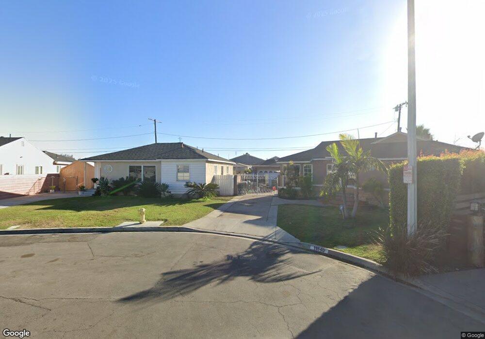
11844 Cheddar St Norwalk, CA 90650
Estimated Value: $695,000 - $772,000
3
Beds
1
Bath
1,122
Sq Ft
$656/Sq Ft
Est. Value
About This Home
This home is located at 11844 Cheddar St, Norwalk, CA 90650 and is currently estimated at $736,277, approximately $656 per square foot. 11844 Cheddar St is a home located in Los Angeles County with nearby schools including Julia B. Morrison Elementary School, Corvallis Middle School, and Norwalk High School.
Ownership History
Date
Name
Owned For
Owner Type
Purchase Details
Closed on
Mar 3, 2003
Sold by
The Davis Trust
Bought by
Kawasaki Alex A and Kawasaki Karen M
Current Estimated Value
Home Financials for this Owner
Home Financials are based on the most recent Mortgage that was taken out on this home.
Original Mortgage
$192,000
Interest Rate
5.72%
Purchase Details
Closed on
Jun 5, 2002
Sold by
Davis Carole S and Davis Phil Robert
Bought by
Davis Phil R and Davis Trust
Purchase Details
Closed on
Aug 22, 2001
Sold by
Davis Carole S and Davis Trust
Bought by
Davis Robert F and Davis Carole S
Create a Home Valuation Report for This Property
The Home Valuation Report is an in-depth analysis detailing your home's value as well as a comparison with similar homes in the area
Home Values in the Area
Average Home Value in this Area
Purchase History
| Date | Buyer | Sale Price | Title Company |
|---|---|---|---|
| Kawasaki Alex A | $240,000 | Fidelity | |
| Davis Phil R | -- | -- | |
| Davis Robert F | -- | -- |
Source: Public Records
Mortgage History
| Date | Status | Borrower | Loan Amount |
|---|---|---|---|
| Previous Owner | Kawasaki Alex A | $192,000 | |
| Closed | Kawasaki Alex A | $48,000 |
Source: Public Records
Tax History Compared to Growth
Tax History
| Year | Tax Paid | Tax Assessment Tax Assessment Total Assessment is a certain percentage of the fair market value that is determined by local assessors to be the total taxable value of land and additions on the property. | Land | Improvement |
|---|---|---|---|---|
| 2025 | $4,611 | $347,578 | $275,320 | $72,258 |
| 2024 | $4,611 | $340,764 | $269,922 | $70,842 |
| 2023 | $4,457 | $334,083 | $264,630 | $69,453 |
| 2022 | $4,379 | $327,534 | $259,442 | $68,092 |
| 2021 | $4,317 | $321,112 | $254,355 | $66,757 |
| 2019 | $4,193 | $311,589 | $246,811 | $64,778 |
| 2018 | $3,991 | $305,480 | $241,972 | $63,508 |
| 2016 | $3,822 | $293,620 | $232,577 | $61,043 |
| 2015 | $3,787 | $289,211 | $229,084 | $60,127 |
| 2014 | $3,528 | $283,547 | $224,597 | $58,950 |
Source: Public Records
Map
Nearby Homes
- 12700 Woods Ave
- 12414 Arlee Ave
- 12012 Sproul St Unit 1/2
- 11657 Dune St
- 11816 Arlee Ave
- 12874 Sycamore Village Dr
- 12714 Orr And Day Rd
- 12720 Harvest Ave
- 12344 Spry St
- 13623 Roseton Ave
- 11408 Foster Rd
- 12608 Longworth Ave
- 13918 Flallon Ave
- 12628 Fairford Ave
- 12020 Orange St Unit A
- 11136 Lyndora St
- 11402 Alburtis Ave
- 11331 Pioneer Blvd
- 11101 Imperial Hwy Unit 87
- 11101 Imperial Hwy Unit 129
- 11850 Cheddar St
- 11840 Cheddar St
- 11837 Cheddar St
- 11864 Lyndora St
- 11856 Lyndora St
- 11870 Lyndora St
- 11850 Lyndora St
- 11844 Lyndora St
- 11838 Lyndora St
- 11867 Lyndora St
- 11857 Lyndora St
- 11851 Lyndora St
- 11871 Lyndora St
- 11830 Lyndora St
- 11890 Lyndora St
- 11883 Lyndora St
- 11841 Lyndora St
- 11847 Lyndora St
- 12803 Bombardier Ave
- 11837 Lyndora St