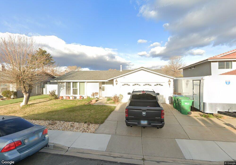
1185 La Via Way Sparks, NV 89434
O'Callaghan NeighborhoodEstimated Value: $435,439 - $445,000
4
Beds
2
Baths
1,536
Sq Ft
$288/Sq Ft
Est. Value
About This Home
This home is located at 1185 La Via Way, Sparks, NV 89434 and is currently estimated at $441,860, approximately $287 per square foot. 1185 La Via Way is a home located in Washoe County with nearby schools including Katherine Dunn Elementary School, George L Dilworth Middle School, and Edward C Reed High School.
Ownership History
Date
Name
Owned For
Owner Type
Purchase Details
Closed on
May 14, 2016
Sold by
Ebbs Thomas M and Ebbs Betty H
Bought by
Ebbs Family Trust
Current Estimated Value
Home Financials for this Owner
Home Financials are based on the most recent Mortgage that was taken out on this home.
Original Mortgage
$122,675
Interest Rate
3.58%
Mortgage Type
New Conventional
Purchase Details
Closed on
Aug 25, 2003
Sold by
Ebbs Thomas M and Ebbs Betty H
Bought by
Ebbs Thomas M and Ebbs Betty H
Create a Home Valuation Report for This Property
The Home Valuation Report is an in-depth analysis detailing your home's value as well as a comparison with similar homes in the area
Home Values in the Area
Average Home Value in this Area
Purchase History
| Date | Buyer | Sale Price | Title Company |
|---|---|---|---|
| Ebbs Family Trust | -- | Title Source Inc | |
| Ebbs Thomas M | -- | Title Source Inc | |
| Ebbs Thomas M | -- | -- |
Source: Public Records
Mortgage History
| Date | Status | Borrower | Loan Amount |
|---|---|---|---|
| Closed | Ebbs Family Trust | $122,675 |
Source: Public Records
Tax History Compared to Growth
Tax History
| Year | Tax Paid | Tax Assessment Tax Assessment Total Assessment is a certain percentage of the fair market value that is determined by local assessors to be the total taxable value of land and additions on the property. | Land | Improvement |
|---|---|---|---|---|
| 2025 | $1,502 | $60,423 | $37,275 | $23,148 |
| 2024 | $1,502 | $55,406 | $32,620 | $22,786 |
| 2023 | $1,057 | $52,781 | $31,710 | $21,071 |
| 2022 | $1,419 | $45,680 | $27,475 | $18,205 |
| 2021 | $1,317 | $39,926 | $21,175 | $18,751 |
| 2020 | $1,235 | $39,898 | $20,510 | $19,388 |
| 2019 | $1,176 | $38,142 | $18,865 | $19,277 |
| 2018 | $1,122 | $32,781 | $13,405 | $19,376 |
| 2017 | $1,077 | $32,630 | $12,810 | $19,820 |
| 2016 | $1,049 | $33,079 | $12,355 | $20,724 |
| 2015 | $1,049 | $30,852 | $9,695 | $21,157 |
| 2014 | $1,007 | $29,103 | $8,435 | $20,668 |
| 2013 | -- | $26,843 | $6,055 | $20,788 |
Source: Public Records
Map
Nearby Homes
- 1218 Junction Dr
- 857 Cherry Tree Dr Unit 3
- 1544 Woodhaven Ln
- 1332 Coachman Ct
- 675 Parlanti Ln Unit 52
- 675 Parlanti Ln Unit 124
- 675 Parlanti Ln Unit 42
- 675 Parlanti Ln
- 675 Parlanti Ln Unit 88
- 949 Crestwood Dr Unit 3
- 1728 Bluehaven Dr
- 1897 Bonita Vista Dr
- 801 Woodglen Dr Unit 2
- 848 Parkside Dr Unit 1
- 1970 Woodhaven Ln
- 907 Camino Real Dr
- 1973 Rio Tinto Dr
- 1990 Fargo Way
- 1770 Burnside Dr
- 684 Oakwood Dr Unit 3
- 1183 La Via Way
- 1189 La Via Way
- 1172 El Capitan Ct
- 1162 El Capitan Ct
- 1182 El Capitan Ct
- 1175 La Via Way
- 1195 La Via Way
- 1186 La Via Way
- 1184 La Via Way
- 1188 La Via Way
- 1186 El Capitan Ct
- 1152 El Capitan Ct
- 1180 La Via Way
- 1173 La Via Way
- 1192 La Via Way
- 1176 La Via Way
- 1124 El Capitan Ct
- 1116 El Capitan Ct
- 1134 El Capitan Ct
- 1148 El Capitan Ct