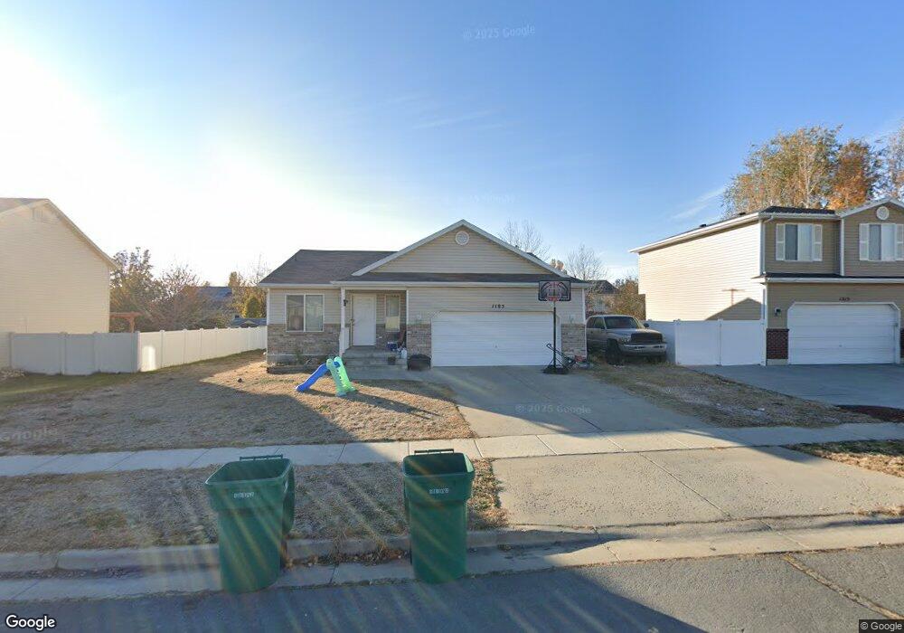
1185 N 2425 W Layton, UT 84041
Estimated Value: $474,000 - $519,433
3
Beds
2
Baths
2,736
Sq Ft
$180/Sq Ft
Est. Value
About This Home
This home is located at 1185 N 2425 W, Layton, UT 84041 and is currently estimated at $491,608, approximately $179 per square foot. 1185 N 2425 W is a home located in Davis County with nearby schools including Ellison Park School, Shoreline Junior High School, and Layton High School.
Ownership History
Date
Name
Owned For
Owner Type
Purchase Details
Closed on
Oct 5, 2009
Sold by
Bank Of America National Association
Bought by
Woolsey Brett
Current Estimated Value
Purchase Details
Closed on
May 15, 2009
Sold by
Maes Michelle
Bought by
Bank Of America National Association
Purchase Details
Closed on
Jan 9, 2007
Sold by
Ward Leland and Ward Christine
Bought by
Maes Michelle
Home Financials for this Owner
Home Financials are based on the most recent Mortgage that was taken out on this home.
Original Mortgage
$160,000
Interest Rate
8%
Mortgage Type
Purchase Money Mortgage
Purchase Details
Closed on
Sep 20, 2004
Sold by
Woodside Homes Corp
Bought by
Ward Leland and Ward Christine
Home Financials for this Owner
Home Financials are based on the most recent Mortgage that was taken out on this home.
Original Mortgage
$124,000
Interest Rate
6%
Mortgage Type
Purchase Money Mortgage
Create a Home Valuation Report for This Property
The Home Valuation Report is an in-depth analysis detailing your home's value as well as a comparison with similar homes in the area
Home Values in the Area
Average Home Value in this Area
Purchase History
| Date | Buyer | Sale Price | Title Company |
|---|---|---|---|
| Woolsey Brett | -- | First American Title | |
| Bank Of America National Association | $176,000 | Etitle Insurance Agency | |
| Maes Michelle | -- | Hickman Land Title Co | |
| Ward Leland | -- | Us Title Of Utah |
Source: Public Records
Mortgage History
| Date | Status | Borrower | Loan Amount |
|---|---|---|---|
| Previous Owner | Maes Michelle | $160,000 | |
| Previous Owner | Maes Michelle | $40,000 | |
| Previous Owner | Ward Leland | $124,000 | |
| Closed | Ward Leland | $31,000 |
Source: Public Records
Tax History
| Year | Tax Paid | Tax Assessment Tax Assessment Total Assessment is a certain percentage of the fair market value that is determined by local assessors to be the total taxable value of land and additions on the property. | Land | Improvement |
|---|---|---|---|---|
| 2025 | $2,463 | $258,501 | $106,211 | $152,290 |
| 2024 | $2,341 | $247,500 | $118,446 | $129,054 |
| 2023 | $2,259 | $421,000 | $115,293 | $305,707 |
| 2022 | $2,462 | $249,150 | $73,391 | $175,759 |
| 2021 | $2,279 | $344,000 | $110,122 | $233,878 |
| 2020 | $2,058 | $298,000 | $92,264 | $205,736 |
| 2019 | $2,009 | $285,000 | $95,783 | $189,217 |
| 2018 | $1,819 | $259,000 | $83,884 | $175,116 |
| 2016 | $1,582 | $116,215 | $32,390 | $83,825 |
| 2015 | $1,606 | $109,230 | $32,390 | $76,840 |
| 2014 | $1,516 | $108,101 | $32,390 | $75,711 |
| 2013 | -- | $90,247 | $28,952 | $61,295 |
Source: Public Records
Map
Nearby Homes
- 1141 N 2275 W
- 1477 N 2375 W
- 1430 N 2100 W
- 818 N 2625 W
- 867 N 2125 W
- 1491 N 1875 W
- 1491 N 1875 W Unit 158
- 1452 N 1875 W Unit 146
- 1487 N 1875 W
- 1487 N 1875 W Unit 159
- 1483 N 1875 W
- 1479 N 1875 W
- 1479 N 1875 W Unit 161
- 1475 N 1875 W
- 1471 N 1875 W
- 1471 N 1875 W Unit 163
- 1463 N 1875 W Unit 165
- 1459 N 1875 W Unit 166
- 1459 N 1875 W
- 1455 N 1875 W Unit 167