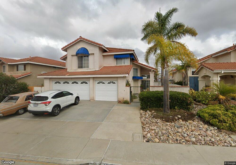
11851 River Rim Rd San Diego, CA 92126
Mira Mesa NeighborhoodEstimated Value: $1,453,000 - $1,673,000
5
Beds
4
Baths
2,760
Sq Ft
$561/Sq Ft
Est. Value
About This Home
This home is located at 11851 River Rim Rd, San Diego, CA 92126 and is currently estimated at $1,549,342, approximately $561 per square foot. 11851 River Rim Rd is a home located in San Diego County with nearby schools including Sandburg Elementary School, Challenger Middle School, and Mira Mesa High School.
Ownership History
Date
Name
Owned For
Owner Type
Purchase Details
Closed on
Jul 29, 2015
Sold by
Childs Philip E
Bought by
Childs Philip E and Childs Barbara H
Current Estimated Value
Purchase Details
Closed on
Dec 3, 2003
Sold by
Childs Philip E
Bought by
Childs Philip E
Purchase Details
Closed on
May 17, 1999
Sold by
Childs Barbara H
Bought by
Childs Philip E and Childs Barbara H
Purchase Details
Closed on
Aug 25, 1998
Sold by
Kuhn Barbara H and Childs Philip E
Bought by
Childs Philip E and Childs Barbara H
Purchase Details
Closed on
Aug 20, 1993
Sold by
Kuhn Barbara H and Childs Philip E
Bought by
Kuhn Barbara H and Childs Philip E
Purchase Details
Closed on
Jul 30, 1993
Purchase Details
Closed on
Dec 18, 1989
Create a Home Valuation Report for This Property
The Home Valuation Report is an in-depth analysis detailing your home's value as well as a comparison with similar homes in the area
Home Values in the Area
Average Home Value in this Area
Purchase History
| Date | Buyer | Sale Price | Title Company |
|---|---|---|---|
| Childs Philip E | -- | None Available | |
| Childs Philip E | -- | -- | |
| Childs Barbara H | -- | -- | |
| Childs Philip E | -- | -- | |
| Childs Philip E | -- | -- | |
| Kuhn Barbara H | -- | -- | |
| -- | $218,000 | -- | |
| -- | $291,000 | -- |
Source: Public Records
Tax History Compared to Growth
Tax History
| Year | Tax Paid | Tax Assessment Tax Assessment Total Assessment is a certain percentage of the fair market value that is determined by local assessors to be the total taxable value of land and additions on the property. | Land | Improvement |
|---|---|---|---|---|
| 2025 | $4,602 | $370,497 | $152,954 | $217,543 |
| 2024 | $4,602 | $363,233 | $149,955 | $213,278 |
| 2023 | $4,494 | $356,112 | $147,015 | $209,097 |
| 2022 | $4,365 | $349,131 | $144,133 | $204,998 |
| 2021 | $4,325 | $342,286 | $141,307 | $200,979 |
| 2020 | $4,271 | $338,778 | $139,859 | $198,919 |
| 2019 | $4,193 | $332,136 | $137,117 | $195,019 |
| 2018 | $3,924 | $325,625 | $134,429 | $191,196 |
| 2017 | $80 | $319,242 | $131,794 | $187,448 |
| 2016 | $3,760 | $312,983 | $129,210 | $183,773 |
| 2015 | $3,706 | $308,283 | $127,270 | $181,013 |
| 2014 | -- | $302,245 | $124,777 | $177,468 |
Source: Public Records
Map
Nearby Homes
- 8141 Calle Nueva
- 7758 Prairie Shadow Rd
- 8054 Los Sabalos St
- 7646 Acama St
- 7636 Acama St
- 11329 Avenida Del Gato
- 11305 Avenida Del Gato
- 11153 Acaso Way
- 11323 Trebol St
- 11550 Caminito la Bar Unit 118
- 11545 Caminito la Bar Unit 74
- 8419 Menkar Rd
- 11149 Blythe Rd
- 11313 Zapata Ave Unit 6
- 7444 Mason Heights Ln
- 11161 Camino Ruiz Unit 44
- 11187 Kelowna Rd Unit 76
- 8393 Capricorn Way Unit 90
- 11262 Ganesta Rd
- 11358 Vela Dr
- 11839 River Rim Rd
- 11863 River Rim Rd
- 11827 River Rim Rd
- 11875 River Rim Rd
- 11887 River Rim Rd
- 11815 River Rim Rd
- 11834 River Rim Rd
- 11822 River Rim Rd
- 11858 River Rim Rd
- 11803 River Rim Rd
- 7865 Norcanyon Way
- 7950 Winans Cove
- 11895 River Rim Rd
- 11864 River Rim Rd
- 11870 River Rim Rd
- 11882 River Rim Rd
- 7935 Dell Rim Ct
- 11797 River Rim Rd
- 7845 Norcanyon Way
- 7930 Dell Rim Ct