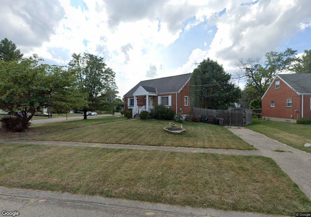
1186 Madeleine Cir Cincinnati, OH 45231
Finneytown NeighborhoodEstimated Value: $196,000 - $249,000
3
Beds
2
Baths
1,581
Sq Ft
$139/Sq Ft
Est. Value
About This Home
This home is located at 1186 Madeleine Cir, Cincinnati, OH 45231 and is currently estimated at $219,712, approximately $138 per square foot. 1186 Madeleine Cir is a home located in Hamilton County with nearby schools including Mt Healthy High School, John Paul II Catholic School, and St. Vivian School.
Ownership History
Date
Name
Owned For
Owner Type
Purchase Details
Closed on
Jul 29, 2008
Sold by
Miller Clinton E and Miller Jamie
Bought by
Bauer Kathryn A
Current Estimated Value
Home Financials for this Owner
Home Financials are based on the most recent Mortgage that was taken out on this home.
Original Mortgage
$97,440
Outstanding Balance
$63,440
Interest Rate
6.51%
Mortgage Type
FHA
Estimated Equity
$156,272
Purchase Details
Closed on
Dec 13, 2002
Sold by
Johnathan Barber and Johnathan Julie
Bought by
Miller Clinton E and Miller Jamie
Home Financials for this Owner
Home Financials are based on the most recent Mortgage that was taken out on this home.
Original Mortgage
$110,030
Interest Rate
6.01%
Mortgage Type
FHA
Purchase Details
Closed on
Jan 31, 1996
Sold by
Mecklenburg Charlene R
Bought by
Barber Johnathan and Browning Julie
Home Financials for this Owner
Home Financials are based on the most recent Mortgage that was taken out on this home.
Original Mortgage
$77,198
Interest Rate
7.11%
Mortgage Type
FHA
Create a Home Valuation Report for This Property
The Home Valuation Report is an in-depth analysis detailing your home's value as well as a comparison with similar homes in the area
Home Values in the Area
Average Home Value in this Area
Purchase History
| Date | Buyer | Sale Price | Title Company |
|---|---|---|---|
| Bauer Kathryn A | $106,340 | Ltoc | |
| Miller Clinton E | $110,900 | -- | |
| Barber Johnathan | -- | Midland Title Security Inc |
Source: Public Records
Mortgage History
| Date | Status | Borrower | Loan Amount |
|---|---|---|---|
| Open | Bauer Kathryn A | $97,440 | |
| Previous Owner | Miller Clinton E | $110,030 | |
| Previous Owner | Barber Johnathan | $77,198 |
Source: Public Records
Tax History
| Year | Tax Paid | Tax Assessment Tax Assessment Total Assessment is a certain percentage of the fair market value that is determined by local assessors to be the total taxable value of land and additions on the property. | Land | Improvement |
|---|---|---|---|---|
| 2025 | $3,636 | $52,143 | $12,320 | $39,823 |
| 2024 | $3,552 | $52,143 | $12,320 | $39,823 |
| 2023 | $3,492 | $52,143 | $12,320 | $39,823 |
| 2022 | $3,069 | $33,243 | $12,159 | $21,084 |
| 2021 | $3,011 | $33,243 | $12,159 | $21,084 |
| 2020 | $3,060 | $33,243 | $12,159 | $21,084 |
| 2019 | $2,810 | $28,172 | $10,304 | $17,868 |
| 2018 | $2,594 | $28,172 | $10,304 | $17,868 |
| 2017 | $2,472 | $28,172 | $10,304 | $17,868 |
| 2016 | $2,591 | $29,022 | $10,640 | $18,382 |
| 2015 | $2,608 | $29,022 | $10,640 | $18,382 |
| 2014 | $2,609 | $29,022 | $10,640 | $18,382 |
| 2013 | $2,657 | $30,548 | $11,200 | $19,348 |
Source: Public Records
Map
Nearby Homes
- 1125 Murkett Ct
- 1101 Meadowind Ct
- 1116 Madeleine Cir
- 8693 Mockingbird Ln
- 1123 Compton Rd
- 8663 Mockingbird Ln
- 1115 Compton Rd
- 8829 Mockingbird Ln
- 1144 Hempstead Dr
- 8609 Balboa Dr
- 1285 Landis Ln
- 1052 Vacationland Dr
- 7352 Clovernook Ave
- 8491 Daly Rd
- 8990 Mockingbird Ln
- 958 Hollytree Dr
- 7227 Bernard Ave
- 1202 Ashmore Ct
- 8433 Jonfred Ct
- 1283 Bellune Dr
- 8893 Monsanto Dr
- 1190 Madeleine Cir
- 1194 Madeleine Cir
- 8899 Monsanto Dr
- 1187 Madeleine Cir
- 8886 Monsanto Dr
- 1191 Madeleine Cir
- 8896 Monsanto Dr
- 1183 Madeleine Cir
- 1198 Madeleine Cir
- 8906 Daly Rd
- 1195 Madeleine Cir
- 8903 Monsanto Dr
- 8904 Monsanto Dr
- 8853 Monsanto Dr
- 8914 Daly Rd
- 8858 Monsanto Dr
- 8860 Daly Rd
- 8907 Monsanto Dr
- 1179 Madeleine Cir
Your Personal Tour Guide
Ask me questions while you tour the home.