Estimated Value: $202,000 - $217,000
--
Bed
1
Bath
1,508
Sq Ft
$140/Sq Ft
Est. Value
About This Home
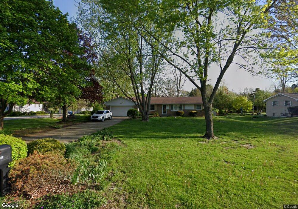
This home is located at 1188 W Rowland St, Flint, MI 48507 and is currently estimated at $211,852, approximately $140 per square foot. 1188 W Rowland St is a home located in Genesee County with nearby schools including Anderson Elementary School, McGrath Elementary School, and Grand Blanc West Middle School.
Ownership History
Date
Name
Owned For
Owner Type
Purchase Details
Closed on
Nov 1, 2024
Sold by
Martz Scott A
Bought by
Martz Todd B and Martz Bonnie Jean
Current Estimated Value
Home Financials for this Owner
Home Financials are based on the most recent Mortgage that was taken out on this home.
Original Mortgage
$160,000
Outstanding Balance
$158,230
Interest Rate
6.08%
Mortgage Type
New Conventional
Estimated Equity
$53,622
Purchase Details
Closed on
Oct 17, 2002
Sold by
Brandt Kent M
Bought by
Martz Scott A and Piske Mark A
Create a Home Valuation Report for This Property
The Home Valuation Report is an in-depth analysis detailing your home's value as well as a comparison with similar homes in the area
Home Values in the Area
Average Home Value in this Area
Purchase History
| Date | Buyer | Sale Price | Title Company |
|---|---|---|---|
| Martz Todd B | $200,000 | Mason Burgess Title | |
| Martz Scott A | $128,000 | Lawyers Title Insurance Corp |
Source: Public Records
Mortgage History
| Date | Status | Borrower | Loan Amount |
|---|---|---|---|
| Open | Martz Todd B | $160,000 |
Source: Public Records
Tax History Compared to Growth
Tax History
| Year | Tax Paid | Tax Assessment Tax Assessment Total Assessment is a certain percentage of the fair market value that is determined by local assessors to be the total taxable value of land and additions on the property. | Land | Improvement |
|---|---|---|---|---|
| 2025 | $2,353 | $92,700 | $0 | $0 |
| 2024 | $1,368 | $87,300 | $0 | $0 |
| 2023 | $1,305 | $79,100 | $0 | $0 |
| 2022 | $2,067 | $72,700 | $0 | $0 |
| 2021 | $2,035 | $69,200 | $0 | $0 |
| 2020 | $1,203 | $65,400 | $0 | $0 |
| 2019 | $1,186 | $62,500 | $0 | $0 |
| 2018 | $1,856 | $56,800 | $0 | $0 |
| 2017 | $1,776 | $56,200 | $0 | $0 |
| 2016 | $1,768 | $53,200 | $0 | $0 |
| 2015 | $1,513 | $46,500 | $0 | $0 |
| 2014 | $1,034 | $44,500 | $0 | $0 |
| 2012 | -- | $41,800 | $41,800 | $0 |
Source: Public Records
Map
Nearby Homes
- 1136 W Rowland St
- 1256 W Rowland St
- 4480 Cherrytree Ln
- 1044 W Rowland St
- 4460 Saint Martins Dr
- 4505 Old Carriage Rd
- 1203 Pickwick Place
- 4493 Fenton Rd
- 1144 Pickwick Place
- 1130 Leisure Dr Unit 21
- 1045 Leisure Dr Unit 7
- 1380 Sunset Blvd
- 00 Coolidge Dr
- 000 Coolidge Dr
- 0000 Coolidge Dr
- 1108 Trotwood Ln
- 0000 Mckinley Blvd
- 1072 W Williamson Ave
- 00 Mckinley Blvd
- 000 Mckinley Blvd
- 1174 W Rowland St
- 1198 W Rowland St
- 1160 W Rowland St
- 1208 W Rowland St
- 1152 W Rowland St
- 1216 W Rowland St
- 1199 W Maple Ave
- 1189 W Rowland St
- 1175 W Maple Ave
- 1173 W Rowland St
- 1197 W Rowland St
- 1234 W Rowland St
- 1207 W Rowland St
- 1159 W Rowland St
- 1211 W Maple Ave
- 1223 W Maple Ave
- 1153 W Maple Ave
- 1221 W Rowland St
- 1128 W Rowland St
- 1244 W Rowland St