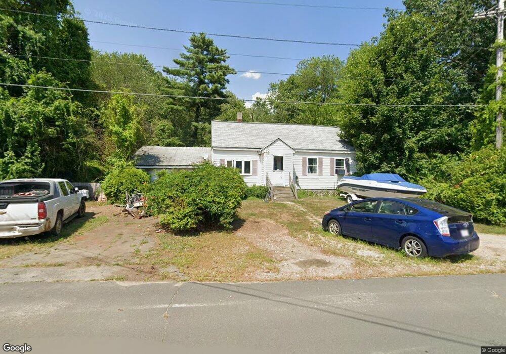
119 Brookside Rd Orange, MA 01364
Estimated Value: $309,000 - $337,000
3
Beds
1
Bath
1,050
Sq Ft
$312/Sq Ft
Est. Value
About This Home
This home is located at 119 Brookside Rd, Orange, MA 01364 and is currently estimated at $328,086, approximately $312 per square foot. 119 Brookside Rd is a home located in Franklin County with nearby schools including Fisher Hill and Ralph C Mahar Regional School.
Ownership History
Date
Name
Owned For
Owner Type
Purchase Details
Closed on
Apr 18, 2003
Sold by
Brousard Bonnie and Brow Bonnie
Bought by
Brow Bonnie
Current Estimated Value
Home Financials for this Owner
Home Financials are based on the most recent Mortgage that was taken out on this home.
Original Mortgage
$60,000
Outstanding Balance
$25,776
Interest Rate
5.75%
Mortgage Type
Purchase Money Mortgage
Estimated Equity
$302,310
Purchase Details
Closed on
Jul 21, 2000
Sold by
Drowne Lawrence E and Drowne Gwen E
Bought by
Brousard Bonnie
Home Financials for this Owner
Home Financials are based on the most recent Mortgage that was taken out on this home.
Original Mortgage
$52,309
Interest Rate
8.28%
Mortgage Type
Purchase Money Mortgage
Purchase Details
Closed on
Dec 18, 1992
Sold by
Robideau George F and Young Nancy A
Bought by
Drowne Lawrence E and Drowne Given E
Home Financials for this Owner
Home Financials are based on the most recent Mortgage that was taken out on this home.
Original Mortgage
$98,000
Interest Rate
8.3%
Mortgage Type
Purchase Money Mortgage
Create a Home Valuation Report for This Property
The Home Valuation Report is an in-depth analysis detailing your home's value as well as a comparison with similar homes in the area
Home Values in the Area
Average Home Value in this Area
Purchase History
| Date | Buyer | Sale Price | Title Company |
|---|---|---|---|
| Brow Bonnie | -- | -- | |
| Brousard Bonnie | $53,000 | -- | |
| Drowne Lawrence E | $35,000 | -- |
Source: Public Records
Mortgage History
| Date | Status | Borrower | Loan Amount |
|---|---|---|---|
| Open | Drowne Lawrence E | $60,000 | |
| Previous Owner | Drowne Lawrence E | $52,309 | |
| Previous Owner | Drowne Lawrence E | $98,000 |
Source: Public Records
Tax History Compared to Growth
Tax History
| Year | Tax Paid | Tax Assessment Tax Assessment Total Assessment is a certain percentage of the fair market value that is determined by local assessors to be the total taxable value of land and additions on the property. | Land | Improvement |
|---|---|---|---|---|
| 2025 | $44 | $266,900 | $25,900 | $241,000 |
| 2024 | $3,469 | $198,900 | $25,900 | $173,000 |
| 2023 | $2,874 | $160,000 | $25,900 | $134,100 |
| 2022 | $2,954 | $154,500 | $25,900 | $128,600 |
| 2021 | $2,460 | $122,700 | $41,300 | $81,400 |
| 2020 | $2,440 | $120,000 | $39,400 | $80,600 |
| 2019 | $2,394 | $106,300 | $35,200 | $71,100 |
| 2018 | $2,302 | $104,900 | $34,100 | $70,800 |
| 2017 | $2,257 | $106,300 | $34,100 | $72,200 |
| 2016 | $2,124 | $97,900 | $34,100 | $63,800 |
| 2015 | $1,844 | $88,800 | $30,300 | $58,500 |
| 2014 | $1,690 | $85,600 | $26,500 | $59,100 |
Source: Public Records
Map
Nearby Homes
- 31 Rosemont Ave
- 31 Benham St
- 20 Marjorie St
- 25 Benham St
- 189 Robert Dr
- 11 Jeri Dr
- 58 Earl Dr
- 0000 Gage Rd
- 113 New Athol Rd Unit 27
- 837 Partridgeville Rd Unit 3B
- Lot 1 Coolidge St
- 0 Brickyard Rd
- 276 Brickyard Rd
- 340 Brickyard Rd
- 31 Prescott Ln
- 72 East Rd
- 519 E River St Unit 23
- 53 Daniel Shays Hwy
- 459 Fairview Ave
- 3 Chestnut St
- 115 Brookside Rd
- 116 Brookside Rd
- 109 Brookside Rd
- 112 Brookside Rd
- 126 Brookside Rd
- 20 James Ln
- 24 James Ln Unit 23
- 146 Brookside Rd
- 27 Riverside Dr
- 27 Riverside Dr
- 52 Bianca Dr
- 9 Glenwood Ave
- 31 James Ln
- 99 Brookside Rd
- 17 Glenwood Ave
- 100 Brookside Rd
- 56 Riverside Dr
- 130 Brookside Rd
- 156 Brookside Rd
- 41 James Ln