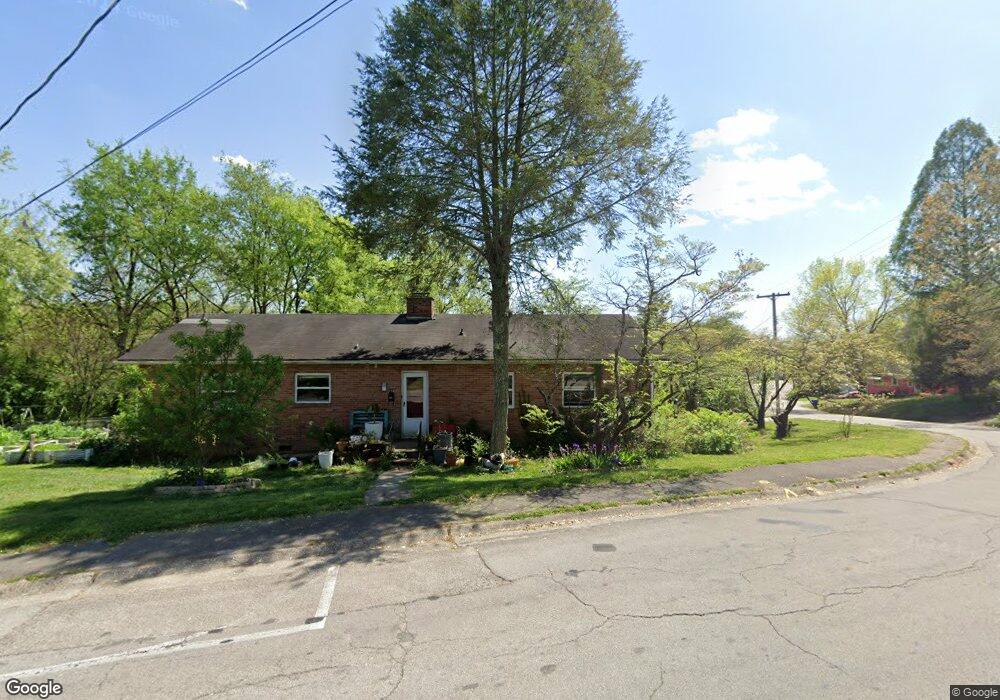
119 Cedar Rd Oak Ridge, TN 37830
Estimated Value: $239,000 - $264,000
4
Beds
2
Baths
1,282
Sq Ft
$195/Sq Ft
Est. Value
About This Home
This home is located at 119 Cedar Rd, Oak Ridge, TN 37830 and is currently estimated at $249,400, approximately $194 per square foot. 119 Cedar Rd is a home located in Anderson County with nearby schools including Glenwood Elementary, Jefferson Middle School, and Oak Ridge High School.
Ownership History
Date
Name
Owned For
Owner Type
Purchase Details
Closed on
Jan 8, 2016
Sold by
Mixon Partners
Bought by
Withington Jared P and Withington Keri L
Current Estimated Value
Home Financials for this Owner
Home Financials are based on the most recent Mortgage that was taken out on this home.
Original Mortgage
$80,077
Outstanding Balance
$64,527
Interest Rate
4.37%
Mortgage Type
FHA
Estimated Equity
$184,873
Purchase Details
Closed on
Jan 24, 2011
Sold by
Mixon Properties Llc
Bought by
Mixon Partners
Purchase Details
Closed on
Oct 15, 2008
Sold by
Federal Home Loan Mortgage Corporation
Bought by
Mixon Properties Llc
Purchase Details
Closed on
Apr 21, 2008
Bought by
Federal Home Loan Mortgage Corp
Create a Home Valuation Report for This Property
The Home Valuation Report is an in-depth analysis detailing your home's value as well as a comparison with similar homes in the area
Home Values in the Area
Average Home Value in this Area
Purchase History
| Date | Buyer | Sale Price | Title Company |
|---|---|---|---|
| Withington Jared P | $88,000 | -- | |
| Mixon Partners | -- | -- | |
| Mixon Properties Llc | $71,000 | -- | |
| Federal Home Loan Mortgage Corp | $82,800 | -- |
Source: Public Records
Mortgage History
| Date | Status | Borrower | Loan Amount |
|---|---|---|---|
| Open | Withington Jared P | $80,077 |
Source: Public Records
Tax History Compared to Growth
Tax History
| Year | Tax Paid | Tax Assessment Tax Assessment Total Assessment is a certain percentage of the fair market value that is determined by local assessors to be the total taxable value of land and additions on the property. | Land | Improvement |
|---|---|---|---|---|
| 2024 | $622 | $25,325 | $6,550 | $18,775 |
| 2023 | $622 | $25,325 | $0 | $0 |
| 2022 | $1,208 | $25,325 | $6,550 | $18,775 |
| 2021 | $1,208 | $25,325 | $6,550 | $18,775 |
| 2020 | $622 | $25,325 | $6,550 | $18,775 |
| 2019 | $981 | $18,675 | $6,025 | $12,650 |
| 2018 | $959 | $18,675 | $6,025 | $12,650 |
| 2017 | $956 | $18,675 | $6,025 | $12,650 |
| 2016 | $956 | $18,675 | $6,025 | $12,650 |
| 2015 | -- | $18,675 | $6,025 | $12,650 |
| 2014 | -- | $18,675 | $6,025 | $12,650 |
| 2013 | -- | $21,075 | $0 | $0 |
Source: Public Records
Map
Nearby Homes
- 114 Aspen Ln
- 119 Aspen Ln
- 126 Atlanta Rd
- 103 Albany Rd
- 130 Andover Cir
- 102 Decatur Rd
- 187 Tacoma Rd
- 115 Euclid Cir
- 131 Clifton Cir
- 126 Clifton Cir
- 125 Arcadia Ln Unit D
- 100 Everest Cir
- 112 Chestnut Hill Rd
- 170 Cumberland View Dr
- 113 Tacoma Rd
- 42 Palisades Pkwy
- 27 Outer Dr
- 45 Palisades Pkwy
- 516 Delaware Ave
- 386 East Dr
- 132 California Ave
- 101 Cedar Rd
- 112 Cedar Rd
- 129 S Alabama Rd
- 101 Cedar Ln
- 130 California Ave
- 131 California Ave
- 100 Cedar Ln
- 131 S Alabama Rd
- 129 California Ave
- 103 Cedar Ln
- 127 S Alabama Rd
- 128 California Ave
- 102 Cedar Ln
- 104 Cedar Ln
- 139 California Ave
- 127 California Ave
- 125 S Alabama Rd
- 100 Carlisle Ln
- 123 S Alabama Rd