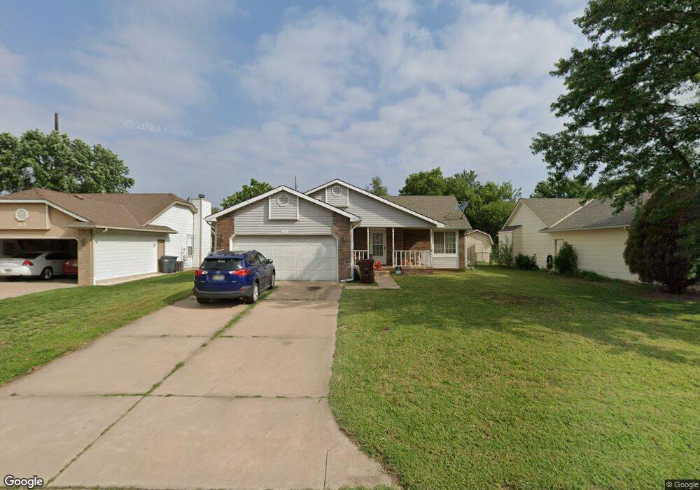
119 Chestnut Dr Mulvane, KS 67110
Estimated Value: $188,898 - $260,000
2
Beds
2
Baths
1,034
Sq Ft
$217/Sq Ft
Est. Value
About This Home
This home is located at 119 Chestnut Dr, Mulvane, KS 67110 and is currently estimated at $224,449, approximately $217 per square foot. 119 Chestnut Dr is a home located in Sedgwick County with nearby schools including Munson Primary School, Mulvane Grade School, and Mulvane Middle School.
Ownership History
Date
Name
Owned For
Owner Type
Purchase Details
Closed on
Feb 23, 2017
Sold by
Slates Kurtis D and Saltes Mary
Bought by
Slates Kurtis D and Slates Mary
Current Estimated Value
Purchase Details
Closed on
May 16, 2008
Sold by
Roberts David H
Bought by
Slates Kurtis D
Home Financials for this Owner
Home Financials are based on the most recent Mortgage that was taken out on this home.
Original Mortgage
$117,570
Outstanding Balance
$75,193
Interest Rate
6.07%
Mortgage Type
FHA
Estimated Equity
$149,256
Create a Home Valuation Report for This Property
The Home Valuation Report is an in-depth analysis detailing your home's value as well as a comparison with similar homes in the area
Home Values in the Area
Average Home Value in this Area
Purchase History
| Date | Buyer | Sale Price | Title Company |
|---|---|---|---|
| Slates Kurtis D | -- | None Available | |
| Slates Kurtis D | -- | None Available |
Source: Public Records
Mortgage History
| Date | Status | Borrower | Loan Amount |
|---|---|---|---|
| Open | Slates Kurtis D | $117,570 |
Source: Public Records
Tax History
| Year | Tax Paid | Tax Assessment Tax Assessment Total Assessment is a certain percentage of the fair market value that is determined by local assessors to be the total taxable value of land and additions on the property. | Land | Improvement |
|---|---|---|---|---|
| 2025 | $3,077 | $22,633 | $4,474 | $18,159 |
| 2023 | $3,077 | $19,539 | $3,209 | $16,330 |
| 2022 | $2,688 | $18,286 | $3,025 | $15,261 |
| 2021 | $2,329 | $16,929 | $2,611 | $14,318 |
| 2020 | $2,239 | $16,434 | $2,611 | $13,823 |
| 2019 | $2,124 | $15,077 | $2,611 | $12,466 |
| 2018 | $1,939 | $14,226 | $1,875 | $12,351 |
| 2017 | $1,881 | $0 | $0 | $0 |
| 2016 | $1,795 | $0 | $0 | $0 |
| 2015 | $1,801 | $0 | $0 | $0 |
| 2014 | $1,761 | $0 | $0 | $0 |
Source: Public Records
Map
Nearby Homes
- 170 Chestnut Dr
- 103 W Rockwood Blvd
- 10100 S Rock Rd
- 1619 N Rock Rd
- 219 Pioneer Place
- 122 E Eagle Watch St
- 1729 N Timbercreek Dr
- 4 Louis Dr
- 1005 N 1st Ave
- 217 E Filmore
- 225 Filmore St
- 1651 N Diamond Cir
- 1647 N Diamond Cir
- 1615 N Diamond Cir
- 1612 N Diamond Cir
- 1616 N Diamond Cir
- 1604 N Diamond Cir
- 1607 N Diamond Cir
- 911 E Jade Ct
- 207 Miller Ave
- 123 Chestnut Dr
- 115 Chestnut Dr
- 127 Chestnut Dr
- 107 Chestnut Dr
- 11030 N Rock Rd
- 122 Chestnut Dr
- 131 Chestnut Dr
- 118 Chestnut Dr
- 126 Chestnut Dr
- 114 Chestnut Dr
- 130 Chestnut Dr
- 100 Chestnut Dr
- 135 Chestnut Dr
- 134 Chestnut Dr
- 105 Maplewood St
- 1444 Shelly Dr
- 1448 Shelly Dr
- 138 Chestnut Dr
- 1520 N Rock Rd
- 1452 Shelly Dr
Your Personal Tour Guide
Ask me questions while you tour the home.