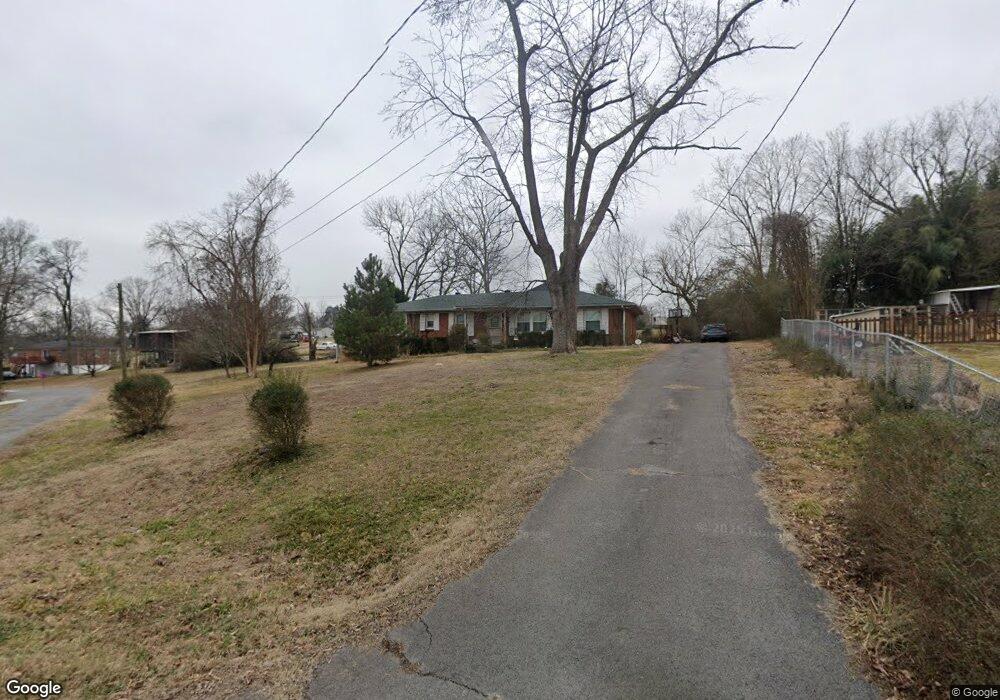
119 Cumberland Cir Gallatin, TN 37066
Estimated Value: $276,000 - $382,000
Studio
2
Baths
1,593
Sq Ft
$197/Sq Ft
Est. Value
About This Home
This home is located at 119 Cumberland Cir, Gallatin, TN 37066 and is currently estimated at $314,232, approximately $197 per square foot. 119 Cumberland Cir is a home located in Sumner County with nearby schools including Vena Stuart Elementary School, Rucker Stewart Middle School, and Gallatin Senior High School.
Ownership History
Date
Name
Owned For
Owner Type
Purchase Details
Closed on
Sep 26, 2024
Sold by
Hunter Brent Alan
Bought by
Hunter Trust
Current Estimated Value
Purchase Details
Closed on
Jan 9, 2024
Sold by
Hunter Family Trust
Bought by
Hunter Brent Alan
Purchase Details
Closed on
Dec 21, 2020
Sold by
Hunter Thomas A and Estate Of Thomas W Hunter
Bought by
Hunter Thomas Andrew and The Hunter Family Trust
Purchase Details
Closed on
Dec 18, 2020
Sold by
The Hunter Famiy Liimited Partnership
Bought by
Hunter Thomas A and Estate Of Thomas W Hunter
Purchase Details
Closed on
Dec 20, 2004
Sold by
Johnson Martin D and Johnson Nora
Bought by
Hunter Family Lp
Purchase Details
Closed on
Oct 30, 1998
Sold by
Delilah Black
Bought by
Johnson Marlin D and Johnson Nora I
Home Financials for this Owner
Home Financials are based on the most recent Mortgage that was taken out on this home.
Original Mortgage
$91,000
Interest Rate
6.61%
Create a Home Valuation Report for This Property
The Home Valuation Report is an in-depth analysis detailing your home's value as well as a comparison with similar homes in the area
Home Values in the Area
Average Home Value in this Area
Purchase History
| Date | Buyer | Sale Price | Title Company |
|---|---|---|---|
| Hunter Trust | -- | None Listed On Document | |
| Hunter Trust | -- | None Listed On Document | |
| Hunter Brent Alan | -- | None Listed On Document | |
| Hunter Thomas Andrew | -- | None Available | |
| Hunter Thomas A | -- | None Available | |
| Hunter Family Lp | $95,000 | Cumberland Title Of Henderso | |
| Johnson Marlin D | $93,900 | Beaty Title Company |
Source: Public Records
Mortgage History
| Date | Status | Borrower | Loan Amount |
|---|---|---|---|
| Previous Owner | Johnson Marlin D | $91,000 |
Source: Public Records
Tax History
| Year | Tax Paid | Tax Assessment Tax Assessment Total Assessment is a certain percentage of the fair market value that is determined by local assessors to be the total taxable value of land and additions on the property. | Land | Improvement |
|---|---|---|---|---|
| 2025 | $946 | $66,550 | $18,750 | $47,800 |
| 2024 | $946 | $66,550 | $18,750 | $47,800 |
| 2023 | $1,289 | $42,225 | $15,000 | $27,225 |
| 2022 | $1,293 | $42,225 | $15,000 | $27,225 |
| 2021 | $1,293 | $42,225 | $15,000 | $27,225 |
| 2020 | $1,293 | $42,225 | $15,000 | $27,225 |
| 2019 | $1,293 | $0 | $0 | $0 |
| 2018 | $1,071 | $0 | $0 | $0 |
| 2017 | $1,071 | $0 | $0 | $0 |
| 2016 | $767 | $0 | $0 | $0 |
| 2015 | -- | $0 | $0 | $0 |
| 2014 | -- | $0 | $0 | $0 |
Source: Public Records
Map
Nearby Homes
- 1428 109s Hwy
- 1380 Highway 109 N
- 1430 S Water Ave
- 415 Old Spring Ln
- 417 Old Spring Ln
- 419 Old Spring Ln
- 409 Old Spring Ln
- 407 Old Spring Ln
- 421 Old Spring Ln
- 423 Old Spring Ln
- 414 Old Spring Ln
- 425 Old Spring Ln
- 412 Old Spring Ln
- 102 Barnwood Rd
- 106 Barnwood Rd
- 2340 Barnwood Rd
- 1679 Barnwood Rd
- 2665 Barnwood Rd
- 1841 Barnwood Rd
- 2882 Barnwood Rd
- 121 Cumberland Cir
- 1417 S Water Ave
- 117 Wayne St
- 1419 S Water Ave
- 1413 S Water Ave
- 113 Wayne St
- 1401 109s Hwy
- 125 Wayne St
- 109S S Highway Hwy
- 120 Cumberland Cir
- 1445 Highway 109s
- 100 Southpark Cir
- 1429 Hwy 109s
- 1429 S Water Ave
- 118 Wayne St
- 129 Wayne St
- 101 Southpark Cir
- 1429 109s Hwy
- 114 Wayne St
- 122 Wayne St
Your Personal Tour Guide
Ask me questions while you tour the home.