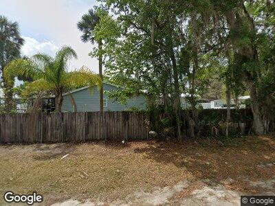
119 Drayton Island Ferry Rd Georgetown, FL 32139
Estimated Value: $474,000 - $694,000
--
Bed
--
Bath
2,112
Sq Ft
$267/Sq Ft
Est. Value
About This Home
This home is located at 119 Drayton Island Ferry Rd, Georgetown, FL 32139 and is currently estimated at $563,642, approximately $266 per square foot. 119 Drayton Island Ferry Rd is a home with nearby schools including Middleton-Burney Elementary School, George C. Miller Jr. Intermediate School, and Crescent City Junior/Senior High School.
Ownership History
Date
Name
Owned For
Owner Type
Purchase Details
Closed on
Nov 5, 2003
Sold by
Register S W and Register Linda
Bought by
Rutherford Joyce M and Fawley Ronald J
Current Estimated Value
Home Financials for this Owner
Home Financials are based on the most recent Mortgage that was taken out on this home.
Original Mortgage
$65,000
Interest Rate
5.75%
Mortgage Type
Balloon
Create a Home Valuation Report for This Property
The Home Valuation Report is an in-depth analysis detailing your home's value as well as a comparison with similar homes in the area
Home Values in the Area
Average Home Value in this Area
Purchase History
| Date | Buyer | Sale Price | Title Company |
|---|---|---|---|
| Rutherford Joyce M | $100,000 | Associated Land Title Group |
Source: Public Records
Mortgage History
| Date | Status | Borrower | Loan Amount |
|---|---|---|---|
| Closed | Rutherford Joyce M | $65,000 |
Source: Public Records
Tax History Compared to Growth
Tax History
| Year | Tax Paid | Tax Assessment Tax Assessment Total Assessment is a certain percentage of the fair market value that is determined by local assessors to be the total taxable value of land and additions on the property. | Land | Improvement |
|---|---|---|---|---|
| 2024 | $8,464 | $509,250 | $156,800 | $352,450 |
| 2023 | $8,003 | $502,300 | $156,800 | $345,500 |
| 2022 | $7,085 | $444,280 | $147,000 | $297,280 |
| 2021 | $6,462 | $377,020 | $0 | $0 |
| 2020 | $6,246 | $358,410 | $0 | $0 |
| 2019 | $5,779 | $324,290 | $307,720 | $16,570 |
| 2018 | $5,681 | $314,010 | $300,970 | $13,040 |
| 2017 | $5,371 | $290,380 | $277,340 | $13,040 |
| 2016 | $4,781 | $257,870 | $0 | $0 |
| 2015 | $4,712 | $251,630 | $0 | $0 |
| 2014 | $4,737 | $252,973 | $0 | $0 |
Source: Public Records
Map
Nearby Homes
- 0 Lone Laurel Ln
- 32 Lone Laurel Ln
- 115 N Lake George Dr
- 110 Lunker Lodge Rd
- 108 Robins Dr
- 120 Carol Ave
- 0 Carol Ave
- 105 Nancy Ct
- 108 Mocking Bird Ln
- 107 Heathton St
- 138 Heathton St
- 120 Meadow Dr
- 113 Peggy Ln
- 143 Mosswood St
- 130 Mosswood St
- 107 Mosswood St
- 117 Mosswood St
- 117 Peggy Ln
- 114 Mosswood St
- 116 Mosswood St
- 119 Drayton Island Ferry Rd
- 117 Drayton Island Ferry Rd
- 110 Drayton Island Ferry Rd
- 111 Port Cove Landing Rd
- 0 Drayton Island Ferry Rd
- 0 Drayton Island Ferry Rd
- 120 Georgetown Landing Rd
- 1463 County Road 309
- 104 J St
- 106 J St
- 108 J St
- 122 J St
- 114 J St
- 1459 County Road 309
- 114 Georgetown Landing Rd
- 123 Georgetown Landing Rd
- 121 Georgetown Landing Rd
- 125 Georgetown Landing Rd
- 1452 County Road 309
- 00 County Road 309