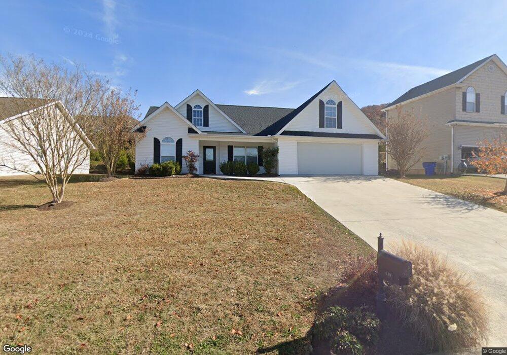
119 Flag Stone Way Clinton, TN 37716
Estimated Value: $306,266 - $394,000
--
Bed
2
Baths
1,667
Sq Ft
$216/Sq Ft
Est. Value
About This Home
This home is located at 119 Flag Stone Way, Clinton, TN 37716 and is currently estimated at $360,067, approximately $215 per square foot. 119 Flag Stone Way is a home located in Anderson County with nearby schools including Norris Elementary School and Norris Middle School.
Ownership History
Date
Name
Owned For
Owner Type
Purchase Details
Closed on
Jul 21, 2005
Sold by
Thiele Patricia H
Bought by
Pugh Roger S
Current Estimated Value
Home Financials for this Owner
Home Financials are based on the most recent Mortgage that was taken out on this home.
Original Mortgage
$167,679
Outstanding Balance
$86,681
Interest Rate
5.51%
Mortgage Type
VA
Estimated Equity
$273,386
Purchase Details
Closed on
Sep 30, 2002
Bought by
Theile Patricia
Purchase Details
Closed on
Jul 14, 1998
Bought by
Cox Raymond and Cox Wife Elaine M
Purchase Details
Closed on
Aug 5, 1997
Create a Home Valuation Report for This Property
The Home Valuation Report is an in-depth analysis detailing your home's value as well as a comparison with similar homes in the area
Home Values in the Area
Average Home Value in this Area
Purchase History
| Date | Buyer | Sale Price | Title Company |
|---|---|---|---|
| Pugh Roger S | $164,150 | -- | |
| Theile Patricia | $400,000 | -- | |
| Cox Raymond | $447,400 | -- | |
| -- | $475,000 | -- |
Source: Public Records
Mortgage History
| Date | Status | Borrower | Loan Amount |
|---|---|---|---|
| Open | -- | $167,679 |
Source: Public Records
Tax History Compared to Growth
Tax History
| Year | Tax Paid | Tax Assessment Tax Assessment Total Assessment is a certain percentage of the fair market value that is determined by local assessors to be the total taxable value of land and additions on the property. | Land | Improvement |
|---|---|---|---|---|
| 2024 | $1,179 | $44,850 | $8,750 | $36,100 |
| 2023 | $1,179 | $44,850 | $0 | $0 |
| 2022 | $1,179 | $44,850 | $8,750 | $36,100 |
| 2021 | $1,179 | $44,850 | $8,750 | $36,100 |
| 2020 | $1,096 | $44,850 | $8,750 | $36,100 |
| 2019 | $1,135 | $39,275 | $7,500 | $31,775 |
| 2018 | $1,096 | $39,275 | $7,500 | $31,775 |
| 2017 | $1,096 | $39,275 | $7,500 | $31,775 |
| 2016 | $1,096 | $39,275 | $7,500 | $31,775 |
| 2015 | -- | $39,275 | $7,500 | $31,775 |
| 2014 | -- | $39,275 | $7,500 | $31,775 |
| 2013 | -- | $44,800 | $0 | $0 |
Source: Public Records
Map
Nearby Homes
- 208 Cornerstone Cir
- 191 Cornerstone Cir
- 174 Flagstone Way
- 214 Mossy Rock Rd
- 229 Mossy Rock Rd
- 218 Mossy Rock Rd
- 2902 Andersonville Hwy
- 285 Joe Owen Rd
- 649 Jade Ct
- 170 Lone Mountain Rd
- 224 Oak Rd
- 145 Grace Cir
- 106 Crescent Rd
- 0 Chicory Dr Unit 1313759
- 3816 Andersonville Hwy
- 0 Larkspur Dr
- 123 Orchard Rd
- 116 Blue Phlox Ln
- 124 Blue Phlox Ln
- 36 Deer Ridge Rd
- 115 Flag Stone Way
- 123 Flag Stone Way
- 123 Flagstone Way
- 0 Millstone Cir Unit 606147
- 0 Millstone Cir Unit 668968
- 0 Millstone Cir Unit 681799
- 0 Millstone Cir Unit 703875
- 118 Millstone Cir
- 114 Millstone Cir
- 111 Flag Stone Way
- 127 Flag Stone Way
- 118 Flag Stone Way
- 114 Flag Stone Way
- 122 Flag Stone Way
- 110 Millstone Cir
- 0 Brookstone Ridge Dr Unit 3 668970
- 110 Flag Stone Way
- 122 Millstone Cir
- 107 Flag Stone Way
- 107 Flagstone Way