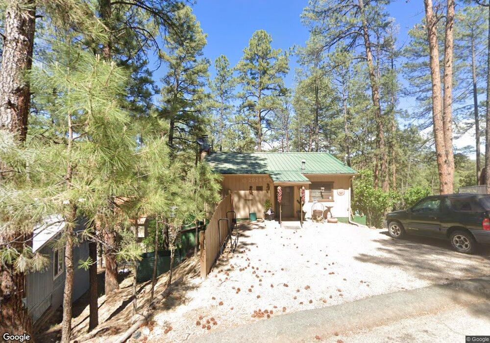
119 High St Ruidoso, NM 88345
Estimated Value: $194,474 - $309,000
2
Beds
2
Baths
1,264
Sq Ft
$213/Sq Ft
Est. Value
About This Home
This home is located at 119 High St, Ruidoso, NM 88345 and is currently estimated at $268,869, approximately $212 per square foot. 119 High St is a home located in Lincoln County with nearby schools including Sierra Vista Primary School, White Mountain Elementary School, and Ruidoso Middle School.
Ownership History
Date
Name
Owned For
Owner Type
Purchase Details
Closed on
Nov 18, 2019
Sold by
Dawkins Mary Joan
Bought by
Dawkins Thomas L and Wilson Cozette R
Current Estimated Value
Purchase Details
Closed on
Aug 24, 2005
Sold by
Kelly Gwen R
Bought by
Dawkins Albert R and Dawkins Mary Joan
Home Financials for this Owner
Home Financials are based on the most recent Mortgage that was taken out on this home.
Original Mortgage
$85,000
Interest Rate
5.61%
Mortgage Type
New Conventional
Purchase Details
Closed on
Aug 21, 1998
Sold by
Garner Sammie E and Garner Martha J
Bought by
Kelly Gwen R
Create a Home Valuation Report for This Property
The Home Valuation Report is an in-depth analysis detailing your home's value as well as a comparison with similar homes in the area
Home Values in the Area
Average Home Value in this Area
Purchase History
| Date | Buyer | Sale Price | Title Company |
|---|---|---|---|
| Dawkins Thomas L | -- | None Available | |
| Dawkins Mary Joan | -- | None Available | |
| Dawkins Albert R | -- | None Available | |
| Kelly Gwen R | -- | None Available |
Source: Public Records
Mortgage History
| Date | Status | Borrower | Loan Amount |
|---|---|---|---|
| Previous Owner | Dawkins Albert R | $85,000 |
Source: Public Records
Tax History Compared to Growth
Tax History
| Year | Tax Paid | Tax Assessment Tax Assessment Total Assessment is a certain percentage of the fair market value that is determined by local assessors to be the total taxable value of land and additions on the property. | Land | Improvement |
|---|---|---|---|---|
| 2025 | $1,183 | $40,532 | $2,650 | $37,882 |
| 2024 | $1,183 | $39,352 | $2,573 | $36,779 |
| 2023 | $1,183 | $38,206 | $2,498 | $35,708 |
| 2022 | $1,121 | $37,093 | $2,425 | $34,668 |
| 2021 | $1,083 | $36,009 | $2,354 | $33,655 |
| 2020 | $1,061 | $34,960 | $2,285 | $32,675 |
| 2019 | $993 | $34,274 | $2,240 | $32,034 |
| 2018 | $958 | $33,276 | $2,175 | $31,101 |
| 2017 | $923 | $32,307 | $2,112 | $30,195 |
| 2015 | $898 | $31,368 | $2,050 | $29,318 |
| 2014 | $871 | $30,454 | $1,990 | $28,464 |
Source: Public Records
Map
Nearby Homes
- 194 Squaw Trail
- 411 Carters Ln
- 174 King Rd Unit 4302
- 174 King Rd Unit 4405
- 174 King Rd Unit 4105
- 303 Pine Rd
- 204 Wingfield St
- 129 Taos Trail
- 110 Sherwood Loop
- 127 Carters Ln
- 111 Mountain Trail
- 2213 Sudderth Dr
- 114 N Vine Rd
- 305 Walton Cir
- 1208 Sudderth Dr
- 201 Bradley
- 220 Lookout Dr Unit 2
- 220 Lookout Dr Unit A4
- 220 Lookout Dr Unit G2
- 102 Cochise Place