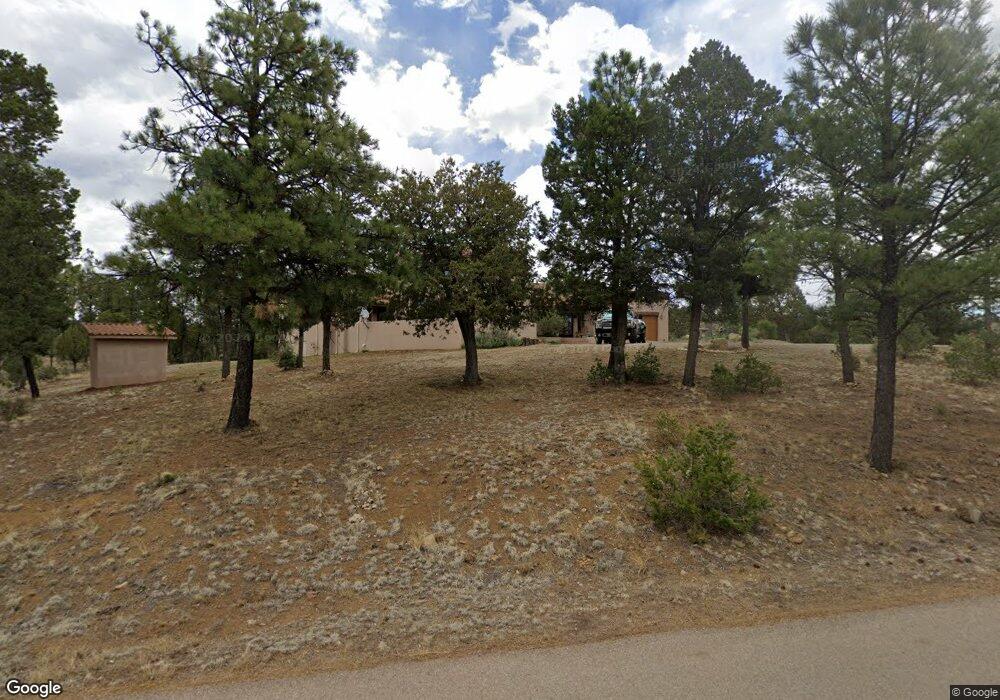
119 Homestead Loop Ruidoso, NM 88345
Estimated Value: $471,000 - $987,000
3
Beds
3
Baths
3,881
Sq Ft
$192/Sq Ft
Est. Value
About This Home
This home is located at 119 Homestead Loop, Ruidoso, NM 88345 and is currently estimated at $743,797, approximately $191 per square foot. 119 Homestead Loop is a home located in Lincoln County with nearby schools including Sierra Vista Primary School, White Mountain Elementary School, and Ruidoso Middle School.
Ownership History
Date
Name
Owned For
Owner Type
Purchase Details
Closed on
Dec 4, 2015
Sold by
Bownds Dorthy and Brashear Alvin L
Bought by
Smith Robert Dale and Smith Carla D
Current Estimated Value
Home Financials for this Owner
Home Financials are based on the most recent Mortgage that was taken out on this home.
Original Mortgage
$200,000
Outstanding Balance
$83,269
Interest Rate
3.81%
Mortgage Type
New Conventional
Estimated Equity
$660,528
Purchase Details
Closed on
Oct 29, 2013
Sold by
Haynes Bobbie and Haynes Gailynn
Bought by
Bownds Dorthy
Create a Home Valuation Report for This Property
The Home Valuation Report is an in-depth analysis detailing your home's value as well as a comparison with similar homes in the area
Home Values in the Area
Average Home Value in this Area
Purchase History
| Date | Buyer | Sale Price | Title Company |
|---|---|---|---|
| Smith Robert Dale | -- | None Available | |
| Bownds Dorthy | -- | Lincoln Cnty Abstract & Titl |
Source: Public Records
Mortgage History
| Date | Status | Borrower | Loan Amount |
|---|---|---|---|
| Open | Smith Robert Dale | $200,000 |
Source: Public Records
Tax History Compared to Growth
Tax History
| Year | Tax Paid | Tax Assessment Tax Assessment Total Assessment is a certain percentage of the fair market value that is determined by local assessors to be the total taxable value of land and additions on the property. | Land | Improvement |
|---|---|---|---|---|
| 2025 | $3,550 | $216,015 | $19,315 | $196,700 |
| 2024 | $3,550 | $209,723 | $18,752 | $190,971 |
| 2023 | $3,550 | $203,615 | $18,206 | $185,409 |
| 2022 | $2,895 | $191,040 | $17,676 | $173,364 |
| 2021 | $2,862 | $191,021 | $17,674 | $173,347 |
| 2020 | $3,272 | $191,021 | $17,674 | $173,347 |
| 2019 | $3,261 | $191,021 | $17,674 | $173,347 |
| 2018 | $3,250 | $191,021 | $17,674 | $173,347 |
| 2017 | $3,129 | $191,021 | $17,674 | $173,347 |
| 2015 | $3,483 | $205,299 | $17,676 | $187,623 |
| 2014 | -- | $171,833 | $17,676 | $154,157 |
Source: Public Records
Map
Nearby Homes
- 122 Tuscan Dr
- 112 Top Side Dr
- 105 Wagon Trail
- 111 Coker Ln
- 110 Coker Ln
- 425 White Mountain Meadows Dr
- 111 Top Side Dr
- Tract 1A Blue Lake Dr
- 103 Coker Ln
- 700 Gavilan Canyon Rd
- 545 White Mountain Meadows Dr
- 551 White Mountain Meadows Dr
- 116 Pat Thompson Ct
- 143 Charles McClellan Dr
- 118 Charles McClellan Dr
- 113 Charles McClellan Dr
- 197 Lady Hawk Ln
- 105 Milagro Hills Ct
- 107 Pat Thompson Ct
- 104 Pat Thompson Ct
- 119 Homestead Loop
- 119 Homestead Loop
- 108 Homestead Loop
- 12 Homestead Loop
- 8 Homestead Loop
- 118 Tuscan Dr
- 104 Homestead Loop
- 120 Homestead Loop
- 120 Homestead Loop
- 126 Tuscan Dr
- 120 Tuscan Dr
- 116 Tuscan Dr
- 114 Tuscan Dr
- 140 Homestead Loop
- 113 Tuscan Dr
- 115 Tuscan Dr
- 126 Homestead Loop
- 126 Homestead Loop
- 117 Tuscan Dr
- 757 Gavilan Canyon Rd