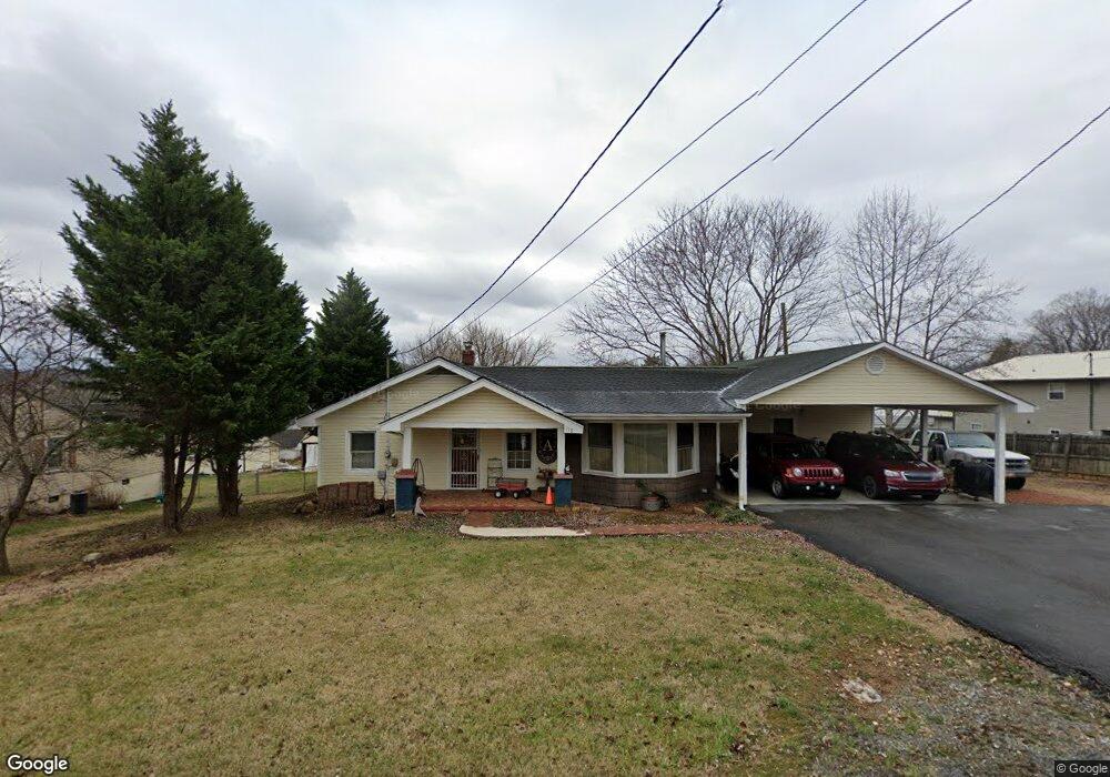
119 Jarrett Buck Loop Johnson City, TN 37601
Central NeighborhoodEstimated Value: $283,395 - $338,000
--
Bed
2
Baths
2,135
Sq Ft
$147/Sq Ft
Est. Value
About This Home
This home is located at 119 Jarrett Buck Loop, Johnson City, TN 37601 and is currently estimated at $314,465, approximately $147 per square foot. 119 Jarrett Buck Loop is a home located in Carter County with nearby schools including Solid Rock Academy, Munsey Kindergarten, and Central Baptist Preschool & Kindergarten.
Ownership History
Date
Name
Owned For
Owner Type
Purchase Details
Closed on
May 4, 1994
Sold by
Roark E J
Bought by
Addison Ricky L
Current Estimated Value
Purchase Details
Closed on
Oct 21, 1993
Bought by
Roark Nora Ann Byers
Purchase Details
Closed on
Apr 2, 1991
Bought by
Byers Nora Ann L and Byers Ja E Jimmy W
Purchase Details
Closed on
Jun 4, 1951
Bought by
Byers Nora Ann
Create a Home Valuation Report for This Property
The Home Valuation Report is an in-depth analysis detailing your home's value as well as a comparison with similar homes in the area
Home Values in the Area
Average Home Value in this Area
Purchase History
| Date | Buyer | Sale Price | Title Company |
|---|---|---|---|
| Addison Ricky L | -- | -- | |
| Roark Nora Ann Byers | -- | -- | |
| Byers Nora Ann L | $25,900 | -- | |
| Byers Nora Ann | -- | -- |
Source: Public Records
Tax History Compared to Growth
Tax History
| Year | Tax Paid | Tax Assessment Tax Assessment Total Assessment is a certain percentage of the fair market value that is determined by local assessors to be the total taxable value of land and additions on the property. | Land | Improvement |
|---|---|---|---|---|
| 2024 | $903 | $41,425 | $3,950 | $37,475 |
| 2023 | $903 | $41,425 | $0 | $0 |
| 2022 | $841 | $41,425 | $3,950 | $37,475 |
| 2021 | $841 | $41,425 | $3,950 | $37,475 |
| 2020 | $810 | $41,425 | $3,950 | $37,475 |
| 2019 | $810 | $32,800 | $3,250 | $29,550 |
| 2018 | $810 | $32,800 | $3,250 | $29,550 |
| 2017 | $810 | $32,800 | $3,250 | $29,550 |
| 2016 | $804 | $32,800 | $3,250 | $29,550 |
| 2015 | $804 | $32,800 | $3,250 | $29,550 |
| 2014 | $821 | $33,525 | $3,250 | $30,275 |
Source: Public Records
Map
Nearby Homes
- 2504 Elizabethton Hwy
- 131 Greenlee Rd
- 2142 Dave Buck Rd
- Hillside Hillside Dr
- 119 Hillside Dr
- 115 Hillside Dr
- 121 Clark Dr
- 119 Carrville Ave
- 194 Sparks Rd
- 1960 Dave Buck Rd
- 110 Warrior Ln Unit 2
- 101 Glaze Farm Way
- 40 Glaze Farm Way
- 94 Glaze Farm Way
- 45 Glaze Farm Way
- 35 Glaze Farm Way
- 31 Glaze Farm Way
- 60 Glaze Farm Way
- 70 Glaze Farm Way
- 24 Glaze Farm Way
- 117 Jarrett Buck Loop
- 118 Jarrett Buck Loop
- 113 Jarrett Buck Loop
- 114 Jarrett Buck Loop
- 120 Jarrett Buck Loop
- 127 Jarrett St
- 167 Jarrett Buck Loop
- 124 Jarrett Buck Loop
- 111 Jarrett Buck Loop
- 128 Jarrett Buck Loop
- 178 Jarrett Buck Loop
- 163 Jarrett Buck Loop
- 110 Jarrett Buck Loop
- 173 Jarrett Buck Loop
- 149 Jarrett Buck Loop
- 107 Jarrett Buck Loop
- 119 Bowers St
- 127 Bowers St
- 106 Jarrett Buck Loop
- 159 Jarrett Buck Loop
