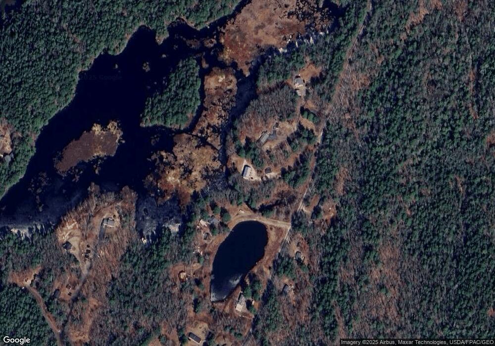
119 Meadowbrook Rd Phippsburg, ME 04562
Phippsburg NeighborhoodEstimated Value: $364,808 - $710,000
4
Beds
2
Baths
1,500
Sq Ft
$340/Sq Ft
Est. Value
About This Home
This home is located at 119 Meadowbrook Rd, Phippsburg, ME 04562 and is currently estimated at $510,202, approximately $340 per square foot. 119 Meadowbrook Rd is a home with nearby schools including Morse High School.
Ownership History
Date
Name
Owned For
Owner Type
Purchase Details
Closed on
Dec 10, 2019
Sold by
Boucher Glen K and Boucher Sharon B
Bought by
Boucher Ft and Boucher
Current Estimated Value
Purchase Details
Closed on
Nov 20, 2018
Sold by
Darling Clara M Est and Darling
Bought by
Boucher Glen K and Boucher Sharon B
Home Financials for this Owner
Home Financials are based on the most recent Mortgage that was taken out on this home.
Original Mortgage
$157,500
Interest Rate
4.7%
Mortgage Type
New Conventional
Create a Home Valuation Report for This Property
The Home Valuation Report is an in-depth analysis detailing your home's value as well as a comparison with similar homes in the area
Home Values in the Area
Average Home Value in this Area
Purchase History
| Date | Buyer | Sale Price | Title Company |
|---|---|---|---|
| Boucher Ft | -- | None Available | |
| Boucher Ft | -- | None Available | |
| Boucher Glen K | -- | -- | |
| Boucher Glen K | -- | -- |
Source: Public Records
Mortgage History
| Date | Status | Borrower | Loan Amount |
|---|---|---|---|
| Previous Owner | Boucher Glen K | $157,500 |
Source: Public Records
Tax History Compared to Growth
Tax History
| Year | Tax Paid | Tax Assessment Tax Assessment Total Assessment is a certain percentage of the fair market value that is determined by local assessors to be the total taxable value of land and additions on the property. | Land | Improvement |
|---|---|---|---|---|
| 2024 | $2,701 | $229,300 | $77,500 | $151,800 |
| 2023 | $2,623 | $229,300 | $77,500 | $151,800 |
| 2022 | $2,321 | $229,300 | $77,500 | $151,800 |
| 2021 | $2,087 | $229,300 | $77,500 | $151,800 |
| 2020 | $2,096 | $229,300 | $77,500 | $151,800 |
| 2019 | $2,096 | $229,300 | $77,500 | $151,800 |
| 2018 | $2,073 | $229,300 | $77,500 | $151,800 |
| 2017 | $2,050 | $229,300 | $77,500 | $151,800 |
| 2016 | $1,999 | $229,300 | $77,500 | $151,800 |
| 2015 | $1,963 | $229,300 | $77,500 | $151,800 |
| 2014 | $1,789 | $229,300 | $77,500 | $151,800 |
Source: Public Records
Map
Nearby Homes
- 434 Campbell Pond Rd
- 8 Holbrook Dr
- Lot 82-C Hartland Dr
- 25 Echo Ln
- 1-A Winnegance Ln
- 550 Main Rd
- 140 Clifford Rd
- 88 Campbell Pond Rd
- 46 Dam Cove Rd
- 15 Church Ln
- 04-06 Main Rd
- 0 Main Rd
- 197 Main Rd
- Lot #2 Rte 209 Main Rd
- 93 Governors Point Rd
- 17-1 Bald Head Rd
- 49 Cottage Rd
- 17 Kennebec Shores North Rd N
- 146 Oak Ledge Rd
- 42 Indian Point Terrace
- 117 Meadowbrook Rd
- 19 Darling Ln
- 144 Meadowbrook Rd
- 134 Meadowbrook
- 115 Meadowbrook Rd
- 27 Darling Ln
- 150 Meadowbrook Rd
- 155 Meadowbrook Rd
- 27 Bog Ln
- 5 Fred Brigham Rd
- 171 Meadowbrook Rd
- 11 Fred Brigham Rd
- 0 Meadowbrook Rd
- 12 Bog Ln
- 49 Fred Brigham Rd
- 0 Fred Brigham Rd Unit 496635
- 0 Fred Brigham Rd Unit 475955
- 0 Fred Brigham Rd Unit 1586696
- 0 Fred Brigham Rd
- 59 Fred Brigham Rd
