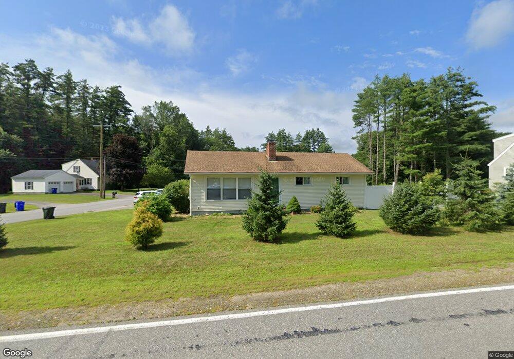
119 New Boston Rd Goffstown, NH 03045
Estimated Value: $455,000 - $484,000
3
Beds
1
Bath
2,518
Sq Ft
$186/Sq Ft
Est. Value
About This Home
This home is located at 119 New Boston Rd, Goffstown, NH 03045 and is currently estimated at $469,091, approximately $186 per square foot. 119 New Boston Rd is a home located in Hillsborough County with nearby schools including Mountain View Middle School and Goffstown High School.
Ownership History
Date
Name
Owned For
Owner Type
Purchase Details
Closed on
Jun 9, 2008
Sold by
Rheault Paul E
Bought by
Laspee Penny L
Current Estimated Value
Home Financials for this Owner
Home Financials are based on the most recent Mortgage that was taken out on this home.
Original Mortgage
$202,500
Interest Rate
6.11%
Mortgage Type
Purchase Money Mortgage
Create a Home Valuation Report for This Property
The Home Valuation Report is an in-depth analysis detailing your home's value as well as a comparison with similar homes in the area
Home Values in the Area
Average Home Value in this Area
Purchase History
| Date | Buyer | Sale Price | Title Company |
|---|---|---|---|
| Laspee Penny L | $225,000 | -- |
Source: Public Records
Mortgage History
| Date | Status | Borrower | Loan Amount |
|---|---|---|---|
| Open | Laspee Penny L | $194,304 | |
| Closed | Laspee Penny L | $202,500 |
Source: Public Records
Tax History Compared to Growth
Tax History
| Year | Tax Paid | Tax Assessment Tax Assessment Total Assessment is a certain percentage of the fair market value that is determined by local assessors to be the total taxable value of land and additions on the property. | Land | Improvement |
|---|---|---|---|---|
| 2024 | $7,403 | $362,200 | $174,200 | $188,000 |
| 2023 | $6,642 | $352,200 | $174,200 | $178,000 |
| 2022 | $5,991 | $227,700 | $105,800 | $121,900 |
| 2021 | $5,652 | $227,700 | $105,800 | $121,900 |
| 2020 | $12,903 | $227,700 | $105,800 | $121,900 |
| 2019 | $5,597 | $227,700 | $105,800 | $121,900 |
| 2018 | $4,235 | $227,700 | $105,800 | $121,900 |
| 2017 | $5,902 | $196,300 | $87,400 | $108,900 |
| 2016 | $5,188 | $196,300 | $87,400 | $108,900 |
| 2015 | $5,339 | $189,600 | $79,200 | $110,400 |
| 2014 | $4,571 | $169,300 | $79,200 | $90,100 |
Source: Public Records
Map
Nearby Homes
- 16 Palmer Rd
- 25 Pleasant St
- 12 S Mast St
- 39 S Mast St
- 232 N Mast St
- 99 Elm St
- 120 S Mast St
- 137 Elm St
- 88 Saunders Rd
- 152 S Mast St
- 21A Apple Tree Dr
- 22 Winter Hill Rd
- 12 Maplewood Ave
- 2 Larch St Unit 1
- 111 Bog Brook Rd
- 7 Arrowwood Rd
- 34 Lull Rd
- 45 Range Rd
- 914 Back Mountain Rd
- 174 S Stark Hwy Unit 13
- 121 New Boston Rd
- 8 Hermsdorf Ave
- 5 Hermsdorf Ave
- 118 New Boston Rd
- 1 Hermsdorf Ave
- 120 New Boston Rd
- 11 Hermsdorf Ave
- 6 Palmer Rd
- 129 New Boston Rd
- 3 Palmer Rd
- 112 New Boston Rd
- 10 Palmer Rd
- 130 New Boston Rd
- 102 New Boston Rd Unit 33-17-1
- 105 New Boston Rd
- 19 Hermsdorf Ave
- 9 Palmer Rd
- 12 Palmer Rd
- 134 New Boston Rd
- 135 New Boston Rd