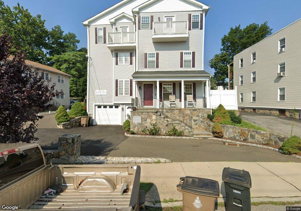
119 Seaside Ave Unit C Stamford, CT 06902
East Side Stamford NeighborhoodEstimated Value: $685,000 - $783,000
4
Beds
4
Baths
2,139
Sq Ft
$344/Sq Ft
Est. Value
About This Home
This home is located at 119 Seaside Ave Unit C, Stamford, CT 06902 and is currently estimated at $735,443, approximately $343 per square foot. 119 Seaside Ave Unit C is a home located in Fairfield County with nearby schools including K. T. Murphy Elementary School, Rippowam Middle School, and Stamford High School.
Ownership History
Date
Name
Owned For
Owner Type
Purchase Details
Closed on
May 12, 2008
Sold by
119 Seaside Avenue Llc
Bought by
Angeles Carazon and Angeles Romeo
Current Estimated Value
Home Financials for this Owner
Home Financials are based on the most recent Mortgage that was taken out on this home.
Original Mortgage
$465,500
Outstanding Balance
$316,928
Interest Rate
7.37%
Estimated Equity
$418,515
Create a Home Valuation Report for This Property
The Home Valuation Report is an in-depth analysis detailing your home's value as well as a comparison with similar homes in the area
Home Values in the Area
Average Home Value in this Area
Purchase History
| Date | Buyer | Sale Price | Title Company |
|---|---|---|---|
| Angeles Carazon | $490,000 | -- |
Source: Public Records
Mortgage History
| Date | Status | Borrower | Loan Amount |
|---|---|---|---|
| Open | Angeles Carazon | $465,500 |
Source: Public Records
Tax History Compared to Growth
Tax History
| Year | Tax Paid | Tax Assessment Tax Assessment Total Assessment is a certain percentage of the fair market value that is determined by local assessors to be the total taxable value of land and additions on the property. | Land | Improvement |
|---|---|---|---|---|
| 2025 | $7,363 | $307,830 | $0 | $307,830 |
| 2024 | $7,191 | $307,830 | $0 | $307,830 |
| 2023 | $7,770 | $307,830 | $0 | $307,830 |
| 2022 | $7,478 | $275,220 | $0 | $275,220 |
| 2021 | $7,414 | $275,220 | $0 | $275,220 |
| 2020 | $7,252 | $275,220 | $0 | $275,220 |
| 2019 | $7,252 | $275,220 | $0 | $275,220 |
| 2018 | $7,026 | $275,220 | $0 | $275,220 |
| 2017 | $6,782 | $252,210 | $0 | $252,210 |
| 2016 | $6,588 | $252,210 | $0 | $252,210 |
| 2015 | $6,414 | $252,210 | $0 | $252,210 |
| 2014 | $6,252 | $252,210 | $0 | $252,210 |
Source: Public Records
Map
Nearby Homes
- 203 Sylvan Knoll Rd
- 15 Mathews St
- 171 Sylvan Knoll Rd
- 105 Houston Terrace
- 120 Webb Ave
- 175 Seaside Ave Unit 1
- 274 Sylvan Knoll Rd
- 421 Sylvan Knoll Rd
- 16 Neponsit St
- 209 Seaside Ave Unit 2
- 214 Seaside Ave
- 214 Seaside Ave Unit 2
- 31 Waterbury Ave
- 16 Houston Terrace Unit 7
- 74 Standish Rd Unit 3
- 26 Courtland Ave Unit 1
- 59 Courtland Ave Unit 3O
- 16 Revere Dr Unit 1
- 23 Standish Rd Unit 2
- 33 Dora St
- 119 Seaside Ave Unit B
- 119 Seaside Ave Unit A
- 125 Seaside Ave
- 111 Seaside Ave
- 129 Seaside Ave
- 109 Seaside Ave
- 122 Seaside Ave
- 122 Seaside Ave Unit 2
- 122 Seaside Ave Unit 2nd fl
- 133 Seaside Ave
- 114 Seaside Ave
- 105 Seaside Ave
- 126 Seaside Ave
- 209 Sylvan Knoll Rd Unit 209
- 137 Seaside Ave
- 130 Seaside Ave
- 235 Sylvan Knoll Rd Unit 235
- 211 Sylvan Knoll Rd Unit 211
- 237 Sylvan Knoll Rd
- 197 Sylvan Knoll Rd