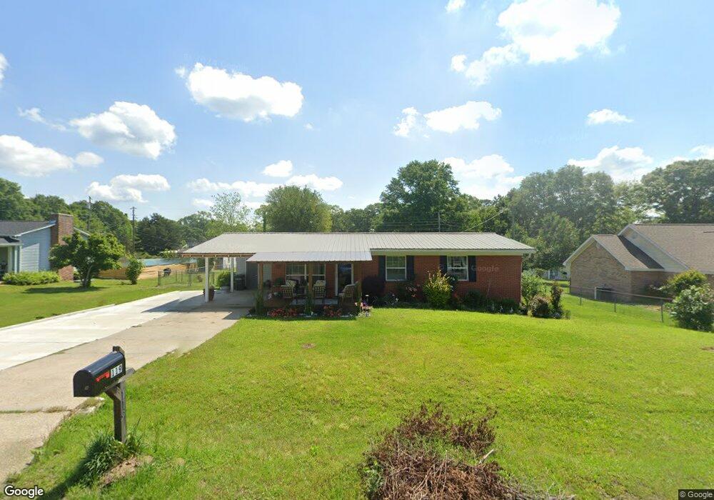
119 Shamrock Dr Laurel, MS 39443
Estimated Value: $97,635 - $142,000
3
Beds
2
Baths
1,200
Sq Ft
$104/Sq Ft
Est. Value
About This Home
This home is located at 119 Shamrock Dr, Laurel, MS 39443 and is currently estimated at $125,159, approximately $104 per square foot. 119 Shamrock Dr is a home located in Jones County with nearby schools including St. John's Day School.
Ownership History
Date
Name
Owned For
Owner Type
Purchase Details
Closed on
Jan 8, 2019
Sold by
Pearson John M and Pearson Margaret W
Bought by
West Amanda C
Current Estimated Value
Home Financials for this Owner
Home Financials are based on the most recent Mortgage that was taken out on this home.
Original Mortgage
$79,532
Outstanding Balance
$69,641
Interest Rate
4.5%
Mortgage Type
FHA
Estimated Equity
$55,518
Purchase Details
Closed on
Aug 4, 2010
Sold by
Sharpe Ronald Lewis and Hankins Edna Dianne
Bought by
Pearson John M
Home Financials for this Owner
Home Financials are based on the most recent Mortgage that was taken out on this home.
Original Mortgage
$59,081,000
Interest Rate
4.6%
Create a Home Valuation Report for This Property
The Home Valuation Report is an in-depth analysis detailing your home's value as well as a comparison with similar homes in the area
Purchase History
| Date | Buyer | Sale Price | Title Company |
|---|---|---|---|
| West Amanda C | -- | -- | |
| Pearson John M | -- | -- |
Source: Public Records
Mortgage History
| Date | Status | Borrower | Loan Amount |
|---|---|---|---|
| Open | West Amanda C | $79,532 | |
| Previous Owner | Pearson John M | $59,081,000 |
Source: Public Records
Tax History
| Year | Tax Paid | Tax Assessment Tax Assessment Total Assessment is a certain percentage of the fair market value that is determined by local assessors to be the total taxable value of land and additions on the property. | Land | Improvement |
|---|---|---|---|---|
| 2025 | -- | $5,237 | $0 | $0 |
| 2024 | -- | $4,876 | $0 | $0 |
| 2023 | -- | $4,829 | $0 | $0 |
| 2022 | $0 | $4,829 | $0 | $0 |
| 2021 | $936 | $4,829 | $0 | $0 |
| 2020 | $936 | $4,701 | $0 | $0 |
| 2019 | $936 | $7,052 | $0 | $0 |
| 2018 | $432 | $4,701 | $0 | $0 |
| 2017 | $431 | $4,701 | $0 | $0 |
| 2016 | $383 | $4,296 | $0 | $0 |
| 2015 | $351 | $4,277 | $0 | $0 |
| 2014 | $351 | $4,238 | $0 | $0 |
Source: Public Records
Map
Nearby Homes
- 107 Shamrock Dr
- 121 Shamrock Dr
- 35 Kennon Ave
- 97 Shamrock Dr
- 31 Kennon Ave
- 116 Shamrock Dr
- 122 Shamrock Dr
- 129 Shamrock Dr
- 28 Kennon Ave
- 104 Shamrock Dr
- 110 Shamrock Dr
- 126 Shamrock Dr
- 100 Shamrock Dr
- 23 Kennon Ave
- 96 Shamrock Dr
- 133 Shamrock Dr
- 30 Kennon Ave
- 89 Shamrock Dr
- 92 Shamrock Dr
- 15 Kennon Ave
Your Personal Tour Guide
Ask me questions while you tour the home.