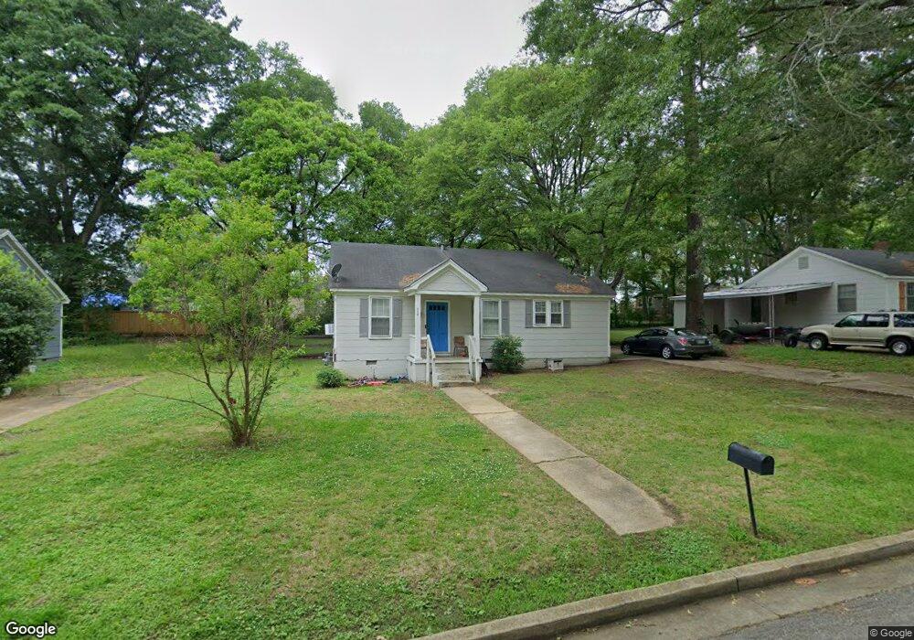
119 Tedford St Tupelo, MS 38801
Willis Heights NeighborhoodEstimated Value: $71,000 - $160,000
--
Bed
--
Bath
1,092
Sq Ft
$98/Sq Ft
Est. Value
About This Home
This home is located at 119 Tedford St, Tupelo, MS 38801 and is currently estimated at $106,981, approximately $97 per square foot. 119 Tedford St is a home located in Lee County with nearby schools including Rankin Elementary School, Joyner Elementary School, and Tupelo Middle School.
Ownership History
Date
Name
Owned For
Owner Type
Purchase Details
Closed on
Jan 9, 2017
Bought by
Love Constance
Current Estimated Value
Purchase Details
Closed on
Oct 23, 2009
Sold by
Mcferrin Stacy
Bought by
Bramlett Johnette
Home Financials for this Owner
Home Financials are based on the most recent Mortgage that was taken out on this home.
Original Mortgage
$40,979
Interest Rate
5.03%
Mortgage Type
Purchase Money Mortgage
Create a Home Valuation Report for This Property
The Home Valuation Report is an in-depth analysis detailing your home's value as well as a comparison with similar homes in the area
Home Values in the Area
Average Home Value in this Area
Purchase History
| Date | Buyer | Sale Price | Title Company |
|---|---|---|---|
| Love Constance | $44,750 | -- | |
| Love Constance | -- | -- | |
| Bramlett Johnette | -- | -- |
Source: Public Records
Mortgage History
| Date | Status | Borrower | Loan Amount |
|---|---|---|---|
| Previous Owner | Bramlett Johnette | $40,979 |
Source: Public Records
Tax History Compared to Growth
Tax History
| Year | Tax Paid | Tax Assessment Tax Assessment Total Assessment is a certain percentage of the fair market value that is determined by local assessors to be the total taxable value of land and additions on the property. | Land | Improvement |
|---|---|---|---|---|
| 2025 | $1,054 | $7,749 | $0 | $0 |
| 2024 | $1,054 | $7,749 | $0 | $0 |
| 2023 | $924 | $6,774 | $0 | $0 |
| 2022 | $907 | $6,774 | $0 | $0 |
| 2021 | $907 | $6,774 | $0 | $0 |
| 2020 | $907 | $6,774 | $0 | $0 |
| 2019 | $848 | $6,335 | $0 | $0 |
| 2018 | $848 | $6,335 | $0 | $0 |
| 2017 | $389 | $4,223 | $0 | $0 |
| 2016 | $389 | $4,223 | $0 | $0 |
| 2015 | $385 | $4,209 | $0 | $0 |
| 2014 | $385 | $4,209 | $0 | $0 |
Source: Public Records
Map
Nearby Homes
- 115 Enoch Ave
- 123 Enoch Ave
- 1525 Central Ave
- 1603 Boggan Dr
- 404 Smith St
- 400 Smith St
- 210 S Highland Dr
- 214 Nanney Dr
- 2306 Woods St
- 1201 W Main St
- 401 S Foster Dr
- 405 S Foster Dr
- 1005 Lawndale Dr
- 623 Maynard Dr
- 1338 W Jackson St
- 355 Rankin Blvd
- 207 Rankin Blvd
- 0 Leonard Dr
- 920 Eisenhower Dr
- 712 George Ave