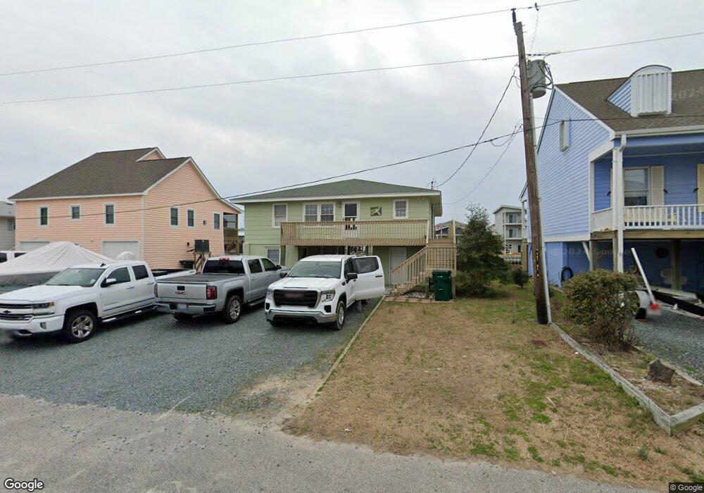
119 Trout Ave Holly Ridge, NC 28445
Estimated Value: $803,000 - $1,160,000
4
Beds
3
Baths
1,152
Sq Ft
$820/Sq Ft
Est. Value
About This Home
This home is located at 119 Trout Ave, Holly Ridge, NC 28445 and is currently estimated at $944,204, approximately $819 per square foot. 119 Trout Ave is a home with nearby schools including North Topsail Elementary School, Topsail Middle School, and Topsail High School.
Ownership History
Date
Name
Owned For
Owner Type
Purchase Details
Closed on
Aug 24, 2023
Sold by
Garrett Robert W
Bought by
Gallagher Lindsay Sally
Current Estimated Value
Home Financials for this Owner
Home Financials are based on the most recent Mortgage that was taken out on this home.
Original Mortgage
$340,000
Outstanding Balance
$332,466
Interest Rate
6.96%
Mortgage Type
New Conventional
Estimated Equity
$611,738
Purchase Details
Closed on
Jul 31, 2019
Sold by
Canoy Ray T and Canoy Sue G
Bought by
Garrett Robert W
Purchase Details
Closed on
Oct 5, 1993
Bought by
Canoy Ray T
Create a Home Valuation Report for This Property
The Home Valuation Report is an in-depth analysis detailing your home's value as well as a comparison with similar homes in the area
Home Values in the Area
Average Home Value in this Area
Purchase History
| Date | Buyer | Sale Price | Title Company |
|---|---|---|---|
| Gallagher Lindsay Sally | $846,000 | None Listed On Document | |
| Garrett Robert W | $258,000 | None Available | |
| Canoy Ray T | $134,000 | -- |
Source: Public Records
Mortgage History
| Date | Status | Borrower | Loan Amount |
|---|---|---|---|
| Open | Gallagher Lindsay Sally | $340,000 |
Source: Public Records
Tax History Compared to Growth
Tax History
| Year | Tax Paid | Tax Assessment Tax Assessment Total Assessment is a certain percentage of the fair market value that is determined by local assessors to be the total taxable value of land and additions on the property. | Land | Improvement |
|---|---|---|---|---|
| 2024 | $3,748 | $451,620 | $346,732 | $104,888 |
| 2023 | $3,748 | $451,620 | $346,732 | $104,888 |
| 2022 | $3,331 | $451,620 | $346,732 | $104,888 |
| 2021 | $3,331 | $451,620 | $346,732 | $104,888 |
| 2020 | $3,331 | $451,620 | $346,732 | $104,888 |
| 2019 | $3,331 | $451,620 | $346,732 | $104,888 |
| 2018 | $3,164 | $406,968 | $323,400 | $83,568 |
| 2017 | $3,164 | $406,968 | $323,400 | $83,568 |
| 2016 | $3,123 | $406,968 | $323,400 | $83,568 |
| 2015 | -- | $406,968 | $323,400 | $83,568 |
| 2014 | $2,379 | $406,968 | $323,400 | $83,568 |
| 2013 | -- | $406,968 | $323,400 | $83,568 |
| 2012 | -- | $406,968 | $323,400 | $83,568 |
Source: Public Records
Map
Nearby Homes
- 1711 S Anderson Blvd
- 1904 Ocean Blvd
- 2003 Ocean Blvd
- 1602 Ocean Blvd
- 2139 Ocean Blvd Unit A
- 2120 Shoreline Dr
- 1331 Carolina Blvd
- 1040 Ocean Blvd
- 1008 Ocean Blvd
- 965 Tower Ct Unit B
- 932 Observation Ln
- 901 Ocean Blvd Unit B
- 1629 Kings Landing Rd
- 1475 Kings Landing Rd
- 806 Channel Blvd
- 1966 Kings Landing Rd
- 1984 Kings Landing Rd
- 362 Olde Point Loop
- 1406 Kings Landing Rd
- 713 Channel Blvd
- 121 Trout Ave
- 117 Trout Ave
- 123 Trout Ave
- 115 Trout Ave
- 125 Trout Ave
- 1711 Carolina Blvd
- 113 Trout Ave
- 1709 Carolina Blvd
- 120 Boryk Ave
- 120 Boryk Ave
- 1710 S Anderson Blvd
- 116 Boryk Ave
- 122 Boryk Ave
- 122 Boryk Ave
- 118 Boryk Ave
- 111 Trout Ave
- 127 Trout Ave
- 124 Boryk Ave
- 1707 Carolina Blvd
- 114 Boryk Ave