Estimated Value: $175,349 - $204,000
--
Bed
--
Bath
1,168
Sq Ft
$162/Sq Ft
Est. Value
About This Home
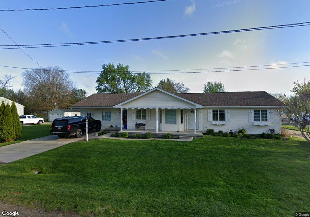
This home is located at 1190 Alton Ave, Flint, MI 48507 and is currently estimated at $188,837, approximately $161 per square foot. 1190 Alton Ave is a home located in Genesee County with nearby schools including Anderson Elementary School, McGrath Elementary School, and Grand Blanc West Middle School.
Ownership History
Date
Name
Owned For
Owner Type
Purchase Details
Closed on
Feb 15, 2022
Sold by
Martin Gail L
Bought by
Tinnin Brett R and Tinnin Katherine L
Current Estimated Value
Purchase Details
Closed on
Nov 6, 2003
Sold by
Fannie Mae
Bought by
Martin John C and Martin Gail L
Purchase Details
Closed on
Aug 14, 2002
Sold by
Gmac Mtg Corp
Bought by
Federal National Mortgage Association
Purchase Details
Closed on
Jul 31, 2002
Sold by
Hosea Patricia L
Bought by
Gmac Mtg Corp
Create a Home Valuation Report for This Property
The Home Valuation Report is an in-depth analysis detailing your home's value as well as a comparison with similar homes in the area
Home Values in the Area
Average Home Value in this Area
Purchase History
| Date | Buyer | Sale Price | Title Company |
|---|---|---|---|
| Tinnin Brett R | -- | None Listed On Document | |
| Martin John C | $75,000 | First American Title | |
| Federal National Mortgage Association | -- | -- | |
| Gmac Mtg Corp | $46,120 | -- |
Source: Public Records
Tax History Compared to Growth
Tax History
| Year | Tax Paid | Tax Assessment Tax Assessment Total Assessment is a certain percentage of the fair market value that is determined by local assessors to be the total taxable value of land and additions on the property. | Land | Improvement |
|---|---|---|---|---|
| 2025 | $3,352 | $65,000 | $0 | $0 |
| 2024 | $2,195 | $61,800 | $0 | $0 |
| 2023 | $2,092 | $59,500 | $0 | $0 |
| 2022 | $2,146 | $54,900 | $0 | $0 |
| 2021 | $2,103 | $48,800 | $0 | $0 |
| 2020 | $1,460 | $47,300 | $0 | $0 |
| 2019 | $1,438 | $40,800 | $0 | $0 |
| 2018 | $1,448 | $35,300 | $0 | $0 |
| 2017 | $1,389 | $35,400 | $0 | $0 |
| 2016 | $1,279 | $33,500 | $0 | $0 |
| 2015 | $1,081 | $32,700 | $0 | $0 |
| 2014 | $739 | $31,400 | $0 | $0 |
| 2012 | -- | $35,500 | $35,500 | $0 |
Source: Public Records
Map
Nearby Homes
- 1195 Alton Ave
- 1283 Woodnoll Dr
- 1037 E Hill Rd
- 1380 Sunset Blvd
- 1075 E Hill Rd
- 1130 Leisure Dr Unit 21
- 0 Taylor Dr Unit 50159493
- 1096 Harding Dr
- 1045 Leisure Dr Unit 7
- 0000 Mckinley Blvd
- 0 Harding Dr Unit 20251056693
- 00 Coolidge Dr
- 000 Coolidge Dr
- 0000 Coolidge Dr
- 00 Mckinley Blvd
- 000 Mckinley Blvd
- 6137 Pebbleshire Dr
- 1329 Arrowwood Ln
- 1226 Harding Dr
- 6042 Birch Dr
- 1202 Alton Ave
- 1178 Alton Ave
- 1162 Alton Ave
- 1189 Alton Ave
- 1175 Alton Ave
- 1203 Alton Ave
- 1192 Kingston Ave
- 1196 Kingston Ave
- 1206 Kingston Ave
- 1174 Kingston Ave
- 1152 Alton Ave
- 1159 W Hill Rd
- 1158 Kingston Ave
- 1210 Kingston Ave
- 1150 Kingston Ave
- 1149 W Hill Rd
- 1240 Kingston Ave
- 1240 Kingston Ave
- 1140 Kingston Ave
- 1187 Kingston Ave