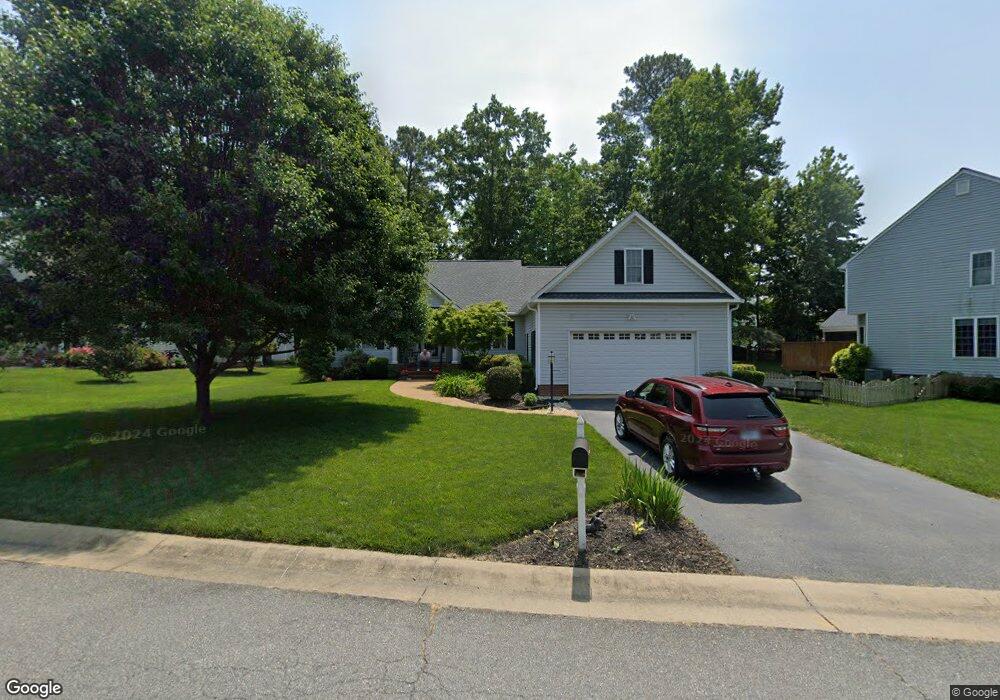
11901 Nevis Dr Midlothian, VA 23114
Estimated Value: $482,000 - $501,000
4
Beds
3
Baths
2,182
Sq Ft
$226/Sq Ft
Est. Value
About This Home
This home is located at 11901 Nevis Dr, Midlothian, VA 23114 and is currently estimated at $493,458, approximately $226 per square foot. 11901 Nevis Dr is a home located in Chesterfield County with nearby schools including W W Gordon Elementary School, Midlothian Middle School, and Monacan High School.
Ownership History
Date
Name
Owned For
Owner Type
Purchase Details
Closed on
Sep 24, 2019
Sold by
Glen H Bruce
Bought by
Glen H Bruce
Current Estimated Value
Purchase Details
Closed on
May 1, 2001
Sold by
Main Street Homes
Bought by
Glenn H B H and Glenn Karen L
Home Financials for this Owner
Home Financials are based on the most recent Mortgage that was taken out on this home.
Original Mortgage
$156,000
Outstanding Balance
$57,603
Interest Rate
6.88%
Mortgage Type
New Conventional
Estimated Equity
$435,855
Create a Home Valuation Report for This Property
The Home Valuation Report is an in-depth analysis detailing your home's value as well as a comparison with similar homes in the area
Home Values in the Area
Average Home Value in this Area
Purchase History
| Date | Buyer | Sale Price | Title Company |
|---|---|---|---|
| Glen H Bruce | -- | None Available | |
| Glenn H B H | $210,091 | -- |
Source: Public Records
Mortgage History
| Date | Status | Borrower | Loan Amount |
|---|---|---|---|
| Open | Glenn H B H | $156,000 |
Source: Public Records
Tax History Compared to Growth
Tax History
| Year | Tax Paid | Tax Assessment Tax Assessment Total Assessment is a certain percentage of the fair market value that is determined by local assessors to be the total taxable value of land and additions on the property. | Land | Improvement |
|---|---|---|---|---|
| 2025 | $4,212 | $470,400 | $72,000 | $398,400 |
| 2024 | $4,212 | $438,200 | $67,000 | $371,200 |
| 2023 | $3,710 | $407,700 | $65,000 | $342,700 |
| 2022 | $3,354 | $364,600 | $62,000 | $302,600 |
| 2021 | $3,105 | $319,900 | $60,000 | $259,900 |
| 2020 | $3,039 | $319,900 | $60,000 | $259,900 |
| 2019 | $2,949 | $310,400 | $60,000 | $250,400 |
| 2018 | $2,811 | $298,300 | $60,000 | $238,300 |
| 2017 | $2,739 | $280,100 | $60,000 | $220,100 |
| 2016 | $2,609 | $271,800 | $60,000 | $211,800 |
| 2015 | $2,532 | $261,100 | $60,000 | $201,100 |
| 2014 | $2,501 | $257,900 | $60,000 | $197,900 |
Source: Public Records
Map
Nearby Homes
- 11933 Exbury Terrace
- 11907 Exbury Ct
- 11625 Nevis Dr
- 11960 Lucks Ln
- 11950 Lucks Ln
- 11970 Lucks Ln
- 1418 Crawford Wood Place
- 1009 Woodlet Meadow Ln
- 1606 Bantry Loop
- 1526 Crawford Wood Dr
- 1712 Porters Mill Ln
- 1937 Bantry Dr
- 1002 Wedgemont Place
- 914 Spirea Rd
- 12325 Logan Trace Rd
- 11301 Mansfield Crossing Ct
- 1407 Sycamore Ridge Ct
- 11630 Smoketree Dr
- 11520 Old Carrollton Ct
- 11312 McCauliff Ct
- 11819 Nevis Dr
- 11913 Nevis Dr
- 11724 Sanbury Ln
- 11813 Nevis Dr
- 11730 Sanbury Ln
- 11718 Sanbury Ln
- 1412 Nevis Ct
- 11742 Sanbury Ln
- 11712 Sanbury Ln
- 11906 Nevis Dr
- 11912 Nevis Dr
- 1413 Nevis Ct
- 11807 Nevis Dr
- 11918 Nevis Dr
- 11706 Sanbury Ln
- 1406 Nevis Ct
- 11812 Nevis Dr
- 1407 Nevis Ct
- 11731 Sanbury Ln
- 11725 Sanbury Ln