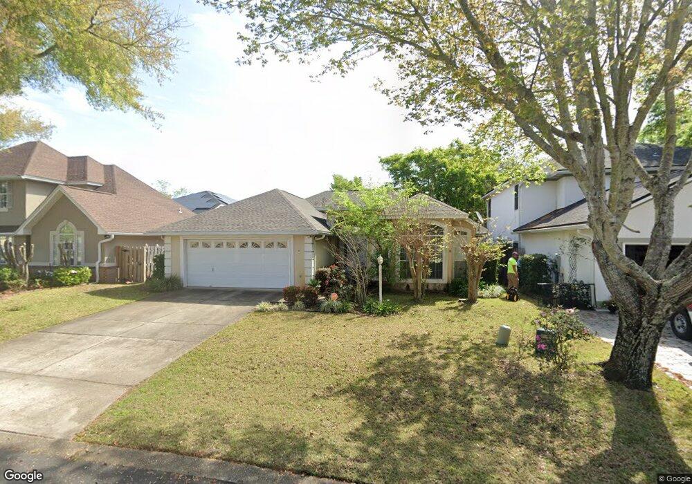
1192 Cathridge Trace Fort Walton Beach, FL 32547
Wright NeighborhoodEstimated Value: $398,000 - $484,000
3
Beds
2
Baths
1,825
Sq Ft
$235/Sq Ft
Est. Value
About This Home
This home is located at 1192 Cathridge Trace, Fort Walton Beach, FL 32547 and is currently estimated at $429,589, approximately $235 per square foot. 1192 Cathridge Trace is a home located in Okaloosa County with nearby schools including Longwood Elementary School, W.C. Pryor Middle School, and Choctawhatchee Senior High School.
Ownership History
Date
Name
Owned For
Owner Type
Purchase Details
Closed on
Jan 4, 2023
Sold by
Powers Alicia Marie
Bought by
Powers Alicia Marie and Powers Mark May
Current Estimated Value
Home Financials for this Owner
Home Financials are based on the most recent Mortgage that was taken out on this home.
Original Mortgage
$273,750
Outstanding Balance
$265,253
Interest Rate
6.58%
Mortgage Type
New Conventional
Estimated Equity
$164,336
Purchase Details
Closed on
Nov 2, 2013
Sold by
Fondacaro David Robert
Bought by
Fondacaro Alicia Marie
Home Financials for this Owner
Home Financials are based on the most recent Mortgage that was taken out on this home.
Original Mortgage
$231,880
Interest Rate
4.16%
Mortgage Type
VA
Purchase Details
Closed on
Jun 30, 2011
Sold by
Wiggins Steven L
Bought by
Fondacaro David Robert and Fondacaro Alicia Marie
Home Financials for this Owner
Home Financials are based on the most recent Mortgage that was taken out on this home.
Original Mortgage
$232,902
Interest Rate
4.63%
Mortgage Type
VA
Purchase Details
Closed on
Jun 1, 2006
Sold by
Wiggins Chi Yong
Bought by
Wiggins Steven
Purchase Details
Closed on
Feb 13, 2003
Sold by
Hamilton Ercell C and Hamilton Patricia W
Bought by
Wiggins Steven I and Wiggins Chi Yong
Home Financials for this Owner
Home Financials are based on the most recent Mortgage that was taken out on this home.
Original Mortgage
$169,950
Interest Rate
5.93%
Mortgage Type
VA
Purchase Details
Closed on
Jul 16, 2001
Sold by
Jimmy Henderson Ii Construction Co Inc
Bought by
Hamilton Ercell C and Hamilton Patricia W
Home Financials for this Owner
Home Financials are based on the most recent Mortgage that was taken out on this home.
Original Mortgage
$156,285
Interest Rate
7.16%
Mortgage Type
VA
Purchase Details
Closed on
Jan 18, 2001
Sold by
Henderson General Contractor
Bought by
Jimmy Henderson Ii Construction Co Inc
Create a Home Valuation Report for This Property
The Home Valuation Report is an in-depth analysis detailing your home's value as well as a comparison with similar homes in the area
Home Values in the Area
Average Home Value in this Area
Purchase History
| Date | Buyer | Sale Price | Title Company |
|---|---|---|---|
| Powers Alicia Marie | $202,500 | Atlas Title Company | |
| Fondacaro Alicia Marie | -- | None Available | |
| Fondacaro David Robert | $228,000 | Old South Land Title | |
| Wiggins Steven | -- | None Available | |
| Wiggins Steven I | $165,000 | First Natl Land Title Co Inc | |
| Hamilton Ercell C | $156,300 | Associated Land Title Group | |
| Jimmy Henderson Ii Construction Co Inc | $34,000 | Associated Land Title Group |
Source: Public Records
Mortgage History
| Date | Status | Borrower | Loan Amount |
|---|---|---|---|
| Open | Powers Alicia Marie | $273,750 | |
| Previous Owner | Fondacaro Alicia Marie | $231,880 | |
| Previous Owner | Fondacaro David Robert | $232,902 | |
| Previous Owner | Wiggins Steven I | $169,950 | |
| Previous Owner | Hamilton Ercell C | $156,285 |
Source: Public Records
Tax History Compared to Growth
Tax History
| Year | Tax Paid | Tax Assessment Tax Assessment Total Assessment is a certain percentage of the fair market value that is determined by local assessors to be the total taxable value of land and additions on the property. | Land | Improvement |
|---|---|---|---|---|
| 2024 | $4,584 | $403,438 | $103,373 | $300,065 |
| 2023 | $4,584 | $407,992 | $93,975 | $314,017 |
| 2022 | $4,245 | $377,932 | $87,827 | $290,105 |
| 2021 | $3,709 | $297,124 | $65,347 | $231,777 |
| 2020 | $3,310 | $255,675 | $64,059 | $191,616 |
| 2019 | $3,144 | $239,633 | $61,009 | $178,624 |
| 2018 | $2,967 | $223,539 | $0 | $0 |
| 2017 | $2,860 | $214,530 | $0 | $0 |
| 2016 | $2,688 | $202,801 | $0 | $0 |
| 2015 | $2,567 | $190,932 | $0 | $0 |
| 2014 | $1,915 | $178,476 | $0 | $0 |
Source: Public Records
Map
Nearby Homes
- 1956 Woodcrest Ridge
- 1942 Woodcrest Ridge Unit 2
- 1961 Chesapeake Ridge
- 606 Lee St
- 1810 Scirocco Loop
- 1602 Mariah Way E
- 1905 Mistral Ln W
- 816 Lark St Unit 5, 6, 7, 8
- 1100 Crosswinds Landing Unit 14
- 1100 Crosswinds Landing Unit 19
- 1100 Crosswinds Landing Unit 21
- 818 Lark St Unit 1, 2, 3, 4
- 765 Pine Alley St
- 850 Holbrook Cir
- 508 Parkview Rd NW Unit A, B & C
- 518 Parkview Rd NW Unit A
- 940 Central Ave Unit 15
- 1002 Hondo Ave
- 1013 Gloria Ave
- 941 Ashley Ln Unit D
- 1190 Cathridge Trace
- 1958 Procteridge Ct
- 1960 Procteridge Ct
- 1188 Cathridge Trace
- 1962 Procteridge Ct
- 1187 Cathridge Trace
- 1195 Cathridge Trace
- 1964 Procteridge Ct
- 1184 Cathridge Trace
- 1198 Cathridge Trace
- 1961 Procteridge Ct
- 1963 Procteridge Ct
- 1199 Cathridge Trace
- 1182 Cathridge Trace
- 1966 Procteridge Ct
- 1950 Procteridge Ct
- 1965 Procteridge Ct
- 1964 Woodcrest Ridge
- 1966 Woodcrest Ridge Unit 13
- 1953 Procteridge Ct