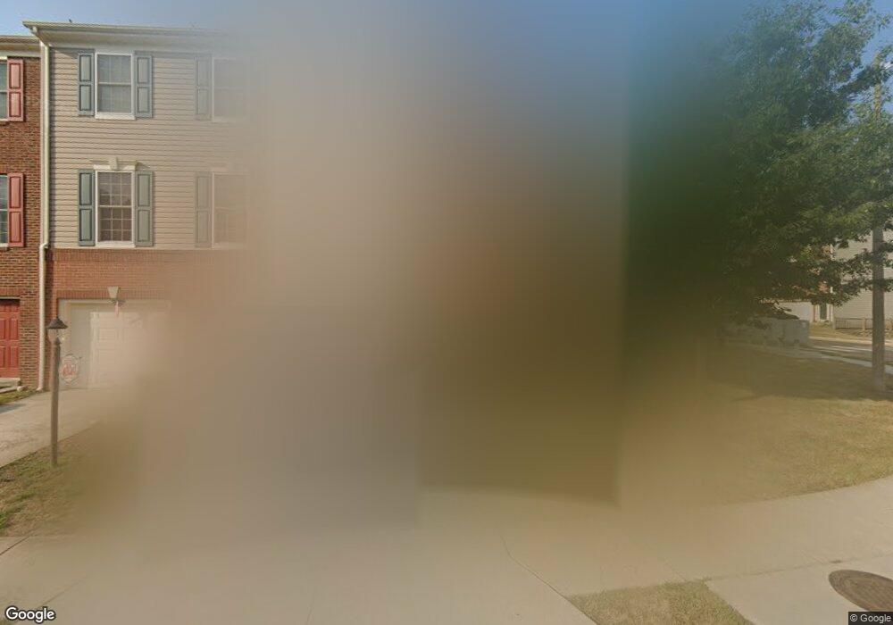
11927 Hayes Station Way Manassas, VA 20109
Estimated Value: $444,000 - $501,000
3
Beds
2
Baths
1,348
Sq Ft
$358/Sq Ft
Est. Value
About This Home
This home is located at 11927 Hayes Station Way, Manassas, VA 20109 and is currently estimated at $481,973, approximately $357 per square foot. 11927 Hayes Station Way is a home located in Prince William County with nearby schools including Chris Yung Elementary School, Gainesville Middle School, and Unity Reed High School.
Ownership History
Date
Name
Owned For
Owner Type
Purchase Details
Closed on
Jul 28, 2006
Sold by
Independence L L C
Bought by
Benavides Jacob M
Current Estimated Value
Home Financials for this Owner
Home Financials are based on the most recent Mortgage that was taken out on this home.
Original Mortgage
$256,600
Outstanding Balance
$153,304
Interest Rate
6.67%
Mortgage Type
New Conventional
Estimated Equity
$328,669
Create a Home Valuation Report for This Property
The Home Valuation Report is an in-depth analysis detailing your home's value as well as a comparison with similar homes in the area
Home Values in the Area
Average Home Value in this Area
Purchase History
| Date | Buyer | Sale Price | Title Company |
|---|---|---|---|
| Benavides Jacob M | $320,840 | -- |
Source: Public Records
Mortgage History
| Date | Status | Borrower | Loan Amount |
|---|---|---|---|
| Open | Benavides Jacob M | $256,600 |
Source: Public Records
Tax History Compared to Growth
Tax History
| Year | Tax Paid | Tax Assessment Tax Assessment Total Assessment is a certain percentage of the fair market value that is determined by local assessors to be the total taxable value of land and additions on the property. | Land | Improvement |
|---|---|---|---|---|
| 2025 | $4,243 | $457,600 | $152,500 | $305,100 |
| 2024 | $4,243 | $426,600 | $145,200 | $281,400 |
| 2023 | $4,155 | $399,300 | $130,100 | $269,200 |
| 2022 | $4,250 | $375,100 | $125,200 | $249,900 |
| 2021 | $4,125 | $336,700 | $103,900 | $232,800 |
| 2020 | $4,883 | $315,000 | $87,700 | $227,300 |
| 2019 | $4,537 | $292,700 | $83,500 | $209,200 |
| 2018 | $3,271 | $270,900 | $79,500 | $191,400 |
| 2017 | $3,299 | $265,700 | $79,500 | $186,200 |
| 2016 | $3,269 | $265,800 | $76,600 | $189,200 |
| 2015 | $3,016 | $254,000 | $76,600 | $177,400 |
| 2014 | $3,016 | $239,500 | $72,900 | $166,600 |
Source: Public Records
Map
Nearby Homes
- 9090 Brewer Creek Place
- 9035 Brewer Creek Place
- 9096 Ribbon Falls Loop
- 11817 Medway Church Loop
- 8637 Huddersfield Way
- 11911 Waterton Lake Ln
- 11972 Mirror Lake Ln
- 12205 Desoto Falls Ct
- 12200 Emory Falls Ct
- 9218 Dawkins Crest Cir
- 12620 Crabtree Falls Dr
- 12324 Malvern Way
- 12673 Crabtree Falls Dr
- 8776 Dunstable Loop
- 8768 Dunstable Loop
- 12041 Lake Dorian Dr
- 12664 Crabtree Falls Dr
- 11479 Robertson Dr
- 9256 Crestview Ridge Dr
- 9213 Big Springs Loop
- 11925 Hayes Station Way
- 11923 Hayes Station Way
- 8921 Tappen Mill Way
- 11921 Hayes Station Way
- 8923 Tappen Mill Way
- 11919 Hayes Station Way
- 8925 Tappen Mill Way
- 11926 Hayes Station Way
- 11928 Hayes Station Way
- 11924 Hayes Station Way
- 8927 Tappen Mill Way
- 11922 Hayes Station Way
- 11915 Hayes Station Way
- 12001 Sorrel River Way
- 8992 Brewer Creek Place
- 11920 Hayes Station Way
- 8990 Brewer Creek Place
- 8922 Tappen Mill Way
- 8988 Brewer Creek Place
- 8929 Tappen Mill Way