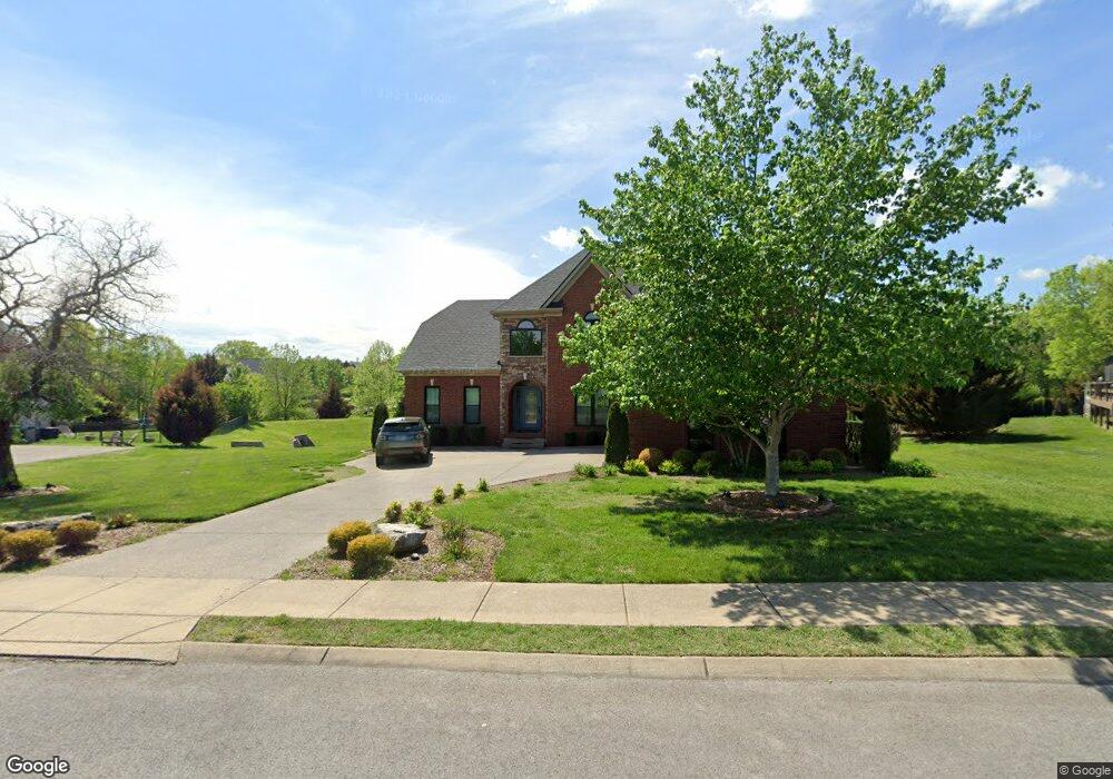
1193 Mccoury Ln Spring Hill, TN 37174
Estimated Value: $621,897 - $712,000
--
Bed
3
Baths
2,713
Sq Ft
$251/Sq Ft
Est. Value
About This Home
This home is located at 1193 Mccoury Ln, Spring Hill, TN 37174 and is currently estimated at $679,724, approximately $250 per square foot. 1193 Mccoury Ln is a home located in Williamson County with nearby schools including Primrose School of Spring Hill.
Ownership History
Date
Name
Owned For
Owner Type
Purchase Details
Closed on
Apr 5, 2004
Sold by
Overfelt Stephen T and Overfelt Sarah A
Bought by
Denholm Scott F and Denholm Erica C
Current Estimated Value
Home Financials for this Owner
Home Financials are based on the most recent Mortgage that was taken out on this home.
Original Mortgage
$226,400
Outstanding Balance
$111,552
Interest Rate
6.45%
Mortgage Type
Purchase Money Mortgage
Estimated Equity
$568,172
Purchase Details
Closed on
Sep 17, 2003
Sold by
Campbell Station Development Llc
Bought by
Overfelt Stephen T and Overfelt Sarah A
Home Financials for this Owner
Home Financials are based on the most recent Mortgage that was taken out on this home.
Original Mortgage
$211,200
Interest Rate
6.33%
Mortgage Type
Construction
Create a Home Valuation Report for This Property
The Home Valuation Report is an in-depth analysis detailing your home's value as well as a comparison with similar homes in the area
Home Values in the Area
Average Home Value in this Area
Purchase History
| Date | Buyer | Sale Price | Title Company |
|---|---|---|---|
| Denholm Scott F | $283,000 | -- | |
| Overfelt Stephen T | $39,900 | -- |
Source: Public Records
Mortgage History
| Date | Status | Borrower | Loan Amount |
|---|---|---|---|
| Open | Denholm Scott F | $226,400 | |
| Previous Owner | Overfelt Stephen T | $211,200 | |
| Closed | Overfelt Stephen T | $39,900 | |
| Closed | Denholm Scott F | $56,600 |
Source: Public Records
Tax History Compared to Growth
Tax History
| Year | Tax Paid | Tax Assessment Tax Assessment Total Assessment is a certain percentage of the fair market value that is determined by local assessors to be the total taxable value of land and additions on the property. | Land | Improvement |
|---|---|---|---|---|
| 2025 | $798 | $163,975 | $42,500 | $121,475 |
| 2024 | $798 | $107,925 | $22,500 | $85,425 |
| 2023 | $798 | $107,925 | $22,500 | $85,425 |
| 2022 | $1,975 | $107,925 | $22,500 | $85,425 |
| 2021 | $1,975 | $107,925 | $22,500 | $85,425 |
| 2020 | $1,832 | $84,800 | $16,250 | $68,550 |
| 2019 | $1,797 | $83,175 | $16,250 | $66,925 |
| 2018 | $1,738 | $83,175 | $16,250 | $66,925 |
| 2017 | $1,722 | $83,175 | $16,250 | $66,925 |
| 2016 | $1,697 | $83,175 | $16,250 | $66,925 |
| 2015 | -- | $69,400 | $15,000 | $54,400 |
| 2014 | -- | $69,400 | $15,000 | $54,400 |
Source: Public Records
Map
Nearby Homes
- 1083 Auldridge Dr
- 2184 Loudenslager Dr
- 2165 Loudenslager Dr
- 2785 Rutland Ct
- 2052 Hemlock Dr
- 1092 Misty Morn Cir
- 0 O'Hallorn Dr
- 2091 Hemlock Dr
- 0 Campbell Station Pkwy
- 6011 Dupont Cove
- 2021 Hemlock Dr
- 2863 Windy Way
- 2836 Pedigo Place
- 3024 Harrah Dr
- 2127 Loudenslager Dr
- 1039 Hemlock Dr
- 403 Preakness Dr
- 2814 New Port Royal Rd
- 2112 Loudenslager Dr
- 3009 Burnley Ct
- 1091 Auldridge Dr
- 1195 Mccoury Ln
- 1190 Mccoury Ln
- 1188 Mccoury Ln
- 1192 Mccoury Ln
- 1089 Auldridge Dr
- 1189 Mccoury Ln
- 1194 Mccoury Ln
- 5003 Campbell Station Pkwy
- 1187 Mccoury Ln
- 1084 Auldridge Dr
- 1184 Mccoury Ln
- 1001 St Hubbins Dr
- 1185 Mccoury Ln
- 1007 St Hubbins Dr
- 5005 Campbell Station Pkwy
- 1009 St Hubbins Dr
- 1082 Auldridge Dr
- 1085 Auldridge Dr
- 1183 Mccoury Ln