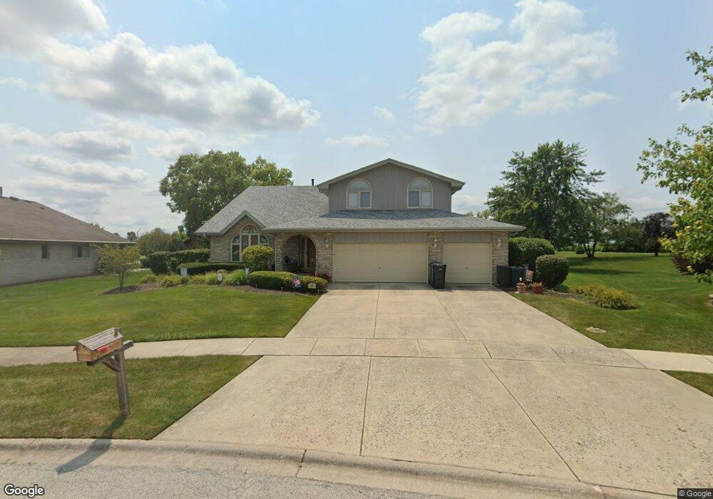
11937 Shannon Ct Orland Park, IL 60467
Grasslands NeighborhoodEstimated Value: $526,000 - $621,000
4
Beds
3
Baths
3,219
Sq Ft
$175/Sq Ft
Est. Value
About This Home
This home is located at 11937 Shannon Ct, Orland Park, IL 60467 and is currently estimated at $562,867, approximately $174 per square foot. 11937 Shannon Ct is a home located in Cook County with nearby schools including Centennial School, Meadow Ridge School, and Century Junior High School.
Ownership History
Date
Name
Owned For
Owner Type
Purchase Details
Closed on
Jun 14, 1995
Sold by
Marquette National Bank Of Chicago
Bought by
Lusk Michael J and Lusk Virginia A
Current Estimated Value
Home Financials for this Owner
Home Financials are based on the most recent Mortgage that was taken out on this home.
Original Mortgage
$203,150
Interest Rate
7.7%
Create a Home Valuation Report for This Property
The Home Valuation Report is an in-depth analysis detailing your home's value as well as a comparison with similar homes in the area
Home Values in the Area
Average Home Value in this Area
Purchase History
| Date | Buyer | Sale Price | Title Company |
|---|---|---|---|
| Lusk Michael J | $269,500 | -- |
Source: Public Records
Mortgage History
| Date | Status | Borrower | Loan Amount |
|---|---|---|---|
| Previous Owner | Lusk Michael J | $203,150 |
Source: Public Records
Tax History Compared to Growth
Tax History
| Year | Tax Paid | Tax Assessment Tax Assessment Total Assessment is a certain percentage of the fair market value that is determined by local assessors to be the total taxable value of land and additions on the property. | Land | Improvement |
|---|---|---|---|---|
| 2024 | $10,769 | $49,000 | $11,572 | $37,428 |
| 2023 | $9,087 | $49,000 | $11,572 | $37,428 |
| 2022 | $9,087 | $36,492 | $9,506 | $26,986 |
| 2021 | $8,823 | $36,491 | $9,505 | $26,986 |
| 2020 | $8,607 | $36,491 | $9,505 | $26,986 |
| 2019 | $9,405 | $40,437 | $8,679 | $31,758 |
| 2018 | $9,144 | $40,437 | $8,679 | $31,758 |
| 2017 | $8,966 | $40,437 | $8,679 | $31,758 |
| 2016 | $8,696 | $33,661 | $7,852 | $25,809 |
| 2015 | $8,577 | $33,661 | $7,852 | $25,809 |
| 2014 | $9,093 | $35,967 | $7,852 | $28,115 |
| 2013 | $8,335 | $35,149 | $7,852 | $27,297 |
Source: Public Records
Map
Nearby Homes
- 17654 Greenfield Ct
- 11854 Swilly Ct
- 17813 Westbrook Dr
- 12130 179th St
- 11914 Dunree Ln
- 12415 W Bruce Rd
- 11528 Brookwood Dr
- 11760 Imperial Ln
- 11573 Brook Hill Dr
- 12057 Longmeadow Ln
- 17389 Highwood Dr
- 18011 Breckenridge Blvd
- 12243 179th St
- 17396 Brook Crossing Ln
- 17950 Settlers Pond Way Unit 3B
- 11424 Lakebrook Ct Unit 281
- 18145 Breckenridge Blvd
- 17292 Lakebrook Dr
- 11228 Cameron Pkwy
- 11508 Lake Shore Dr
- 11929 Shannon Ct
- 11943 Shannon Ct
- 17550 Westbrook Dr Unit 2
- 17558 Westbrook Dr
- 11938 Shannon Ct
- 11915 Swilly Ct
- 11926 Shannon Ct
- 11924 Greenfield Dr
- 11932 Shannon Ct
- 17600 Westbrook Dr Unit 2
- 11912 Swilly Ct Unit 2
- 11909 Swilly Ct Unit 2
- 11916 Greenfield Dr Unit 2
- 11902 Swilly Ct Unit 2
- 17607 Westbrook Dr
- 17610 Westbrook Dr
- 11911 Fane Ct
- 11919 Fane Ct
- 11901 Swilly Ct
- 11929 Fane Ct