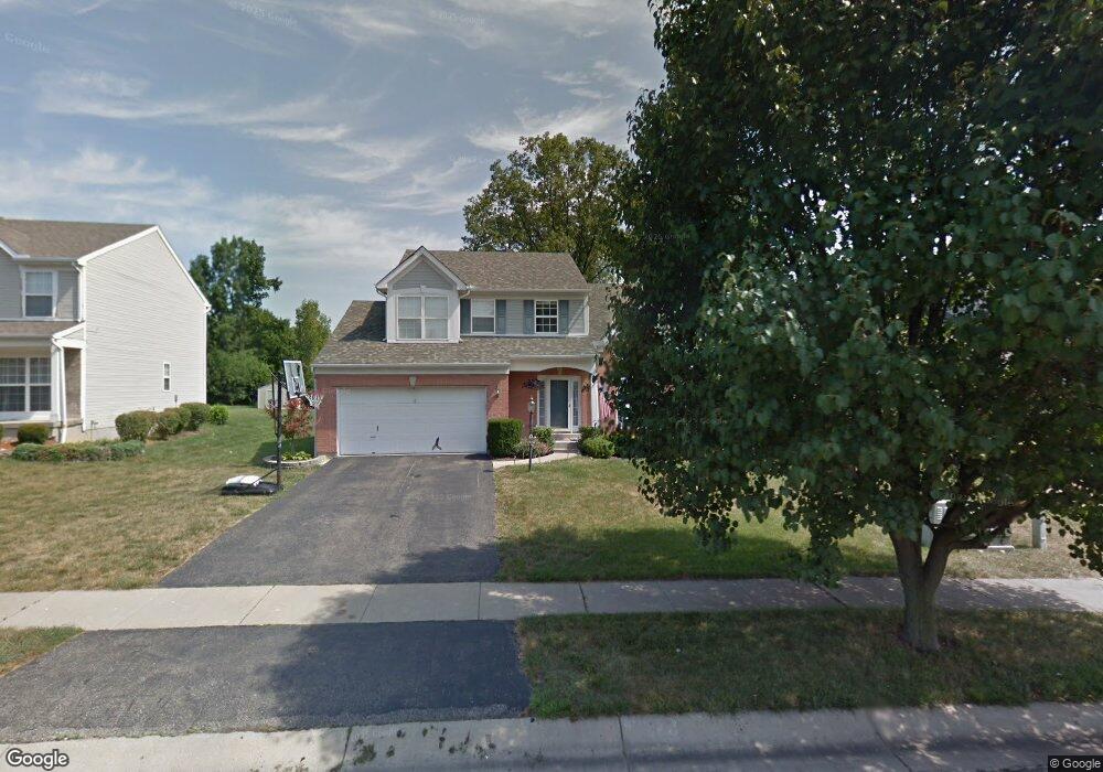
1194 Timberland Dr Cincinnati, OH 45215
Estimated Value: $186,000 - $316,000
4
Beds
3
Baths
1,907
Sq Ft
$142/Sq Ft
Est. Value
About This Home
This home is located at 1194 Timberland Dr, Cincinnati, OH 45215 and is currently estimated at $270,656, approximately $141 per square foot. 1194 Timberland Dr is a home located in Hamilton County with nearby schools including Heritage Hill Elementary School, Princeton Community Middle School, and Princeton High School.
Ownership History
Date
Name
Owned For
Owner Type
Purchase Details
Closed on
Jan 27, 1995
Sold by
Zaring Homes Inc
Bought by
Lambert Paul E and Lambert Debra S
Current Estimated Value
Home Financials for this Owner
Home Financials are based on the most recent Mortgage that was taken out on this home.
Original Mortgage
$129,650
Interest Rate
9.24%
Create a Home Valuation Report for This Property
The Home Valuation Report is an in-depth analysis detailing your home's value as well as a comparison with similar homes in the area
Home Values in the Area
Average Home Value in this Area
Purchase History
| Date | Buyer | Sale Price | Title Company |
|---|---|---|---|
| Lambert Paul E | -- | -- |
Source: Public Records
Mortgage History
| Date | Status | Borrower | Loan Amount |
|---|---|---|---|
| Closed | Lambert Paul E | $129,650 |
Source: Public Records
Tax History
| Year | Tax Paid | Tax Assessment Tax Assessment Total Assessment is a certain percentage of the fair market value that is determined by local assessors to be the total taxable value of land and additions on the property. | Land | Improvement |
|---|---|---|---|---|
| 2025 | $4,183 | $72,044 | $12,075 | $59,969 |
| 2024 | $3,672 | $72,044 | $12,075 | $59,969 |
| 2023 | $3,679 | $72,044 | $12,075 | $59,969 |
| 2022 | $3,437 | $58,734 | $9,338 | $49,396 |
| 2021 | $3,349 | $58,734 | $9,338 | $49,396 |
| 2020 | $3,382 | $58,734 | $9,338 | $49,396 |
| 2019 | $3,169 | $50,631 | $8,050 | $42,581 |
| 2018 | $2,999 | $50,631 | $8,050 | $42,581 |
| 2017 | $2,832 | $50,631 | $8,050 | $42,581 |
| 2016 | $2,689 | $47,569 | $8,033 | $39,536 |
| 2015 | $2,714 | $47,569 | $8,033 | $39,536 |
| 2014 | $2,722 | $47,569 | $8,033 | $39,536 |
| 2013 | $2,694 | $52,854 | $8,925 | $43,929 |
Source: Public Records
Map
Nearby Homes
- 1100 Timberland Dr
- 10152 Chester Rd
- 10136 Chester Rd
- 10124 Chester Rd
- 1201 Dixie Ct
- 502 Marion Rd
- 10167 Wayne Ave
- 1401 Chamberlain Ave
- 857 Steffen Ave
- 1076 Schumard Ave
- 414 Jonte Ave
- 519 Westview Ave
- 0 E Leslie Ave
- 401 Jonte Ave
- 15 Bonham Rd
- 1704 Harmon Dr
- 405 Home Ave
- 335 Albion Ave
- 313 Pershing Ave
- 26 Chestnut Ave
- 1182 Timberland Dr
- 1208 Timberland Dr
- 1170 Timberland Dr
- 1224 Timberland Dr
- 1183 Timberland Dr
- 1238 Timberland Dr
- 1158 Timberland Dr
- 1167 Timberland Dr
- 1199 Timberland Dr
- 1215 Timberland Dr
- 1153 Timberland Dr
- 1231 Timberland Dr
- 1146 Timberland Dr
- 1252 Timberland Dr
- 1340 Timberland Dr
- 1245 Timberland Dr
- 1139 Timberland Dr
- 1132 Timberland Dr
- 1257 Timberland Dr
- 1348 Timberland Dr
Your Personal Tour Guide
Ask me questions while you tour the home.