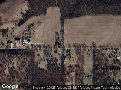
11940 Sutfin Rd Horton, MI 49246
Estimated Value: $152,323 - $231,000
3
Beds
1
Bath
1,224
Sq Ft
$152/Sq Ft
Est. Value
About This Home
This home is located at 11940 Sutfin Rd, Horton, MI 49246 and is currently estimated at $186,081, approximately $152 per square foot. 11940 Sutfin Rd is a home located in Jackson County with nearby schools including Hanover-Horton Elementary School, Hanover-Horton Middle School, and Hanover-Horton High School.
Ownership History
Date
Name
Owned For
Owner Type
Purchase Details
Closed on
Oct 30, 2018
Sold by
Buck Jerry and Buck Jerold L
Bought by
Gilbert Martin P
Current Estimated Value
Purchase Details
Closed on
Nov 10, 2003
Sold by
Kline Edward L and Kline Lois M
Bought by
Gilbert Martin P
Home Financials for this Owner
Home Financials are based on the most recent Mortgage that was taken out on this home.
Original Mortgage
$90,000
Interest Rate
5.88%
Mortgage Type
Purchase Money Mortgage
Purchase Details
Closed on
Apr 5, 1998
Sold by
Kline Kline E E and Kline L
Bought by
Gilbert Martin P
Purchase Details
Closed on
Jul 17, 1996
Sold by
Warblow Wllm
Bought by
Kline Edward L and Kline Lois M
Purchase Details
Closed on
Jun 19, 1996
Sold by
Warblow William H and Warblow Joan B
Bought by
Kline Ed and Kline Lois
Purchase Details
Closed on
Dec 1, 1988
Bought by
Clifford
Create a Home Valuation Report for This Property
The Home Valuation Report is an in-depth analysis detailing your home's value as well as a comparison with similar homes in the area
Home Values in the Area
Average Home Value in this Area
Purchase History
| Date | Buyer | Sale Price | Title Company |
|---|---|---|---|
| Gilbert Martin P | -- | None Available | |
| Gilbert Martin P | $35,000 | -- | |
| Gilbert Martin P | $35,000 | -- | |
| Kline Edward L | -- | -- | |
| Kline Ed | -- | -- | |
| Clifford | $104,000 | -- |
Source: Public Records
Mortgage History
| Date | Status | Borrower | Loan Amount |
|---|---|---|---|
| Previous Owner | Gilbert Martin P | $90,000 |
Source: Public Records
Tax History Compared to Growth
Tax History
| Year | Tax Paid | Tax Assessment Tax Assessment Total Assessment is a certain percentage of the fair market value that is determined by local assessors to be the total taxable value of land and additions on the property. | Land | Improvement |
|---|---|---|---|---|
| 2024 | $773 | $60,300 | $0 | $0 |
| 2022 | $1,087 | $46,500 | $0 | $0 |
| 2021 | $1,091 | $44,100 | $0 | $0 |
| 2020 | $1,135 | $43,300 | $0 | $0 |
| 2019 | $1,103 | $37,400 | $0 | $0 |
| 2018 | $703 | $30,800 | $0 | $0 |
| 2017 | $624 | $30,600 | $0 | $0 |
| 2016 | $446 | $29,600 | $29,600 | $0 |
| 2015 | -- | $27,800 | $27,800 | $0 |
| 2014 | -- | $25,500 | $0 | $0 |
| 2013 | -- | $25,500 | $25,500 | $0 |
Source: Public Records
Map
Nearby Homes
- 283 Westshore Dr
- Lot 6 & 7 Westshore Dr
- 281 Mirror Dr
- 11968 Greenbriar Vl Dr
- 159 Westshore Dr
- 11112 Greenview Ct
- 11968 Greenbriar Dr
- 150 Hollybrook Ct
- 125 Westshore Dr
- 192 Eastshore Dr
- 11437 Highland Hills Dr
- 11477 Highland Hills Dr
- V/L Hollybrook Ct
- 11799 Greenbriar Dr
- 11597 Highland Hills Dr
- 160 Eastshore Dr
- 11767 Greenbriar Dr
- 11752 Baker Rd
- 11715 Baker Rd
- 193 Eastshore Dr
- 11940 Sutfin Rd
- 11940 Sutfin Rd Unit SUTFIN
- 11953 Sutfin Rd
- 11931 Sutfin Rd
- 11921 Sutfin Rd
- 11191 Sutfin Rd
- 11900 Sutfin Rd
- 11900 Patch Rd
- 11931 Sutfin Rd
- 12201 Sutfin Rd
- 11944 Sutfin Rd
- 11936 Sutfin Rd
- 12000 Patch Rd
- Parcel B Sutfin Rd
- Parcel D Sutfin Rd
- Parcel C Sutfin Rd
- Parcel A Sutfin Rd
- v/l Sutfin Rd
- 12125 Patch Rd
- 11901 Patch Rd
