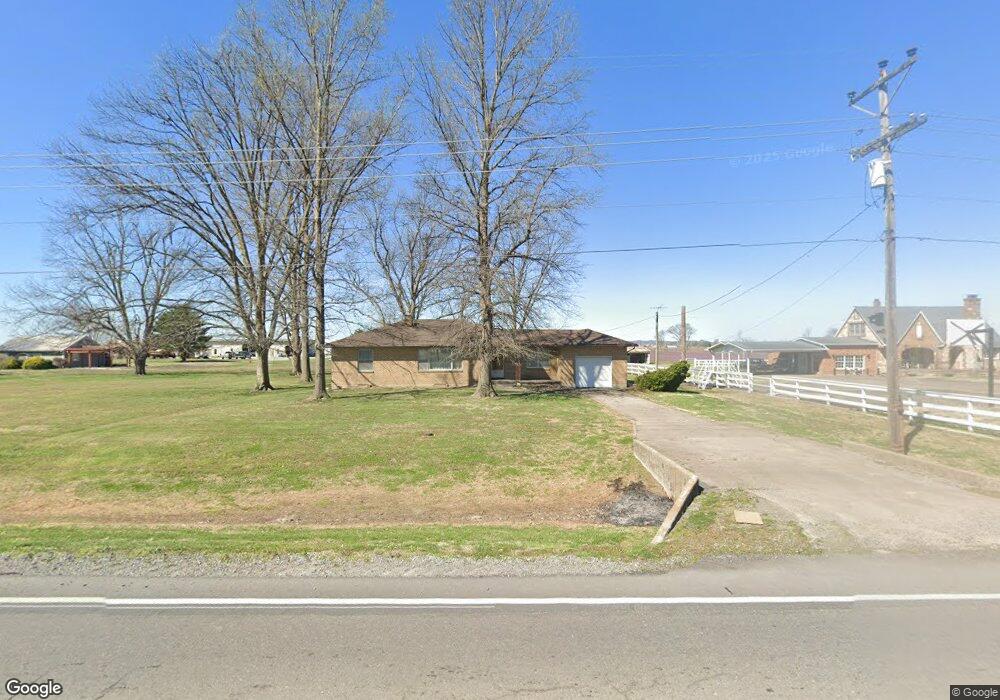
11943 State Highway 77 Chaffee, MO 63740
Estimated Value: $143,594 - $181,000
--
Bed
--
Bath
1,241
Sq Ft
$134/Sq Ft
Est. Value
About This Home
This home is located at 11943 State Highway 77, Chaffee, MO 63740 and is currently estimated at $166,399, approximately $134 per square foot. 11943 State Highway 77 is a home with nearby schools including Chaffee Elementary School, Chaffee Junior/Senior High School, and St. Ambrose School.
Ownership History
Date
Name
Owned For
Owner Type
Purchase Details
Closed on
Oct 2, 2020
Sold by
Cannon Carolyn R
Bought by
Rlt Lisa Capshaw Cushing
Current Estimated Value
Home Financials for this Owner
Home Financials are based on the most recent Mortgage that was taken out on this home.
Original Mortgage
$84,000
Outstanding Balance
$74,714
Interest Rate
2.9%
Mortgage Type
Commercial
Estimated Equity
$91,685
Purchase Details
Closed on
Mar 24, 2020
Sold by
Stone Katherine J
Bought by
Cannon Carolyn R
Create a Home Valuation Report for This Property
The Home Valuation Report is an in-depth analysis detailing your home's value as well as a comparison with similar homes in the area
Home Values in the Area
Average Home Value in this Area
Purchase History
| Date | Buyer | Sale Price | Title Company |
|---|---|---|---|
| Rlt Lisa Capshaw Cushing | -- | Semo Title Company | |
| Cannon Carolyn R | -- | None Available |
Source: Public Records
Mortgage History
| Date | Status | Borrower | Loan Amount |
|---|---|---|---|
| Open | Rlt Lisa Capshaw Cushing | $84,000 |
Source: Public Records
Tax History Compared to Growth
Tax History
| Year | Tax Paid | Tax Assessment Tax Assessment Total Assessment is a certain percentage of the fair market value that is determined by local assessors to be the total taxable value of land and additions on the property. | Land | Improvement |
|---|---|---|---|---|
| 2025 | $736 | $13,590 | $0 | $0 |
| 2024 | $736 | $12,420 | $0 | $0 |
| 2023 | $735 | $12,420 | $0 | $0 |
| 2022 | $714 | $12,030 | $0 | $0 |
| 2021 | $754 | $12,030 | $0 | $0 |
| 2020 | $577 | $11,640 | $0 | $0 |
| 2019 | -- | $11,640 | $0 | $0 |
| 2018 | -- | $11,640 | $0 | $0 |
| 2017 | -- | $11,640 | $0 | $0 |
| 2014 | -- | $11,640 | $0 | $0 |
| 2011 | -- | $11,650 | $0 | $0 |
Source: Public Records
Map
Nearby Homes
- 514 W Yoakum Ave
- 211 Easy St
- 960 State Highway Ee
- 201 S 3rd St
- 323 Wright Ave
- 122 W Parker Ave
- 302 N 3rd St
- 5307 County Road 244
- 1760 State Hwy N
- 661 County Highway 261
- 1064 State Highway A
- County Road 241
- County Road 241
- County Road 241
- County Road 241
- County Road 241
- County Road 241
- County Road 241
- County Road 241
- 104 N Missouri Ave
- 11945 State Highway 77
- 11939 State Highway 77
- 11939 State Highway 77
- 0 Missouri 77
- 12253 Missouri 77
- 11937 State Highway 77
- 506 Elliott Ave
- 11989 State Highway 77
- 11936 State Highway 77
- 11935 State Highway 77
- 12001 State Highway 77
- 502 Elliott Ave
- 11933 State Highway 77
- 11933 Missouri 77
- 12037 State Highway 77
- 11932 State Highway 77
- 430 Elliott Ave
- 12041 State Highway 77
- 428 Elliott Ave
- 429 Elliott Ave