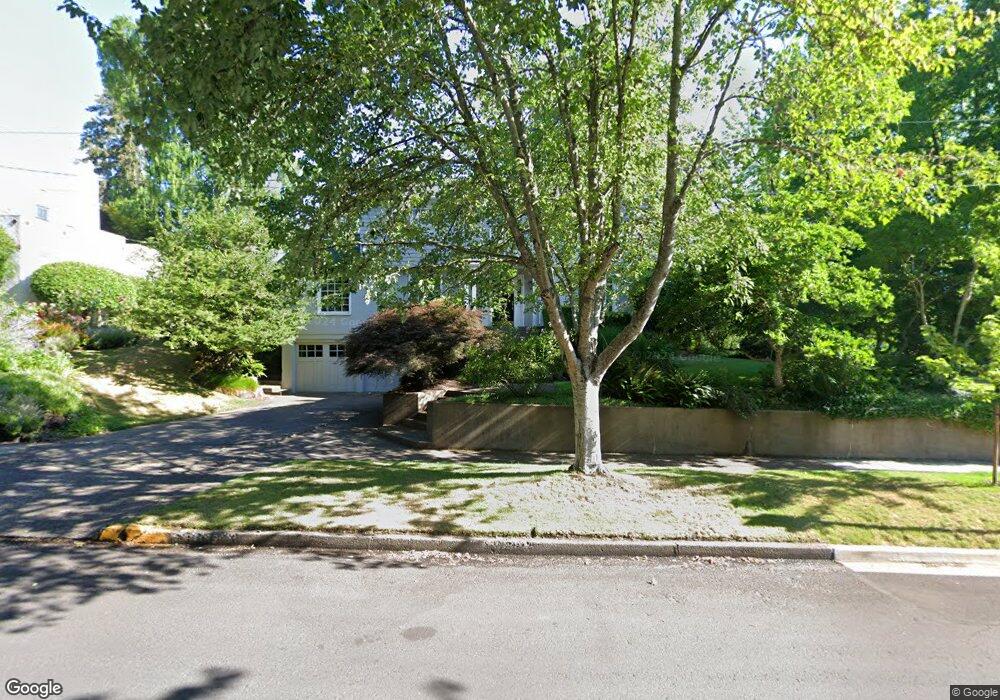
1195 E 21st Ave Eugene, OR 97403
South University NeighborhoodEstimated Value: $1,220,449 - $1,379,000
4
Beds
3
Baths
2,513
Sq Ft
$510/Sq Ft
Est. Value
About This Home
This home is located at 1195 E 21st Ave, Eugene, OR 97403 and is currently estimated at $1,280,483, approximately $509 per square foot. 1195 E 21st Ave is a home located in Lane County with nearby schools including Edison Elementary School, Roosevelt Middle School, and South Eugene High School.
Ownership History
Date
Name
Owned For
Owner Type
Purchase Details
Closed on
Aug 12, 2005
Sold by
Moore John Andrew and Moore Donna W
Bought by
Blucher Robert M and Blucher Suzi A
Current Estimated Value
Home Financials for this Owner
Home Financials are based on the most recent Mortgage that was taken out on this home.
Original Mortgage
$250,000
Interest Rate
5.56%
Mortgage Type
Credit Line Revolving
Purchase Details
Closed on
Jan 15, 2002
Sold by
Giustina A J and Giustina Adriana
Bought by
Moore John Andrew and Moore Donna W
Home Financials for this Owner
Home Financials are based on the most recent Mortgage that was taken out on this home.
Original Mortgage
$285,000
Interest Rate
7.01%
Create a Home Valuation Report for This Property
The Home Valuation Report is an in-depth analysis detailing your home's value as well as a comparison with similar homes in the area
Home Values in the Area
Average Home Value in this Area
Purchase History
| Date | Buyer | Sale Price | Title Company |
|---|---|---|---|
| Blucher Robert M | $970,300 | Cascade Title Co | |
| Moore John Andrew | $411,150 | Cascade Title Co |
Source: Public Records
Mortgage History
| Date | Status | Borrower | Loan Amount |
|---|---|---|---|
| Closed | Blucher Robert M | $250,000 | |
| Closed | Blucher Robert M | $300,000 | |
| Previous Owner | Moore John Andrew | $285,000 |
Source: Public Records
Tax History
| Year | Tax Paid | Tax Assessment Tax Assessment Total Assessment is a certain percentage of the fair market value that is determined by local assessors to be the total taxable value of land and additions on the property. | Land | Improvement |
|---|---|---|---|---|
| 2025 | $14,674 | $753,126 | -- | -- |
| 2024 | $14,491 | $731,191 | -- | -- |
| 2023 | $14,491 | $709,895 | $0 | $0 |
| 2022 | $13,576 | $689,219 | $0 | $0 |
| 2021 | $12,751 | $669,145 | $0 | $0 |
| 2020 | $12,796 | $649,656 | $0 | $0 |
| 2019 | $12,358 | $630,734 | $0 | $0 |
| 2018 | $11,633 | $594,528 | $0 | $0 |
| 2017 | $11,014 | $594,528 | $0 | $0 |
| 2016 | $10,735 | $577,212 | $0 | $0 |
| 2015 | $10,525 | $560,400 | $0 | $0 |
| 2014 | $9,835 | $544,078 | $0 | $0 |
Source: Public Records
Map
Nearby Homes
- 2042 Onyx St
- 780 E 22nd Ave
- 0 Agate St
- 2642 Central Blvd
- 1733 Mill Aly
- 508 E 14th Ave
- 1857 Pearl St
- 193 E 20th Ave
- 1970 Amazon Pkwy
- 2815 Hilyard St
- 275 Sunset Dr
- 181 Civic Dr
- 177 E 20th Ave
- 171 E 20th Ave
- 509 E 13th Ave
- 2683 Cresta de Ruta St
- 1600 Pearl St Unit 608
- 2993 Capital Dr Unit 1
- 2646 Cascara Dr
- 2642 Cascara Dr
- 1165 E 21st Ave
- 2066 University St
- 2114 University St
- 1145 E 21st Ave
- 2085 University St
- 2065 University St
- 2028 University St
- 2068 Onyx Aly
- 2089 Potter St
- 2111 University St
- 2150 University St
- 2045 Potter St
- 1237 E 21st Ave
- 2117 Potter St
- 2000 University St
- 2041 University St
- 1136 E 20th Ave
- 1234 E 21st Ave
- 2015 University St
- 2164 University St
Your Personal Tour Guide
Ask me questions while you tour the home.