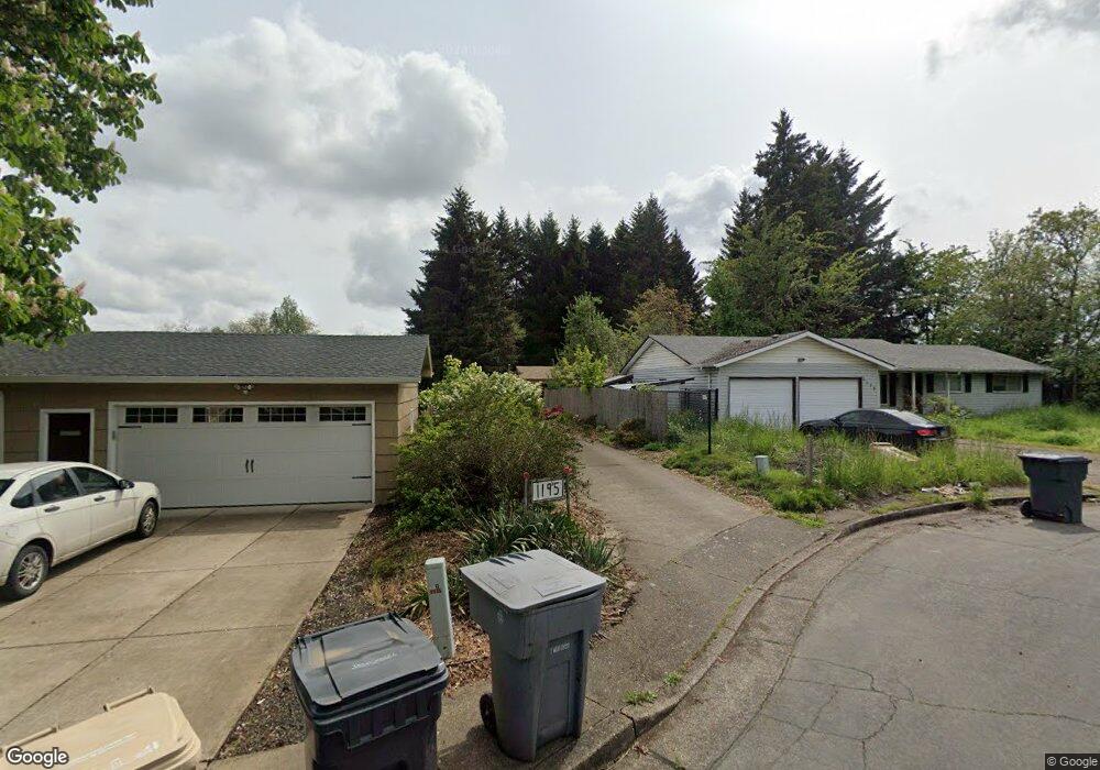
1195 SW Poplar Place Corvallis, OR 97333
Southwest Corvallis NeighborhoodEstimated Value: $494,000 - $575,637
4
Beds
2
Baths
1,344
Sq Ft
$397/Sq Ft
Est. Value
About This Home
This home is located at 1195 SW Poplar Place, Corvallis, OR 97333 and is currently estimated at $532,909, approximately $396 per square foot. 1195 SW Poplar Place is a home located in Benton County with nearby schools including Adams Elementary School, Linus Pauling Middle School, and Corvallis High School.
Ownership History
Date
Name
Owned For
Owner Type
Purchase Details
Closed on
Aug 8, 2023
Sold by
Margarete Kummerow Living Trust
Bought by
Margarete Kummerow Living Trust and Kummerow
Current Estimated Value
Purchase Details
Closed on
Oct 13, 2004
Sold by
Kummerow Margarete
Bought by
Kummerow Margaret and Margarete Kummerow Living Trust
Purchase Details
Closed on
Jul 5, 2001
Sold by
Kummerow Jochen and Kummerow Margarete G
Bought by
Kummerow Jochen and Kummerow Margarete
Purchase Details
Closed on
Sep 18, 1989
Bought by
Kummerow Margarete Tr
Create a Home Valuation Report for This Property
The Home Valuation Report is an in-depth analysis detailing your home's value as well as a comparison with similar homes in the area
Home Values in the Area
Average Home Value in this Area
Purchase History
| Date | Buyer | Sale Price | Title Company |
|---|---|---|---|
| Margarete Kummerow Living Trust | -- | None Listed On Document | |
| Kummerow Margaret | $110,000 | -- | |
| Kummerow Jochen | -- | -- | |
| Kummerow Margarete Tr | $75,000 | -- |
Source: Public Records
Tax History Compared to Growth
Tax History
| Year | Tax Paid | Tax Assessment Tax Assessment Total Assessment is a certain percentage of the fair market value that is determined by local assessors to be the total taxable value of land and additions on the property. | Land | Improvement |
|---|---|---|---|---|
| 2024 | $5,643 | $293,752 | -- | -- |
| 2023 | $5,313 | $285,196 | $0 | $0 |
| 2022 | $5,318 | $276,889 | $0 | $0 |
| 2021 | $5,142 | $268,824 | $0 | $0 |
| 2020 | $4,960 | $260,994 | $0 | $0 |
| 2019 | $4,572 | $253,392 | $0 | $0 |
| 2018 | $4,596 | $246,012 | $0 | $0 |
| 2017 | $4,252 | $238,847 | $0 | $0 |
| 2016 | $4,234 | $231,890 | $0 | $0 |
| 2015 | $4,144 | $225,136 | $0 | $0 |
| 2014 | $4,037 | $218,579 | $0 | $0 |
| 2012 | -- | $206,032 | $0 | $0 |
Source: Public Records
Map
Nearby Homes
- 865 SW Grove St
- 1080 SW 35th St
- 1125 SW Cole Place
- 3559 SW Par Place
- 4149 SW Research Way
- 3871 SW Neer Ave
- 1935 SW Whiteside Dr
- 1907 SW Brooklane Dr
- 2520 SW Whiteside Dr
- 820 SW C Ave
- 3211 SW Hawkeye Ave
- 720 SW 5th St
- 1140 SW Sylvia St
- 136 NW 30th St
- 1750 SW Edging Dr
- 1050 SW Timian St
- 430 SW 6th St
- 3130 NW Van Buren Ave
- 2604 SW Wolverine Dr
- 316 NW 32nd St
- 1135 SW Poplar Place
- 1175 SW Poplar Place
- 1145 SW Poplar Place
- 3060 SW Morris Ave
- 3070 SW Morris Ave
- 1125 SW Poplar Place
- 3020 SW Morris Ave
- 1170 SW Poplar Place
- 1065 SW Poplar Place
- 2960 SW Morris Ave
- 0 SW Poplar Place
- 1150 SW Poplar Place
- 1055 SW Poplar Place
- 1140 SW Poplar Place
- 1160 SW Poplar Place
- 2940 SW Morris Ave
- 1045 SW Poplar Place
- 3055 SW Morris Ave
- 1050 SW Poplar Place
- 3065 SW Morris Ave