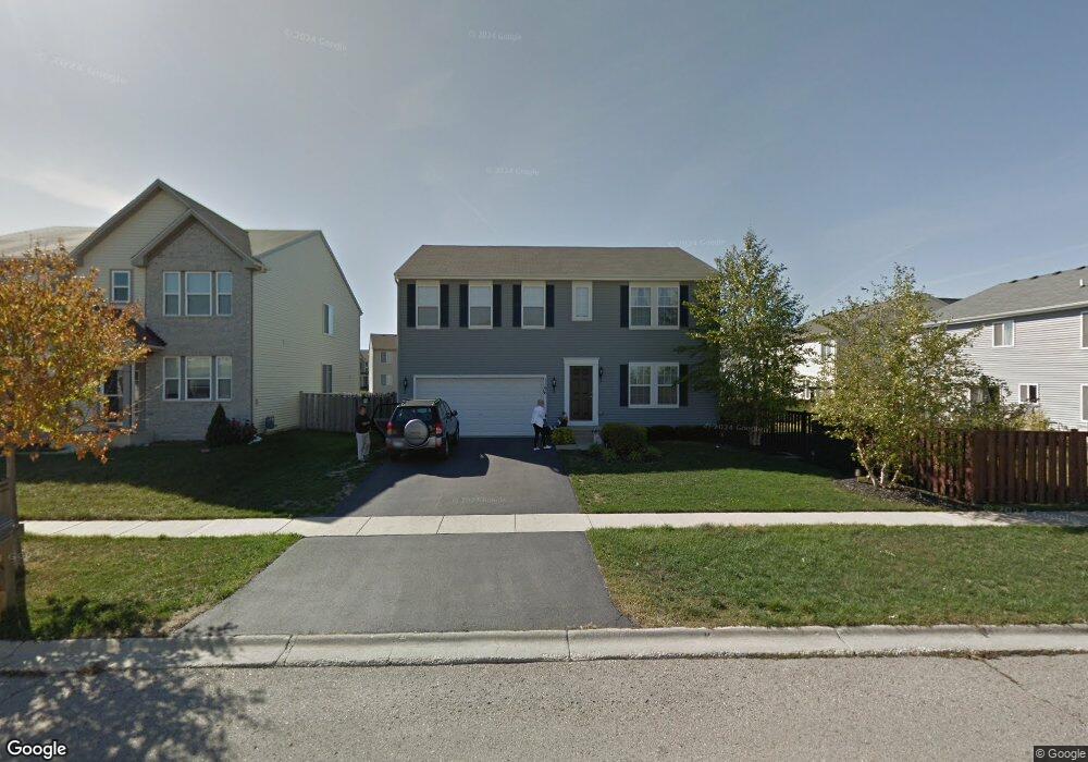
1196 Port Royal Rd Pingree Grove, IL 60140
Estimated Value: $412,000 - $445,000
--
Bed
1
Bath
2,460
Sq Ft
$172/Sq Ft
Est. Value
About This Home
This home is located at 1196 Port Royal Rd, Pingree Grove, IL 60140 and is currently estimated at $422,024, approximately $171 per square foot. 1196 Port Royal Rd is a home located in Kane County with nearby schools including Hampshire Middle School, Hampshire High School, and Cambridge Lakes Charter School.
Ownership History
Date
Name
Owned For
Owner Type
Purchase Details
Closed on
Nov 9, 2006
Sold by
Drh Cambridge Homes Inc
Bought by
Taylor Jacquelyn M
Current Estimated Value
Home Financials for this Owner
Home Financials are based on the most recent Mortgage that was taken out on this home.
Original Mortgage
$205,000
Outstanding Balance
$122,550
Interest Rate
6.4%
Mortgage Type
Purchase Money Mortgage
Estimated Equity
$299,474
Create a Home Valuation Report for This Property
The Home Valuation Report is an in-depth analysis detailing your home's value as well as a comparison with similar homes in the area
Home Values in the Area
Average Home Value in this Area
Purchase History
| Date | Buyer | Sale Price | Title Company |
|---|---|---|---|
| Taylor Jacquelyn M | $274,500 | First American Title |
Source: Public Records
Mortgage History
| Date | Status | Borrower | Loan Amount |
|---|---|---|---|
| Open | Taylor Jacquelyn M | $205,000 |
Source: Public Records
Tax History Compared to Growth
Tax History
| Year | Tax Paid | Tax Assessment Tax Assessment Total Assessment is a certain percentage of the fair market value that is determined by local assessors to be the total taxable value of land and additions on the property. | Land | Improvement |
|---|---|---|---|---|
| 2024 | $9,853 | $119,289 | $30,777 | $88,512 |
| 2023 | $9,619 | $107,875 | $27,832 | $80,043 |
| 2022 | $8,596 | $90,982 | $25,661 | $65,321 |
| 2021 | $8,405 | $85,574 | $24,136 | $61,438 |
| 2020 | $8,275 | $83,389 | $23,520 | $59,869 |
| 2019 | $8,130 | $80,035 | $22,574 | $57,461 |
| 2018 | $7,950 | $75,115 | $21,186 | $53,929 |
| 2017 | $7,808 | $71,531 | $20,175 | $51,356 |
| 2016 | $7,796 | $68,099 | $19,207 | $48,892 |
| 2015 | -- | $64,317 | $18,140 | $46,177 |
| 2014 | -- | $61,807 | $15,630 | $46,177 |
| 2013 | -- | $62,940 | $15,917 | $47,023 |
Source: Public Records
Map
Nearby Homes
- 1173 Sonoma Ct
- 1286 Newport Cir
- 1157 Clearwater Dr
- 1641 Sandcastle Ln
- 1385 Broadland Dr
- 1701 Windward Dr
- 1192 Alta Vista Dr
- 1740 Spinnaker St
- 1840 Spinnaker St
- 955 Emerald Dr
- 1929 Diamond Head Trail
- 898 Emerald Dr
- 1482 Hollow Tree Ln
- 932 Clover Ln
- 1731 Dempsey Cir
- 700 Brighton Dr
- Lot 019 Old Stage Rd
- 562 Lancaster Dr
- 560 Canterbury Ln
- 2307 Upland Rd
- 1186 Port Royal Rd
- 1255 Sarasota Dr
- 1249 Sarasota Dr
- 1176 Port Royal Rd
- 1185 Sarasota Dr
- 1233 Sarasota Dr
- 1177 Sarasota Dr
- 1203 Sarasota Dr
- 1166 Port Royal Rd
- 897 Plateau Dr
- 192 Terrabrook Way
- 188 Terrabrook Way
- 197 Terrabrook Way
- 193 Terrabrook Way
- 191 Terrabrook Way
- 199 Terrabrook Way
- 173 Terrabrook Way
- 1175 Sonoma Ct
- 1177 Sonoma Ct
- 1171 Sonoma Ct