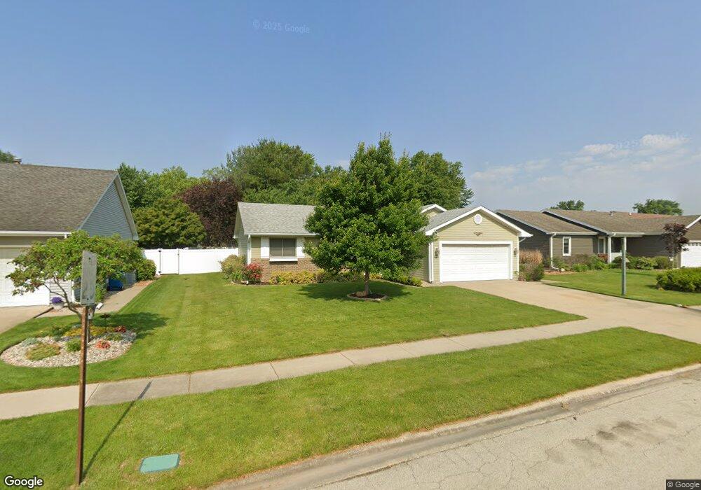
1197 King Arthur Ln Bourbonnais, IL 60914
Estimated Value: $257,000 - $267,199
About This Home
This home is located at 1197 King Arthur Ln, Bourbonnais, IL 60914 and is currently estimated at $262,300, approximately $198 per square foot. 1197 King Arthur Ln is a home located in Kankakee County with nearby schools including St. George Elementary School, Bradley-Bourbonnais Community High School, and Kankakee Valley Montessori School.
Ownership History
Purchase Details
Purchase Details
Home Financials for this Owner
Home Financials are based on the most recent Mortgage that was taken out on this home.Purchase Details
Home Financials for this Owner
Home Financials are based on the most recent Mortgage that was taken out on this home.Home Values in the Area
Average Home Value in this Area
Purchase History
We collect this data history from publicly available records. To have your information removed, we recommend requesting removal directly through your county’s website.
| Date | Buyer | Sale Price | Title Company |
|---|---|---|---|
| Menard Daniel E | -- | None Listed On Document | |
| Menard Daniel E | $230,000 | Standard Title | |
| Schweigert Bradley | $174,000 | Kankakee County Title |
Mortgage History
We collect this data history from publicly available records. To have your information removed, we recommend requesting removal directly through your county’s website.
| Date | Status | Borrower | Loan Amount |
|---|---|---|---|
| Previous Owner | Menard Daniel E | $200,000 | |
| Previous Owner | Schweigert Bradley | $168,780 |
Tax History
| Year | Tax Paid | Tax Assessment Tax Assessment Total Assessment is a certain percentage of the fair market value that is determined by local assessors to be the total taxable value of land and additions on the property. | Land | Improvement |
|---|---|---|---|---|
| 2025 | $4,436 | $76,066 | $9,276 | $66,790 |
| 2024 | $4,436 | $68,193 | $8,751 | $59,442 |
| 2023 | $4,247 | $63,142 | $8,103 | $55,039 |
| 2022 | $4,296 | $56,037 | $7,810 | $48,227 |
| 2021 | $4,020 | $51,718 | $7,638 | $44,080 |
| 2020 | $3,692 | $48,723 | $7,434 | $41,289 |
| 2019 | $3,784 | $47,303 | $7,217 | $40,086 |
| 2018 | $3,743 | $46,604 | $7,110 | $39,494 |
| 2017 | $3,714 | $45,468 | $6,937 | $38,531 |
| 2016 | $3,832 | $46,925 | $6,834 | $40,091 |
| 2015 | $3,929 | $47,688 | $6,766 | $40,922 |
| 2014 | $3,884 | $48,509 | $6,766 | $41,743 |
| 2013 | -- | $49,684 | $6,766 | $42,918 |
Map
- Lot 13 North Point E Cardinal Dr
- 973 Cardinal Dr
- 1390 E Armour Rd
- 1511 Lady Brunetta Rd
- 1354 Rivard Dr
- 860 Pheasant Dr
- 856 Quail Dr
- 1374 Potomac Place
- 1486 Bradley Way
- 1432 Northfield Meadows Blvd
- 1443 Truman Dr
- 1572 Cardinal Dr
- 1425 Argyle Ln N
- 141 Old Farm Mid Ct
- 1602 Amhurst Way
- 1606 Amhurst Way
- 303 Chesterfield Ct Unit 303
- 1490 Derby Dr
- 545 N Monroe Ave
- 1696 Yorktown Dr
- 1165 King Arthur Ln
- 1157 King Arthur Ln
- 1177 King Arthur Ln
- 1141 King Arthur Ln
- 1183 King Arthur Ln
- 1168 King Arthur Ln
- 1160 Cardinal Dr
- 1176 King Arthur Ln
- 1180 Cardinal Dr
- 1135 King Arthur Ln
- 1186 King Arthur Ln
- 1130 Cardinal Dr
- 1140 King Arthur Ln
- 1150 Cardinal Dr
- 1198 King Arthur Ln
- 1127 King Arthur Ln
- 1201 King Arthur Ln
- 1138 King Arthur Ln
- 1200 King Arthur Ln
- 1165 Guinevere Ln
Ask me questions while you tour the home.