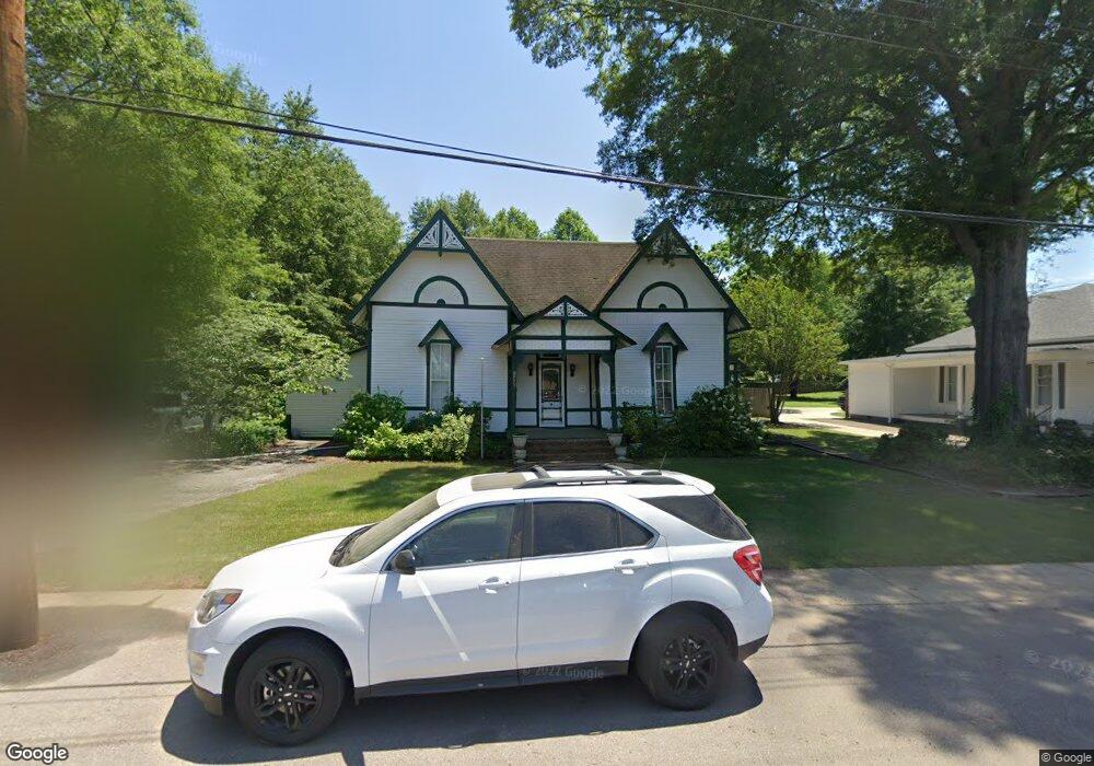
11973 Walker St Arlington, TN 38002
Estimated Value: $356,000 - $395,000
3
Beds
2
Baths
3,012
Sq Ft
$123/Sq Ft
Est. Value
About This Home
This home is located at 11973 Walker St, Arlington, TN 38002 and is currently estimated at $370,977, approximately $123 per square foot. 11973 Walker St is a home located in Shelby County with nearby schools including Arlington Elementary School, Arlington Middle School, and Arlington High School.
Ownership History
Date
Name
Owned For
Owner Type
Purchase Details
Closed on
Aug 31, 2004
Sold by
Hathcock Dana A
Bought by
Hathcock Andrew P
Current Estimated Value
Purchase Details
Closed on
Apr 16, 2001
Sold by
Simpson John L and Simpson Lisa M
Bought by
Hathcock Andrew P and Hathcock Dana A
Home Financials for this Owner
Home Financials are based on the most recent Mortgage that was taken out on this home.
Original Mortgage
$178,000
Interest Rate
6.99%
Purchase Details
Closed on
Jan 6, 1995
Bought by
Garrett Warren C and Garrett Peggy M
Create a Home Valuation Report for This Property
The Home Valuation Report is an in-depth analysis detailing your home's value as well as a comparison with similar homes in the area
Home Values in the Area
Average Home Value in this Area
Purchase History
| Date | Buyer | Sale Price | Title Company |
|---|---|---|---|
| Hathcock Andrew P | -- | -- | |
| Hathcock Andrew P | $158,000 | -- | |
| Garrett Warren C | $103,000 | -- |
Source: Public Records
Mortgage History
| Date | Status | Borrower | Loan Amount |
|---|---|---|---|
| Closed | Hathcock Andrew P | $178,000 |
Source: Public Records
Tax History Compared to Growth
Tax History
| Year | Tax Paid | Tax Assessment Tax Assessment Total Assessment is a certain percentage of the fair market value that is determined by local assessors to be the total taxable value of land and additions on the property. | Land | Improvement |
|---|---|---|---|---|
| 2025 | $2,175 | $77,025 | $16,175 | $60,850 |
| 2024 | $4,349 | $64,150 | $14,525 | $49,625 |
| 2023 | $2,996 | $64,150 | $14,525 | $49,625 |
| 2022 | $2,996 | $64,150 | $14,525 | $49,625 |
| 2021 | $3,034 | $64,150 | $14,525 | $49,625 |
| 2020 | $2,642 | $48,750 | $12,225 | $36,525 |
| 2019 | $1,974 | $48,750 | $12,225 | $36,525 |
| 2018 | $2,535 | $48,750 | $12,225 | $36,525 |
| 2017 | $2,564 | $48,750 | $12,225 | $36,525 |
| 2016 | $2,118 | $38,375 | $0 | $0 |
| 2014 | $1,677 | $38,375 | $0 | $0 |
Source: Public Records
Map
Nearby Homes
- 0 Us 70 Hwy Unit 10096004
- 12133 S Shady Tree Ln
- 11819 Highway 70
- 11850 Us 70 Hwy
- 12150 Osborne Grove Dr
- 12179 S Shady Tree Ln
- 11996 Douglass St
- 6006 Armistead St
- 6071 Woodson St
- 12260 Afton Place
- 5967 Carters Bluff Dr
- 12245 Longhorn Dr
- 12035 Brockwell Rd
- 6350 Bevan Lake Dr
- 6324 Bevan Lake Dr
- 6318 Bevan Lake Dr
- 6314 Bevan Lake Dr
- 6284 Bevan Lake Dr
- 6302 Bevan Lake Dr
- 12262 Kathleen Cove
- 11985 Walker St
- 11965 Walker St
- 11991 Walker St
- 6203 Quintard St
- 11990 Brown St
- 11949 Walker St
- 6183 Quintard St
- 6160 Greenlee St
- 12005 Walker St
- 6210 Quintard St
- 6149 Greenlee St
- 11939 Walker St
- 12015 Brown St
- 6171 Greenlee St
- 6159 Greenlee St
- 6150 Greenlee St
- 12020 Walker St
- 6231 Chester St
- 11971 Brown St
- 6205 Greenlee St