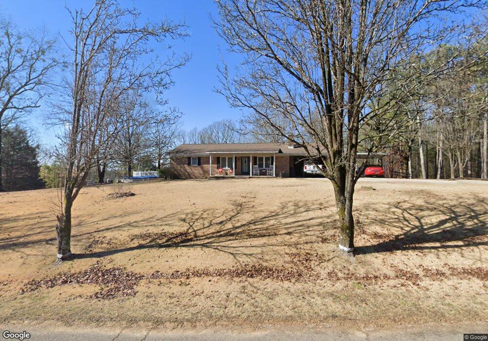
1198 High Smith Rd Finger, TN 38334
Estimated Value: $337,000 - $409,623
--
Bed
2
Baths
2,074
Sq Ft
$180/Sq Ft
Est. Value
About This Home
This home is located at 1198 High Smith Rd, Finger, TN 38334 and is currently estimated at $373,208, approximately $179 per square foot. 1198 High Smith Rd is a home located in McNairy County with nearby schools including Adamsville Elementary School, Bethel Springs Elementary School, and Selmer Elementary School.
Ownership History
Date
Name
Owned For
Owner Type
Purchase Details
Closed on
Oct 27, 2017
Bought by
Plunk Calvin Ricky
Current Estimated Value
Purchase Details
Closed on
Feb 24, 2006
Sold by
Plunk Coolidge
Bought by
Plunk Ricky
Purchase Details
Closed on
Apr 8, 2003
Sold by
Coolidge Plunk
Bought by
Ricky Plunk Calvin
Purchase Details
Closed on
Oct 25, 2002
Sold by
Ann Plunk Barbara
Bought by
Ricky Plunk Calvin
Home Financials for this Owner
Home Financials are based on the most recent Mortgage that was taken out on this home.
Original Mortgage
$57,500
Interest Rate
6.01%
Purchase Details
Closed on
Oct 10, 2002
Bought by
Plunk Ricky
Home Financials for this Owner
Home Financials are based on the most recent Mortgage that was taken out on this home.
Original Mortgage
$57,500
Interest Rate
6.01%
Create a Home Valuation Report for This Property
The Home Valuation Report is an in-depth analysis detailing your home's value as well as a comparison with similar homes in the area
Home Values in the Area
Average Home Value in this Area
Purchase History
| Date | Buyer | Sale Price | Title Company |
|---|---|---|---|
| Plunk Calvin Ricky | $7,500 | -- | |
| Plunk Ricky | -- | -- | |
| Ricky Plunk Calvin | -- | -- | |
| Ricky Plunk Calvin | -- | -- | |
| Plunk Ricky | -- | -- |
Source: Public Records
Mortgage History
| Date | Status | Borrower | Loan Amount |
|---|---|---|---|
| Previous Owner | Plunk Ricky | $57,500 |
Source: Public Records
Tax History Compared to Growth
Tax History
| Year | Tax Paid | Tax Assessment Tax Assessment Total Assessment is a certain percentage of the fair market value that is determined by local assessors to be the total taxable value of land and additions on the property. | Land | Improvement |
|---|---|---|---|---|
| 2025 | $998 | $63,275 | $0 | $0 |
| 2024 | $998 | $63,275 | $22,900 | $40,375 |
| 2023 | $991 | $63,275 | $22,900 | $40,375 |
| 2022 | $991 | $62,825 | $22,900 | $39,925 |
| 2021 | $977 | $47,750 | $19,200 | $28,550 |
| 2020 | $977 | $47,750 | $19,200 | $28,550 |
| 2019 | $977 | $47,750 | $19,200 | $28,550 |
| 2018 | $977 | $47,750 | $19,200 | $28,550 |
| 2017 | $977 | $47,750 | $19,200 | $28,550 |
| 2016 | $958 | $47,750 | $19,200 | $28,550 |
| 2015 | $998 | $47,750 | $19,200 | $28,550 |
| 2014 | $943 | $45,100 | $14,150 | $30,950 |
Source: Public Records
Map
Nearby Homes
- 3677 Center Hill Rd
- 0 Vista Ln
- 1386C Elvin Weeks Rd
- 1386 Elvin Weeks Rd
- 6140 Finger Leapwood Rd
- 1137 Hopewell Church Rd
- 0 Arl Bailey Rd
- 171 Malone Cemetery Rd
- 1100 Stewart Rd
- 000 Stewart Rd
- 1170 Keene Rd
- 5060 Enville Rd
- 50 Braund Rd
- 5865 Enville Rd
- 4745 Enville Rd
- 0 Center Hill Rd
- 357 Terry Hair Rd
- 0 Young Rd
- X Cedar Brook Ln
- 1450 Busby Ln
- 1153 High Smith Rd
- 1103 High Smith Rd
- 1358 High Smith Rd
- 1397 Smith Rd
- 1396 High Smith Rd
- 776 High Smith Rd
- 1470 High Smith Rd
- 4485 Center Hill Rd
- 4000 Center Hill Rd
- 2049 Center Hill Rd
- LOT 000 Center Hill Rd
- Lot 0000 Center Hill Rd
- 00 Center Hill Rd
- 4099 Center Hill Rd
- 2100 Jc Pickett Dr
- 4570 Center Hill Rd
- 4500 Center Hill Rd
- 0 Bullman Rd
- 608 Plunk Cemetery Rd
- 59 Bullman Rd