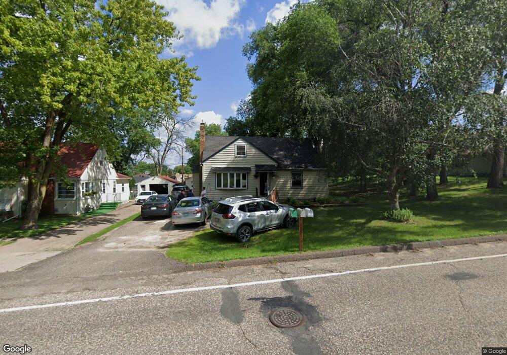
1199 County Road B E Saint Paul, MN 55109
Sherwood Glen NeighborhoodEstimated Value: $294,000 - $350,000
3
Beds
2
Baths
1,579
Sq Ft
$202/Sq Ft
Est. Value
About This Home
This home is located at 1199 County Road B E, Saint Paul, MN 55109 and is currently estimated at $318,961, approximately $202 per square foot. 1199 County Road B E is a home located in Ramsey County with nearby schools including Weaver Elementary School, John Glenn Middle School, and St Jerome Elementary School.
Ownership History
Date
Name
Owned For
Owner Type
Purchase Details
Closed on
Jul 8, 2022
Sold by
Bernold Hunt Dennis and Bernold Rena L
Bought by
Pree Naw and Htoo Sun
Current Estimated Value
Home Financials for this Owner
Home Financials are based on the most recent Mortgage that was taken out on this home.
Original Mortgage
$266,000
Outstanding Balance
$253,373
Interest Rate
5.23%
Mortgage Type
New Conventional
Estimated Equity
$65,588
Purchase Details
Closed on
Jan 9, 2014
Sold by
Wells Fargo Bank Na
Bought by
Secretary Of Housing & Urban Development
Create a Home Valuation Report for This Property
The Home Valuation Report is an in-depth analysis detailing your home's value as well as a comparison with similar homes in the area
Home Values in the Area
Average Home Value in this Area
Purchase History
| Date | Buyer | Sale Price | Title Company |
|---|---|---|---|
| Pree Naw | $280,000 | First American Title | |
| Secretary Of Housing & Urban Development | -- | None Available |
Source: Public Records
Mortgage History
| Date | Status | Borrower | Loan Amount |
|---|---|---|---|
| Open | Pree Naw | $266,000 |
Source: Public Records
Tax History
| Year | Tax Paid | Tax Assessment Tax Assessment Total Assessment is a certain percentage of the fair market value that is determined by local assessors to be the total taxable value of land and additions on the property. | Land | Improvement |
|---|---|---|---|---|
| 2025 | $3,974 | $319,500 | $48,700 | $270,800 |
| 2023 | $3,974 | $288,400 | $48,700 | $239,700 |
| 2022 | $3,022 | $249,200 | $48,700 | $200,500 |
| 2021 | $2,874 | $216,600 | $48,700 | $167,900 |
| 2020 | $2,974 | $211,300 | $48,700 | $162,600 |
| 2019 | $2,322 | $204,600 | $48,700 | $155,900 |
| 2018 | $2,328 | $168,400 | $48,700 | $119,700 |
| 2017 | $2,354 | $164,800 | $48,700 | $116,100 |
| 2016 | $2,286 | $0 | $0 | $0 |
| 2015 | $2,228 | $156,600 | $44,700 | $111,900 |
| 2014 | $2,006 | $0 | $0 | $0 |
Source: Public Records
Map
Nearby Homes
- 1200 Leland Rd E
- 1290 Belmont Ln E
- 2022 English St
- 1461 Grandview Ave E
- 2125 Hazelwood St
- 1481 Sextant Ave E
- 1579 Grandview Ave E
- 1083 Gordon Ave
- 1875 E Shore Dr Unit 302
- 1800 Edward St
- 1855 Birmingham St
- 2457 Dianna Ln
- 1984 Prosperity Rd
- 1764 English St
- 1745 Duluth St
- 822 Palm Ct
- 1894 Maryknoll Ave N
- 1669 Clarence St
- 2615 Flandrau St
- 1633 Etna St
- 1211 County Road B E
- 1187 County Road B E
- 1200 Lark Ave
- 1192 Lark Ave
- 1208 Lark Ave
- 2242 Duluth St
- 1202 County Road B E
- 1198 County Road B E
- 1214 Lark Ave
- 1217 County Road B E
- 1210 County Road B E
- 2210 Duluth St
- 1216 Lark Ave
- 1225 County Road B E
- 1201 Lealand Rd
- 1199 Lark Ave
- 2233 Duluth St
- 1203 Lark Ave
- 1197 Lealand Rd
- 1193 Lark Ave
Your Personal Tour Guide
Ask me questions while you tour the home.