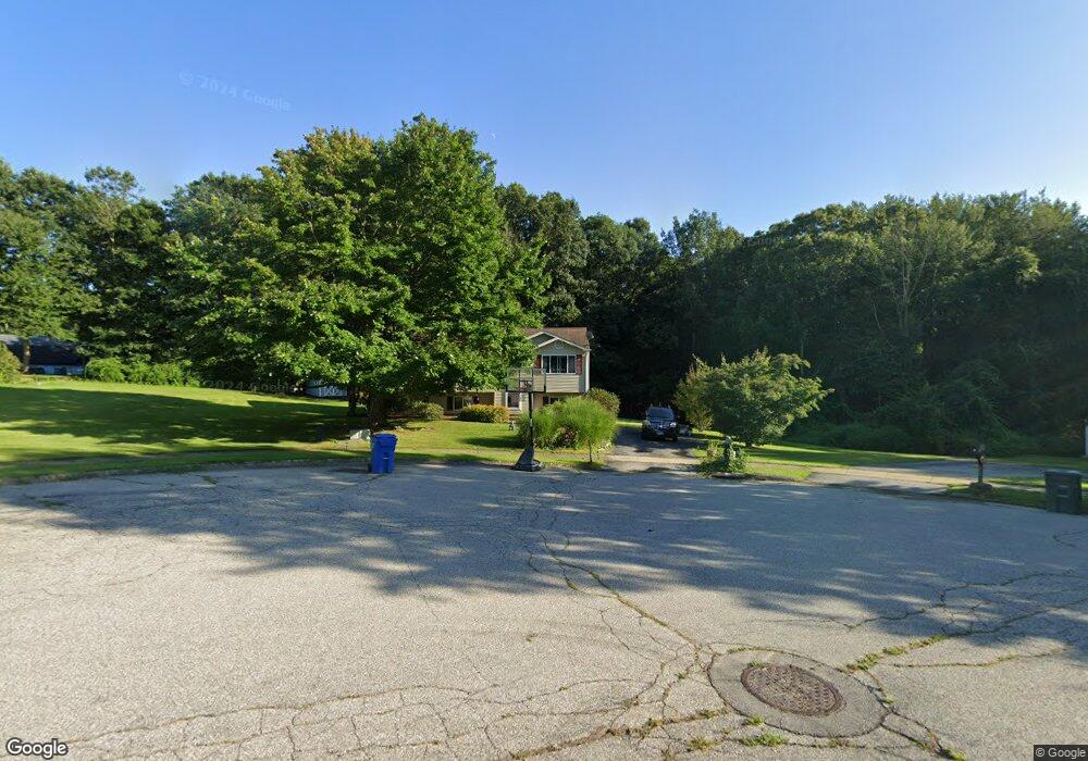
12 Amanda Ct Uncasville, CT 06382
Estimated Value: $341,000 - $389,763
3
Beds
3
Baths
1,032
Sq Ft
$359/Sq Ft
Est. Value
About This Home
This home is located at 12 Amanda Ct, Uncasville, CT 06382 and is currently estimated at $370,691, approximately $359 per square foot. 12 Amanda Ct is a home located in New London County with nearby schools including Leonard J. Tyl Middle School, Montville High School, and Bradley School-New London Regional.
Ownership History
Date
Name
Owned For
Owner Type
Purchase Details
Closed on
Aug 30, 2007
Sold by
Chiappone Harry A
Bought by
Gande Kevin A and Cermak Misty D
Current Estimated Value
Home Financials for this Owner
Home Financials are based on the most recent Mortgage that was taken out on this home.
Original Mortgage
$211,920
Outstanding Balance
$135,133
Interest Rate
6.71%
Estimated Equity
$235,558
Purchase Details
Closed on
Oct 11, 2002
Sold by
Rogulski Joseph and Rogulski Kelly
Bought by
Chiappone Harry
Purchase Details
Closed on
Mar 15, 2000
Sold by
Swarr Donald M and Swarr Deborah A
Bought by
Rogulski Joseph J and Stevens Kelly A
Purchase Details
Closed on
Jun 1, 1992
Sold by
Damato Milford Lp
Bought by
Swarr Donald and Swarr Deborah
Create a Home Valuation Report for This Property
The Home Valuation Report is an in-depth analysis detailing your home's value as well as a comparison with similar homes in the area
Home Values in the Area
Average Home Value in this Area
Purchase History
| Date | Buyer | Sale Price | Title Company |
|---|---|---|---|
| Gande Kevin A | $264,900 | -- | |
| Gande Kevin A | $264,900 | -- | |
| Chiappone Harry | $169,900 | -- | |
| Chiappone Harry | $169,900 | -- | |
| Rogulski Joseph J | $124,000 | -- | |
| Rogulski Joseph J | $124,000 | -- | |
| Swarr Donald | $99,900 | -- |
Source: Public Records
Mortgage History
| Date | Status | Borrower | Loan Amount |
|---|---|---|---|
| Open | Swarr Donald | $211,920 | |
| Closed | Swarr Donald | $17,980 |
Source: Public Records
Tax History Compared to Growth
Tax History
| Year | Tax Paid | Tax Assessment Tax Assessment Total Assessment is a certain percentage of the fair market value that is determined by local assessors to be the total taxable value of land and additions on the property. | Land | Improvement |
|---|---|---|---|---|
| 2025 | $4,975 | $172,340 | $31,570 | $140,770 |
| 2024 | $4,786 | $172,340 | $31,570 | $140,770 |
| 2023 | $4,786 | $172,340 | $31,570 | $140,770 |
| 2022 | $4,603 | $172,340 | $31,570 | $140,770 |
| 2021 | $4,545 | $143,140 | $33,170 | $109,970 |
| 2020 | $4,635 | $143,140 | $33,170 | $109,970 |
| 2019 | $4,653 | $143,140 | $33,170 | $109,970 |
| 2018 | $4,542 | $143,140 | $33,170 | $109,970 |
| 2017 | $4,538 | $143,140 | $33,170 | $109,970 |
| 2016 | $4,630 | $151,250 | $42,580 | $108,670 |
| 2015 | $4,630 | $151,250 | $42,580 | $108,670 |
| 2014 | -- | $151,250 | $42,580 | $108,670 |
Source: Public Records
Map
Nearby Homes
- 79 Cottonwood Ln
- 2 Chesterfield Rd
- 727 Old Colchester Rd
- 82C Pires Dr
- 320 Maple Ave
- 505 Old Colchester Rd
- 72 Pheasant Run
- 636 Connecticut 163
- 465 Gay Hill Rd
- 270 Gay Hill Rd
- 230 Gay Hill Rd
- 0 Monahan Dr
- 63 Velgouse Rd
- 7 Pennsylvania Ave
- 1 High Ridge Cir
- 5 Mountain Laurel Ridge
- 57 Roselund Hill Rd
- 17 Manor Rd
- 19 Wyndwood Rd
- 197 Connecticut Blvd