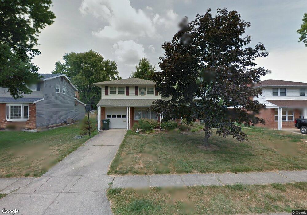
12 Azalea Rd Newark, DE 19711
Christiana NeighborhoodEstimated Value: $331,000 - $392,000
3
Beds
2
Baths
1,230
Sq Ft
$297/Sq Ft
Est. Value
About This Home
This home is located at 12 Azalea Rd, Newark, DE 19711 and is currently estimated at $365,436, approximately $297 per square foot. 12 Azalea Rd is a home located in New Castle County with nearby schools including Heritage Elementary School, Skyline Middle School, and Dickinson (John) High School.
Ownership History
Date
Name
Owned For
Owner Type
Purchase Details
Closed on
May 10, 2021
Sold by
Cook Judith W
Bought by
Jack Sharon
Current Estimated Value
Home Financials for this Owner
Home Financials are based on the most recent Mortgage that was taken out on this home.
Original Mortgage
$160,000
Outstanding Balance
$145,000
Interest Rate
3.1%
Mortgage Type
New Conventional
Estimated Equity
$220,436
Purchase Details
Closed on
Feb 29, 2008
Sold by
Cooper Marion E and Cooper Agnes W
Bought by
Cook Judith W
Home Financials for this Owner
Home Financials are based on the most recent Mortgage that was taken out on this home.
Original Mortgage
$185,625
Interest Rate
5.8%
Mortgage Type
Purchase Money Mortgage
Create a Home Valuation Report for This Property
The Home Valuation Report is an in-depth analysis detailing your home's value as well as a comparison with similar homes in the area
Home Values in the Area
Average Home Value in this Area
Purchase History
| Date | Buyer | Sale Price | Title Company |
|---|---|---|---|
| Jack Sharon | $240,000 | None Listed On Document | |
| Cook Judith W | $247,900 | None Available |
Source: Public Records
Mortgage History
| Date | Status | Borrower | Loan Amount |
|---|---|---|---|
| Open | Jack Sharon | $160,000 | |
| Previous Owner | Cook Judith W | $185,625 |
Source: Public Records
Tax History Compared to Growth
Tax History
| Year | Tax Paid | Tax Assessment Tax Assessment Total Assessment is a certain percentage of the fair market value that is determined by local assessors to be the total taxable value of land and additions on the property. | Land | Improvement |
|---|---|---|---|---|
| 2024 | $2,283 | $61,800 | $11,100 | $50,700 |
| 2023 | $2,014 | $61,800 | $11,100 | $50,700 |
| 2022 | $2,038 | $61,800 | $11,100 | $50,700 |
| 2021 | $2,038 | $61,800 | $11,100 | $50,700 |
| 2020 | $2,045 | $61,800 | $11,100 | $50,700 |
| 2019 | $2,325 | $61,800 | $11,100 | $50,700 |
| 2018 | $264 | $61,800 | $11,100 | $50,700 |
| 2017 | $1,888 | $61,800 | $11,100 | $50,700 |
| 2016 | $1,888 | $61,800 | $11,100 | $50,700 |
| 2015 | $1,769 | $61,800 | $11,100 | $50,700 |
| 2014 | $1,637 | $61,800 | $11,100 | $50,700 |
Source: Public Records
Map
Nearby Homes
- 134 Meadowood Dr
- 906 8th St
- 24 Marta Dr
- 10 Alcott Dr
- 59 Valley Cir
- 2107 Othoson Ave
- 207 Creekside Dr Unit 167
- 2624 Heritage Farm Dr
- 27 Lee Dr Unit 621
- 2702 Barnsley Rd
- 2623 E Riding Dr
- 75 Kathy Ln Unit 656
- 74 Kathy Ln Unit A661
- 108 Gale Dr
- 54 Kathy Ln Unit 671
- 1905 Capitol Trail
- 2304 Milltown Rd
- 508 Michelle Ct
- 2903 Creekside Dr Unit 91
- 2637 Drayton Dr