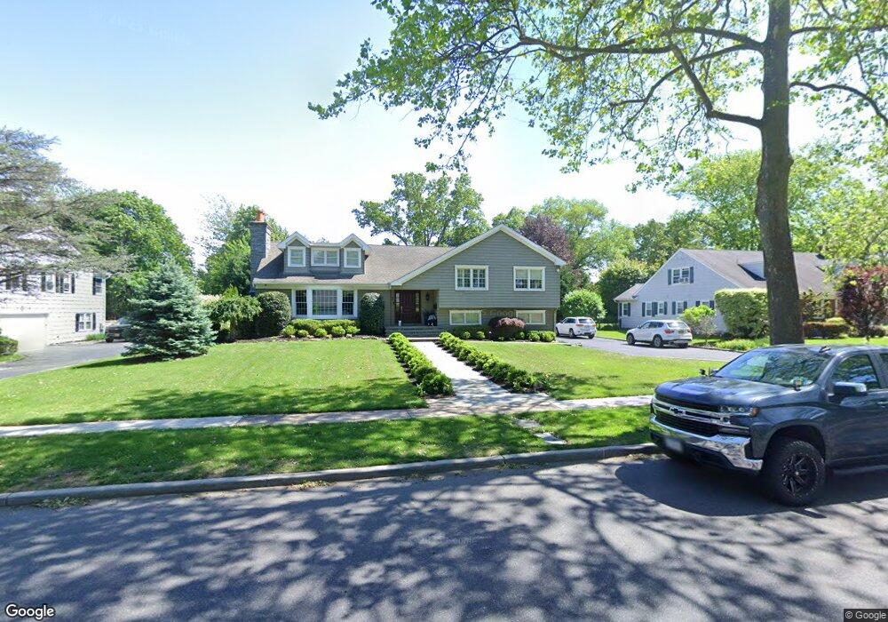
12 Barnes Ln Garden City, NY 11530
Estimated Value: $1,633,000 - $2,003,609
4
Beds
4
Baths
3,754
Sq Ft
$484/Sq Ft
Est. Value
About This Home
This home is located at 12 Barnes Ln, Garden City, NY 11530 and is currently estimated at $1,818,305, approximately $484 per square foot. 12 Barnes Ln is a home located in Nassau County with nearby schools including Locust School, Stewart School, and Garden City Middle School.
Ownership History
Date
Name
Owned For
Owner Type
Purchase Details
Closed on
Oct 23, 2012
Sold by
Wang Shih and Wang Susan
Bought by
Menoudakos Peter and Menoudakos Athena
Current Estimated Value
Home Financials for this Owner
Home Financials are based on the most recent Mortgage that was taken out on this home.
Original Mortgage
$550,000
Outstanding Balance
$379,239
Interest Rate
3.42%
Estimated Equity
$1,439,066
Create a Home Valuation Report for This Property
The Home Valuation Report is an in-depth analysis detailing your home's value as well as a comparison with similar homes in the area
Home Values in the Area
Average Home Value in this Area
Purchase History
| Date | Buyer | Sale Price | Title Company |
|---|---|---|---|
| Menoudakos Peter | -- | -- |
Source: Public Records
Mortgage History
| Date | Status | Borrower | Loan Amount |
|---|---|---|---|
| Open | Menoudakos Peter | $550,000 |
Source: Public Records
Tax History Compared to Growth
Tax History
| Year | Tax Paid | Tax Assessment Tax Assessment Total Assessment is a certain percentage of the fair market value that is determined by local assessors to be the total taxable value of land and additions on the property. | Land | Improvement |
|---|---|---|---|---|
| 2025 | $17,039 | $1,080 | $488 | $592 |
| 2024 | $2,342 | $1,120 | $506 | $614 |
| 2023 | $16,255 | $1,233 | $799 | $434 |
| 2022 | $16,255 | $1,217 | $564 | $653 |
| 2021 | $21,721 | $1,182 | $548 | $634 |
| 2020 | $14,975 | $1,394 | $1,393 | $1 |
| 2019 | $12,928 | $1,394 | $1,393 | $1 |
| 2018 | $12,057 | $1,394 | $0 | $0 |
| 2017 | $8,642 | $1,394 | $1,327 | $67 |
| 2016 | $10,735 | $1,530 | $1,093 | $437 |
| 2015 | $2,384 | $1,650 | $1,071 | $579 |
| 2014 | $2,384 | $1,650 | $1,071 | $579 |
| 2013 | $3,003 | $2,200 | $1,428 | $772 |
Source: Public Records
Map
Nearby Homes
- 200 Hilton Ave Unit 55
- 12 Hamilton Place Unit B5
- 12 Hamilton Place Unit A-10
- 12 Hamilton Place Unit D-11
- 20 Wendell St Unit A16
- 20 Wendell St Unit E2
- 20 Wendell St Unit 39C
- 22 Hamilton Place Unit I1
- 127 2nd St Unit D1
- 32 Hamilton Place Unit I3
- 144 Hilton Ave
- 67 3rd St
- 301 Franklin Ave Unit 114
- 301 Franklin Ave Unit 311
- 301 Franklin Ave Unit 213
- 88 5th St
- 248 Main St
- 82 Hilton Ave
- 79 Union Place
- 32 Stowe Place